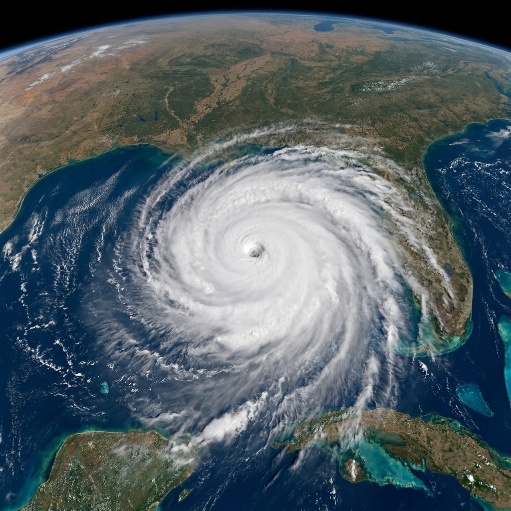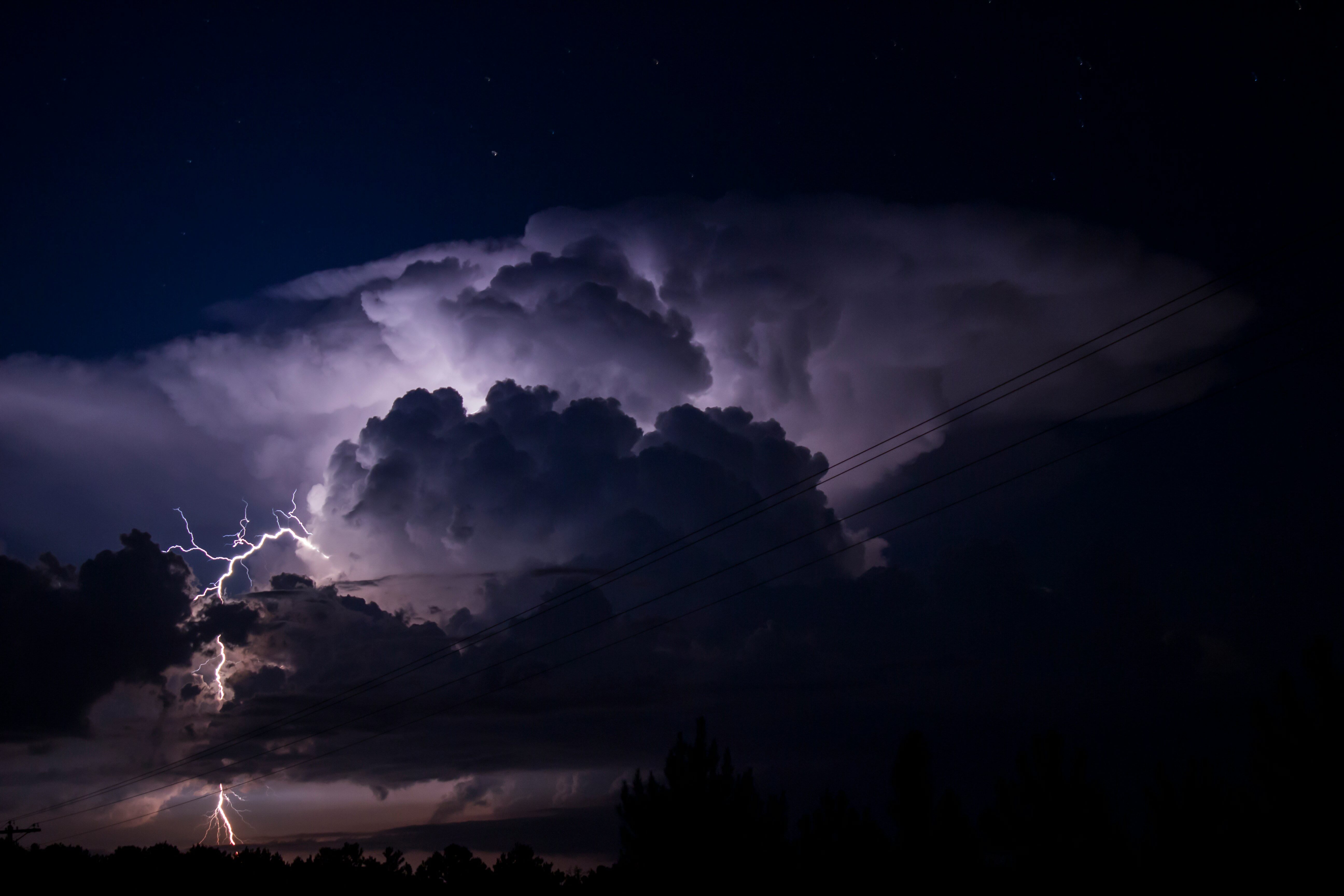
If you have ever watched a satellite loop of a hurricane, it can feel almost alive: a neat spiral of clouds, an eerie calm eye, and bands of rain sweeping across whole states. But hurricanes are not monsters. They are heat engines that run on warm ocean water, moist air, and some very particular atmospheric “house rules.”
Let’s walk through how a hurricane is born, what helps it grow into a major storm, what makes it collapse, and why the forecast cone can shift even when the storm still looks steady on satellite.
The basic recipe
In the Atlantic and eastern Pacific, a hurricane is a tropical cyclone with maximum sustained winds of at least 64 knots (74 mph, 119 km/h). In this basin, “sustained” refers to the 1-minute average used by the National Hurricane Center.
It starts smaller, usually as a cluster of thunderstorms over warm water. To graduate into a hurricane, the storm needs a few key ingredients working together:
- Warm ocean water to provide energy
- Moist air to fuel thunderstorm growth
- Low wind shear so the storm can stay vertically organized
- A pre-existing disturbance to kick things off
- Enough spin from Earth’s rotation to help organize the circulation
- An unstable atmosphere so air can keep rising and building thunderstorms
Miss one of these, and the storm may fizzle, stall, or remain a rainmaker without ever becoming a named storm.
Step 1: Warm water powers the engine
The ocean is the storm’s “battery.” Hurricanes typically need sea surface temperatures around 26.5°C (about 80°F) or warmer, and it helps if that warmth extends several tens of meters down. Why the depth matters: a hurricane’s winds can churn the surface like a giant spoon, pulling colder water up from below. If the warm layer is thin, the storm cools its own fuel supply and weakens.
Warm water does two crucial things:
- It evaporates water into the air. Warm air can hold more water vapor, so the boundary layer over the ocean becomes humid.
- It loads the atmosphere with stored energy. Water vapor carries “hidden” energy called latent heat.
When humid air rises and cools, water vapor condenses into cloud droplets. That condensation releases latent heat into the surrounding air, warming it. Warmer air is lighter, so it rises even faster. This feedback loop is the thunderstorm turbocharger at the heart of a hurricane.

Step 2: A disturbance gathers thunderstorms
Hurricanes rarely start from nothing. In the Atlantic, many begin as tropical waves, ripples of lower pressure that roll off Africa and move west. In other regions, storms can grow from monsoon troughs, remnants of old fronts, or other pockets of unsettled weather.
Think of the disturbance as the initial swirl in a bathtub. By itself, it is not a hurricane. But it can help thunderstorms repeatedly form in the same neighborhood, which is important because hurricanes need time to organize.
Step 3: Pressure drops and winds rush in
As thunderstorms blossom, rising air near the center removes mass from the column of air, and the surface pressure falls. Air responds by flowing inward at low levels toward the lower pressure center.
Here is where the hurricane starts acting like a self-assembling machine:
- Surface air converges toward the low pressure center.
- That inflowing air picks up heat and moisture from the ocean.
- It rises in thunderstorms and releases latent heat.
- Air spreads outward aloft near the top of the storm, like an exhaust system.
As long as the storm’s exhaust stays clear and the ocean keeps supplying warm, moist air, the pressure can continue to fall and winds can strengthen.
Step 4: Earth’s rotation helps organize spin
A common question I used to get from my physics students: “Why doesn’t a hurricane form right on the equator if the water is warm there?”
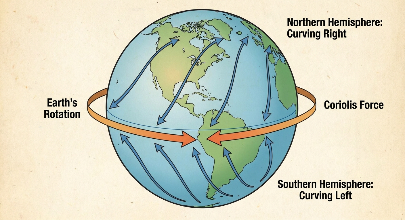
Because hurricanes need help from the Coriolis effect , which comes from Earth’s rotation. The Coriolis effect nudges moving air to curve: to the right in the Northern Hemisphere and to the left in the Southern Hemisphere. Near the equator, that nudge is weak, so thunderstorms struggle to organize into a rotating system.
That is why hurricanes are rare within about 5° of the equator and typically form poleward of roughly 5 to 10° latitude. Once the circulation is established, the storm’s own spin helps maintain its structure, but it usually needs that initial rotational assist to get started.
From depression to hurricane
Meteorologists classify a tropical cyclone by its maximum sustained winds, typically stated in knots operationally and then approximated in mph:
- Tropical depression: ≤33 kt (≤38 mph)
- Tropical storm: 34 to 63 kt (39 to 73 mph), when it gets a name
- Hurricane: ≥64 kt (≥74 mph)
The big transition is organization. A hurricane is not just strong wind. It is a coordinated system with:
- A closed surface circulation
- Persistent deep thunderstorms near the center
- Spiral rainbands that feed warm, moist air inward
- An eyewall, the ring of the most intense winds and rain
When the storm becomes well organized, it can tighten its circulation and concentrate winds closer to the center. That tends to raise peak wind speeds, partly for the same reason an ice skater spins faster when pulling in their arms. In a hurricane, that spin-up also depends on pressure gradients and how the eyewall convection rearranges angular momentum.
Why some storms rapidly intensify
You might hear the phrase rapid intensification, often defined operationally as an increase in maximum sustained winds of at least 30 knots (about 35 mph) in 24 hours. Not every hurricane does this, but when conditions line up, the storm can strengthen surprisingly fast.
Warm water, and warm water that stays warm
Very warm sea surface temperatures help, but so does high ocean heat content, meaning warm water extends deeper. Shallow warmth can be “used up” quickly when mixing brings cold water to the surface.
Moist mid-level air
Hurricanes thrive in humid environments. If drier air gets pulled into the core, it can weaken thunderstorms through evaporation, which cools the air and creates sinking motion that fights the storm’s upward engine.
Low vertical wind shear
Wind shear is a change in wind speed or direction with height. Strong shear can tilt the storm, displace thunderstorms away from the center, and disrupt the heat engine. Low shear lets the storm stack neatly from ocean surface to high atmosphere, like a well-aligned chimney.
A healthy outflow exhaust
Air rising in the core has to go somewhere. Strong outflow high in the atmosphere acts like a good ventilation system, removing air from the top and allowing more to rise from below.
Internal storm structure
Hurricanes can reorganize in ways that either boost or reduce strength. One famous process is an eyewall replacement cycle, where a new outer eyewall forms and chokes off the inner one. During the swap, winds often weaken temporarily, then the storm can re-strengthen with a larger wind field.
Why hurricanes weaken
Hurricanes are picky. Take away their fuel or scramble their structure, and they lose power.
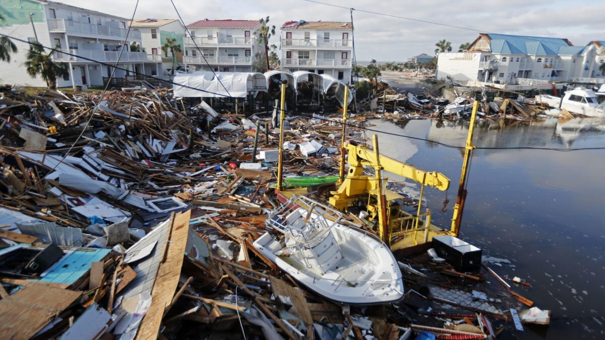
Landfall: friction and a broken fuel line
Over land, a hurricane loses direct access to warm ocean moisture, and surface friction increases. That friction slows winds and disrupts the low-level inflow. The storm can still dump huge amounts of rain far inland, but its core circulation usually decays.
Cooler water and upwelling
Move a storm over cooler water, or stir up cold water from below, and evaporation drops. With less water vapor to condense, less latent heat is released. The engine starts running out of steam.
Wind shear: convection gets displaced
Strong wind shear can shove the thunderstorm towers away from the low pressure center. If the storm cannot keep deep convection wrapped around its core, pressure rises and winds ease.
Dry air intrusion
Dry air can infiltrate the circulation, especially on the edges. Evaporation of cloud and rain cools the air, encouraging sinking motion that works against the storm’s rising core.
Interaction with other weather systems
Sometimes a hurricane merges with mid-latitude fronts and becomes an extratropical cyclone. That does not always mean it becomes harmless. It can still produce powerful winds and flooding. But the energy source shifts from warm-ocean latent heat to temperature contrasts in the atmosphere.
Storm surge: the quiet threat
Wind is dramatic, but storm surge is often the deadliest hurricane hazard. Surge is the abnormal rise of ocean water pushed toward shore by the storm’s winds, with low pressure also contributing a smaller boost. The worst surge tends to happen where onshore winds pile water into shallow coastal waters or funnel it into bays and inlets. Coast shape, seabed slope, and the storm’s size, speed, and angle of approach all matter.
The eye and eyewall
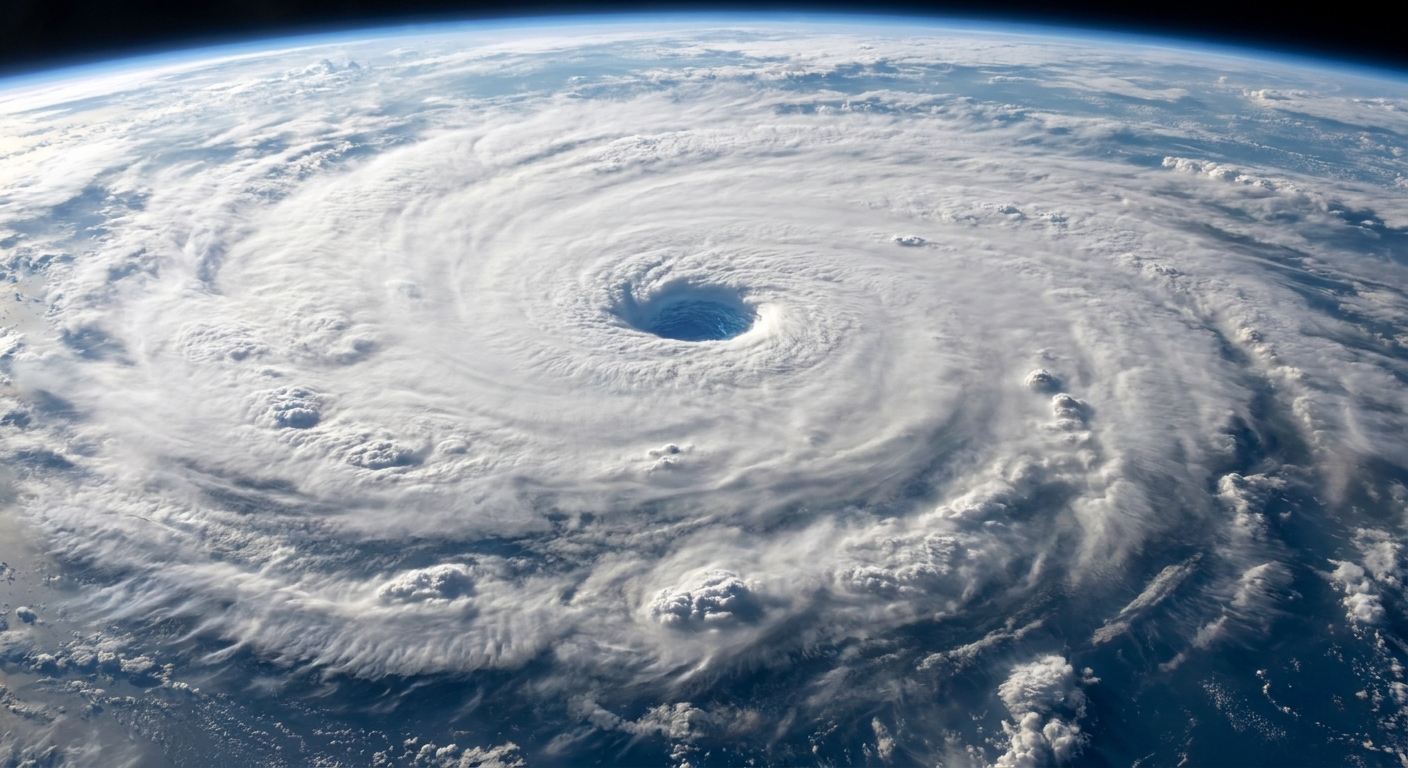
The hurricane eye is often calm and sometimes partly clear because air there is slowly sinking. Sinking air warms and dries, which discourages cloud formation.
Surrounding the eye is the eyewall, where the strongest updrafts live. This is where you typically find the most extreme winds and the heaviest rain. If you have ever seen footage of a sudden lull followed by a violent return of wind, that can happen when the eye passes overhead and the eyewall arrives next.
Why forecasts can change
People are often surprised when a storm track shifts or intensity predictions change, sometimes within a day. Meteorology is not guessing, but it is also not fortune-telling. Hurricanes are sensitive systems, and small changes can ripple outward.
The atmosphere is chaotic
A tiny difference in the storm’s environment, a subtle shift in a steering current, or a pocket of dry air can lead to different outcomes. This is why forecasts come with uncertainty ranges, like the familiar track cone.
Intensity is harder than track
Track forecasts have improved dramatically over the decades because large-scale steering patterns are better observed and modeled. Intensity depends on smaller-scale details like eyewall structure, ocean mixing, and short-lived bursts of thunderstorm activity, features that are tougher to measure and simulate.
The storm can change its own environment
Hurricanes churn the ocean and modify the air around them. A storm might cool the water under its core, ingest dry air from one side, or develop a new eyewall. These internal shifts can swing intensity up or down faster than you would expect from a simple “warm water equals stronger storm” rule.
How storms are tracked
Storm tracking is a team sport involving satellites, aircraft, ocean instruments, and computer models.
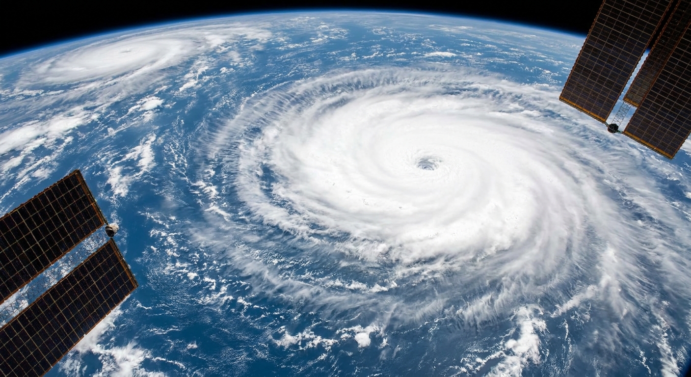
Satellites: the wide-angle view
Geostationary satellites continuously watch cloud tops, storm symmetry, and eye development. Microwave sensors can peer through upper clouds to reveal rainbands and eyewall structure more clearly, which helps identify organization changes.
Hurricane Hunter aircraft: the close-up measurements
When storms threaten land, specialized aircraft fly into them. They measure wind, pressure, temperature, and humidity, and they deploy dropsondes that parachute down and transmit data. That information feeds forecast models and can meaningfully shift predicted track or intensity.
Buoys, floats, and ships: ocean truth data
Ocean buoys record sea surface temperature, wave height, and winds. Argo floats and other instruments help characterize subsurface warmth, the deeper fuel that can make rapid intensification more likely.
Computer models and ensembles
Forecast models simulate the atmosphere and ocean. Because small uncertainties matter, meteorologists also run ensembles, many model runs with slightly different starting conditions. If they cluster tightly, confidence is higher. If they spread out, it is a sign the atmosphere is offering multiple plausible paths.
The big takeaway
A hurricane forms when thunderstorms over warm ocean water organize into a rotating, self-sustaining heat engine. Warm water and moisture provide the fuel, Earth’s rotation helps create structure, and low wind shear lets the system stay neatly stacked. From there, intensification is a tug-of-war between supportive ingredients (warm deep water, moist air, good outflow) and disruptive forces (shear, dry air, land, and cooler seas).
If you want one mental model to keep: hurricanes are less like bombs and more like engines. Engines need fuel, airflow, and stable mechanics. Change any of those, and the performance changes, sometimes slowly, sometimes in a hurry.
Quick FAQ
Do hurricanes spin different directions in different hemispheres?
Yes. They generally rotate counterclockwise in the Northern Hemisphere and clockwise in the Southern Hemisphere because the Coriolis effect deflects moving air in opposite directions.
Can a hurricane cross the equator?
It is extremely rare. The Coriolis effect is too weak near the equator to maintain the organized rotation a tropical cyclone needs.
Is climate change making hurricanes worse?
Warming oceans can increase the odds of heavier rainfall and can support higher peak intensities for some storms. But any single hurricane has multiple influences, including wind shear patterns and regional ocean conditions. The clearest signal is that a warmer atmosphere holds more moisture, so rainfall potential rises.
Why is the cone not the storm’s size?
The forecast cone shows the range of likely locations for the storm’s center, not the full area of impacts. Wind, rain, surge, and tornado risks can extend far outside the cone.