Curiosity, with all its quills showing.
If you follow hurricane season forecasts, you have likely heard the phrase tropical wave. It sounds dramatic, but the idea is wonderfully down-to-earth: a tropical wave is a traveling wrinkle in the trade winds, a gentle trough that can help thunderstorms gather and organize as it moves west.
The short definition
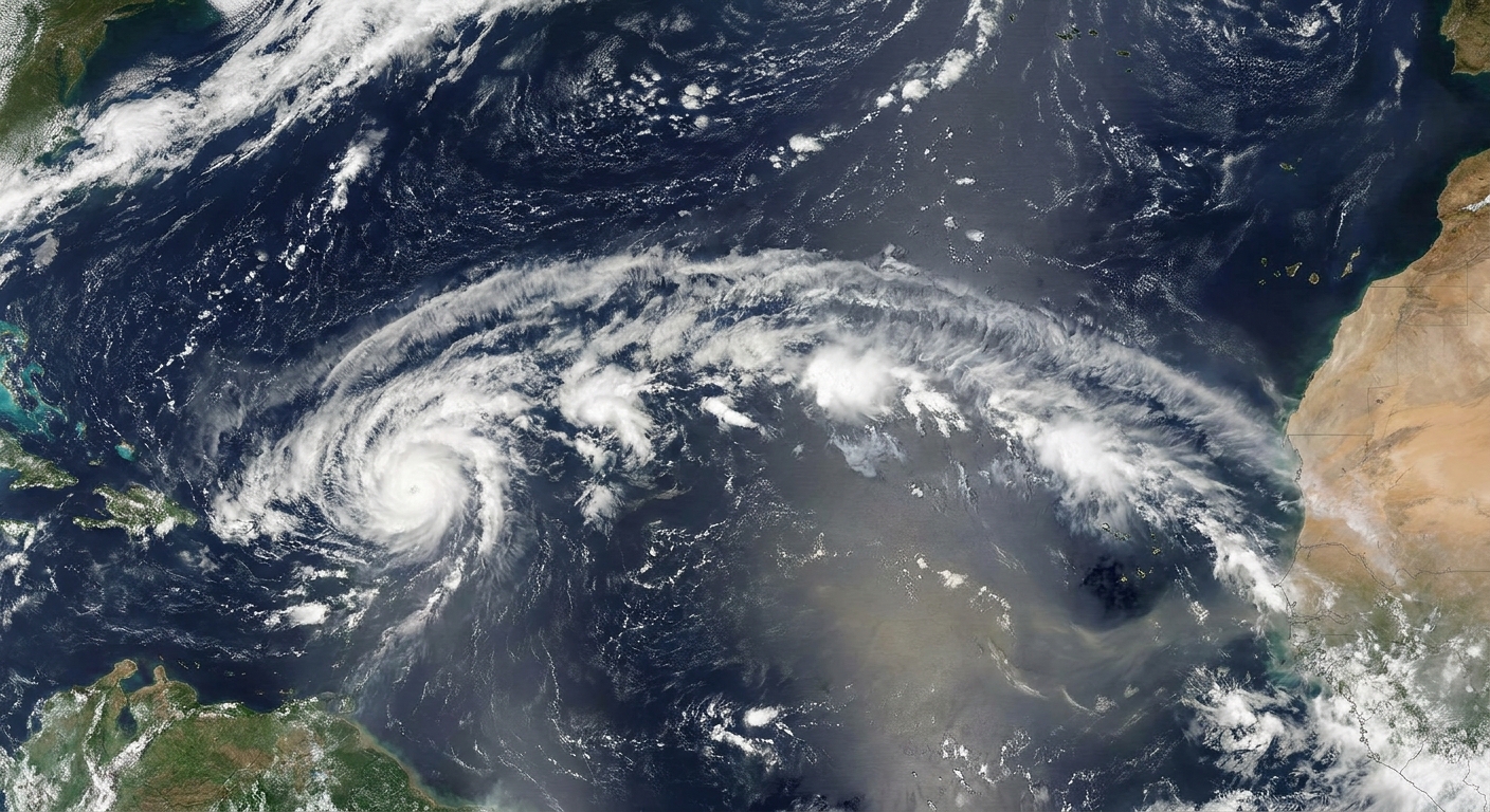
A tropical wave, also called an easterly wave, is a westward-moving trough of lower air pressure embedded in the trade winds of the tropics. In the Northern Hemisphere, winds often shift direction across the wave axis, a change that can encourage low-level convergence and rising air. That upward nudge helps clouds and showers form.
Most tropical waves are not storms. Think of them as disturbances: moving patterns in wind and pressure that can seed areas of thunderstorms. A minority become the “parent” feature of a tropical depression, tropical storm, or hurricane.
What it looks like aloft
In weather maps and analyses, a tropical wave is often described as an open trough. It is not a closed, spinning low like a mature tropical cyclone. Instead, it is a bend in the flow, a region where:
- Pressure is a bit lower than the surrounding environment.
- Winds converge slightly near the surface, nudging air upward.
- Showers and thunderstorms are more likely, especially if the surrounding air is moist and unstable.
On tropical analyses, forecasters may draw a wave axis as a line through that trough. In the mid-levels, a wave can also show up as a subtle kink in the flow and a pocket of enhanced spin, often discussed around the 700 mb level.
Why Africa is a hotspot
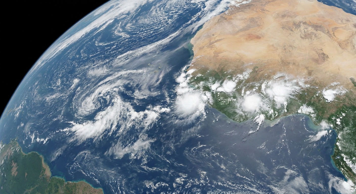
Tropical waves can form in several basins, but a particularly important source region for Atlantic hurricane season is West Africa. Many of the classic Atlantic “seedlings” are African easterly waves that emerge from the continent and roll off the coast near Senegal, Guinea, and surrounding areas into the eastern Atlantic.
These waves are closely tied to the summer setup over Africa, including the African easterly jet and the north to south contrast between the hot, dry Sahara and the wetter monsoon region farther south. That contrast helps disturbances grow and propagate westward. Once a wave reaches the ocean, it can tap into warm water and humid air that may allow thunderstorm clusters to persist and sometimes become better organized.
Tropical waves are especially common from summer into early fall, lining up with the heart of Atlantic hurricane season.
Why waves matter
A tropical wave can influence weather even if it never becomes a named storm. As it passes, it can bring:
- Rounds of heavy rain, sometimes leading to flooding in steep terrain or poor-drainage areas.
- Gusty squalls and rough seas, especially where thunderstorms are strongest.
- A shift in winds and humidity that can change day-to-day weather across the Caribbean, Central America, and the Gulf region.
In other words, “just a wave” can still be a meaningful weather-maker.
How a wave becomes a cyclone
Some waves provide the initial disturbance that later develops into a tropical cyclone. For that to happen, thunderstorms associated with the wave need to become more persistent and better organized, and the system needs an environment that supports strengthening.
Forecasters commonly watch for a few broad signals:
- Warm ocean water to supply heat and moisture.
- Moist air through a deep layer of the atmosphere.
- Low vertical wind shear, meaning winds do not change too sharply with height.
- Increasing organization, often seen as the wave’s trough tightens toward a closed circulation.
Even with those ingredients, development is not guaranteed. Dry air, stronger shear, or disruptive interactions with nearby weather systems can keep a wave disorganized. Another frequent spoiler in the Atlantic is the Saharan Air Layer, a mass of dry, dusty air that can suppress thunderstorms and add stability, making it harder for a wave to consolidate.
How waves are tracked
Tracking a tropical wave is a bit like tracking a moving ripple in a stream. The ripple is real, but its shape changes. Meteorologists rely on multiple observing systems, each contributing a different clue.
Satellite imagery
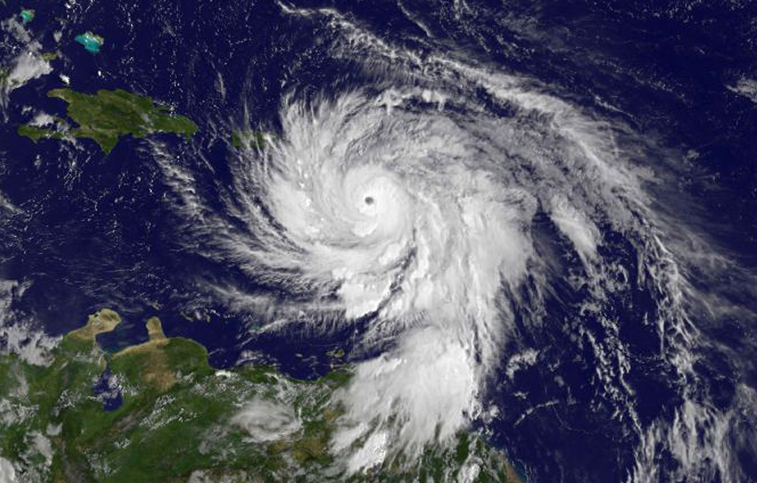
Geostationary satellites continuously watch cloud patterns over the tropics. A wave may show up as a kink in cloud bands or a repeating pulse of thunderstorm clusters moving along with the trades. Infrared imagery helps reveal cold, tall thunderstorm tops, while visible imagery can show structure during daylight hours.
Scatterometer winds over the ocean
Polar-orbiting satellites can estimate surface winds over water using scatterometers. These snapshots help identify wind shifts and pockets of convergence that line up with a wave’s trough axis.
Surface observations and buoys
Buoys and island weather stations can capture subtle changes in wind direction, pressure, and rainfall as a wave passes. Those ground-truth measurements are especially helpful in the Caribbean where land stations are more plentiful.
Weather balloons and aircraft reconnaissance
Weather balloons sample winds and moisture through the atmosphere, adding detail about the environment around a wave. Aircraft reconnaissance is rarely used for a purely open wave, and is more often tasked once a system shows clearer signs of organizing or closing off a circulation.
Numerical weather models
Forecast models simulate the atmosphere and can project where a wave will travel and whether it might consolidate. Models vary, and small differences in moisture, shear, and thunderstorm placement can lead to big differences in outcomes, especially several days out.
What development odds mean
When you see statements like “a tropical wave has a 30% chance of development in 48 hours” (wording varies by agency), that percentage is an estimate of the likelihood that the disturbance will become a tropical cyclone within a set time window.
Those odds are informed by current observations, model guidance, and pattern recognition from many past cases. They are not a promise that a system will or will not develop, and they do not directly tell you how strong a system might become if it does develop.
Two practical ways to read development odds:
- Low odds can still mean locally heavy rain if thunderstorms are already active.
- Rising odds over time often signal that organization is improving or the environment ahead looks more favorable.
Wave vs. disturbance vs. depression
These terms can feel like a vocabulary quiz, but the differences are about structure.
- Tropical wave: an open trough and wind shift moving with the trade winds, often with showers and thunderstorms.
- Tropical disturbance: a general term for an area of unsettled weather that could develop, including waves and other setups.
- Tropical depression: a more organized system with a closed surface circulation and sustained winds below tropical storm strength.
A wave can be part of a disturbance. If that disturbance tightens into a closed circulation, it may be classified as a depression.
Common misconceptions
“A tropical wave is basically a hurricane.”
No. A wave is often far weaker and more open. It can be the seed for a cyclone, but most waves never become one.
“If a wave is mentioned, a storm is coming.”
Not necessarily. Waves are frequent features in the tropics. Many bring rain and then keep moving.
“You can always see the wave clearly on satellite.”
Sometimes the best clue is not a dramatic swirl but a subtle wind shift, a repeating pattern of storms, or a change in cloud organization.
Quick FAQ
How long does a tropical wave last?
A wave can persist for days as it travels across an ocean basin, but its thunderstorm activity may wax and wane. Land interactions, dry air, and wind shear can weaken its signature.
How fast do tropical waves move?
Many move around 10 to 15 knots, sometimes faster or slower depending on the surrounding wind pattern. That is roughly 12 to 17 mph (about 19 to 28 km/h).
Can tropical waves affect the United States?
Yes. In the Atlantic basin, waves commonly bring surges of moisture and thunderstorms into Florida, the Gulf Coast, and sometimes Texas. Farther west, the moisture left behind by tropical systems, especially in the eastern Pacific, can occasionally feed into the North American monsoon and boost storm chances in parts of Arizona and New Mexico.
What should I do if a tropical wave is approaching?
For most locations, it is a cue to monitor rain and flooding potential, especially if you are in a flood-prone area. If forecasts start highlighting development potential, follow updates from official meteorological agencies for your region.
The take-home idea
A tropical wave is a traveling trough in the trade winds: a common, mobile feature of the tropics that can organize showers, shift winds, and sometimes provide the first nudge toward a tropical cyclone. If you picture a moving ripple in the atmospheric flow, you are already most of the way there.