If you have ever wondered why a storm track suddenly shifts, or why one week feels like spring and the next snaps back to winter, you are usually looking at the same behind-the-scenes traffic cop: the jet stream. It is not a single gust or a one-time event. It is a semi-permanent band of strong winds high above us that helps steer weather systems day to day.
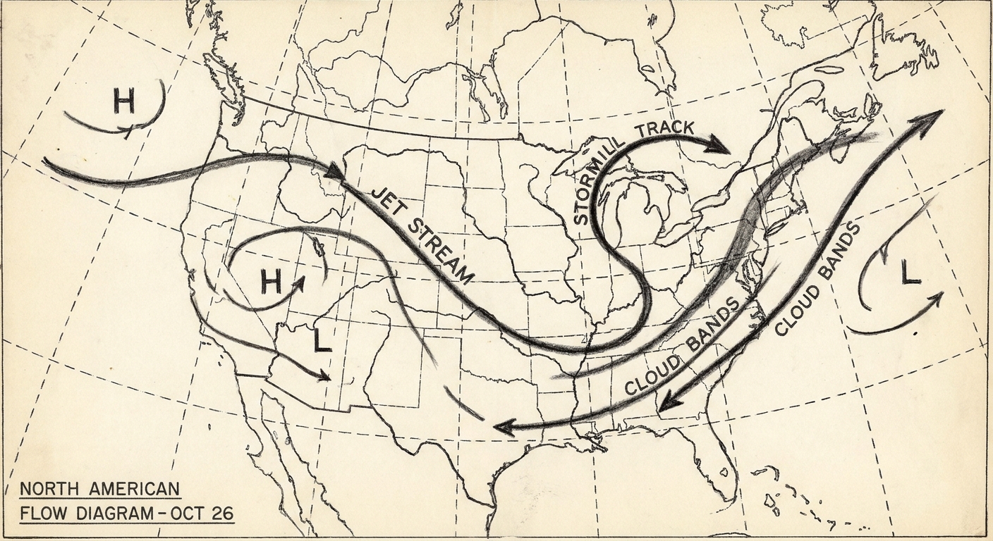
Let’s unpack what the jet stream is, where it lives, why it wiggles, and how those wiggles translate into the forecast you see on your phone.
The jet stream in one sentence
The jet stream is a narrow ribbon of very fast wind in the upper troposphere, typically around 5 to 9 miles (8 to 14 kilometers) above the ground, that forms along strong temperature contrasts and helps guide storms.
Two quick clarifiers that keep a lot of weather conversations from getting tangled:
- Jet stream: mainly a tropospheric wind feature, tied closely to everyday weather.
- Stratospheric polar vortex: a different, higher-altitude wind belt in the stratosphere. It can influence winter patterns, but it is not the same thing as the jet stream you see waving across TV maps.
Where the jet stream lives and why it is so fast
The troposphere is the lowest layer of the atmosphere and the one where almost all weather happens. Near the top of it, winds often accelerate into jet streams.
Why? Picture the atmosphere as a giant heat engine. The equator receives more sunlight than the poles, so the planet builds a persistent north to south temperature gradient. Where that temperature contrast is sharp, the atmosphere responds with sharp changes in pressure with height. That sets up strong high-altitude winds.
In physics terms, the jet stream is closely tied to the thermal wind relationship: stronger horizontal temperature contrasts lead to larger changes in wind speed with height. Add in Earth’s rotation, which turns straight flows into curved ones, and you get fast, meandering rivers of air.
The two main branches: polar jet and subtropical jet
People say “the jet stream” as if it is one fixed line, but there are two headline jets that matter most for midlatitude weather.
The polar jet
The polar jet tends to set up along the boundary between cold polar air and milder midlatitude air, often near what meteorologists call the polar front. It is the one most associated with big swings in temperature and the parade of storms that cross North America and Europe.
Typical characteristics:
- Often stronger in winter, when the pole-to-equator temperature contrast is greatest.
- Frequently sits between about 30° and 60° latitude, but it wanders.
- Closely linked to the movement and intensification of midlatitude cyclones and fronts.
The subtropical jet
The subtropical jet is usually found a bit farther south, near the boundary between tropical and subtropical air masses, often around 20° to 35° latitude. It can be a major player for high-altitude moisture transport and can help energize storms when it overlaps or interacts with the polar jet.
Typical characteristics:
- Can be prominent in winter and spring in many regions.
- Often associated with strong upper-level winds emerging from the Hadley cell circulation.
- Important for storm development when its fast winds help ventilate a growing low-pressure system.
Ridges and troughs: the jet stream’s dips and bulges
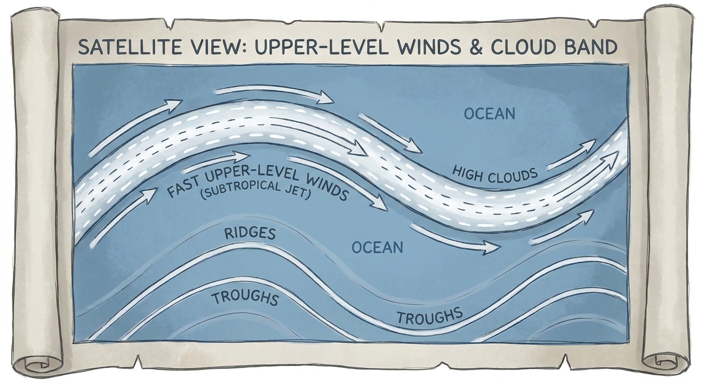
The jet stream rarely forms a neat circle around the planet. Instead, it undulates in big waves. Meteorologists describe these waves with two simple shapes:
- Ridge: a northward bulge in the jet stream. Ridges are often associated with sinking air and, depending on season and location, calmer or warmer conditions near the surface.
- Trough: a southward dip in the jet stream. Troughs are often associated with rising motion and can favor cloudiness, storms, and cooler air spilling equatorward.
Here is a simple map-style sketch you can keep in your head. Imagine you are looking down at the Northern Hemisphere:
        (cooler north)

     Ridge        Trough        Ridge
       /\            \/           /\
      /  \          /  \         /  \
-----/----\--------/----\-------/----\-----  Jet stream path

        (warmer south)
That wavy path matters because the jet stream is not just along for the ride. It helps steer where surface low-pressure systems travel, where fronts stall, and where big temperature boundaries set up.
How the jet stream steers storms
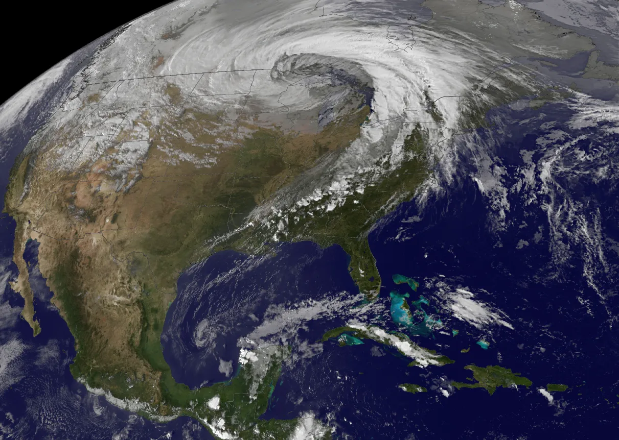
Weather systems are like spinning tops embedded in a flowing river. They tend to move with the broader winds that surround them, especially in the mid and upper atmosphere. Since the jet stream is often the fastest part of that flow, it acts like a high-speed conveyor belt for many storms.
Three practical ways the jet stream influences what you experience at ground level:
1) It guides the storm track
Surface lows and their fronts often travel along the jet stream corridor, particularly near sharp temperature gradients. If the jet shifts north, the typical storm path often shifts north with it. If it dips south, storms tend to follow.
2) It can help storms intensify
Fast winds aloft can remove air from the top of a developing storm system. When the upper atmosphere “pulls air away,” surface pressure can fall, encouraging stronger inflow near the ground and potentially a more intense cyclone. This is one reason meteorologists pay close attention to where jet streaks and their wind maxima sit relative to surface lows.
3) It shapes where cold and warm air meet
Because the polar jet often sits near the boundary between air masses, its position can mark the difference between jacket weather and t-shirt weather over surprisingly short distances. When the jet sets up in a persistent pattern, those contrasts can last for days.
Why the jet stream wiggles at all
If Earth were perfectly uniform, the jet stream would be far smoother. But our planet has mountains, continents, oceans, and strong seasonal changes. Those features disturb the flow and help generate large-scale atmospheric waves.
Some major influences include:
- Temperature contrasts: Stronger north to south temperature differences generally support a stronger jet, especially in winter.
- Land and ocean patterns: Oceans store heat and release it slowly, while land heats and cools quickly. That difference can reshape temperature gradients and shift jet positions.
- Mountain ranges: Features like the Rockies and Himalayas can deflect and reshape high-altitude flow, nudging ridges and troughs into preferred positions.
- Storms themselves: Growing cyclones and anticyclones can amplify the waves, like a moving boat feeding energy into water waves.
Common jet stream myths, gently retired
Myth: The jet stream is the same thing as the polar vortex
No. The jet stream is mainly in the troposphere. The classic polar vortex is a stratospheric circulation higher up. They can interact at times, but they are not interchangeable terms.
Myth: A “strong” jet stream always means harsh weather
A strong jet often means an active storm track somewhere, but whether that translates into rough weather for you depends on where the jet is positioned. A fast jet aimed north of you can mean quieter conditions. A fast jet overhead can mean storm after storm.
Myth: The jet stream is a thin line you could fly through like a tunnel
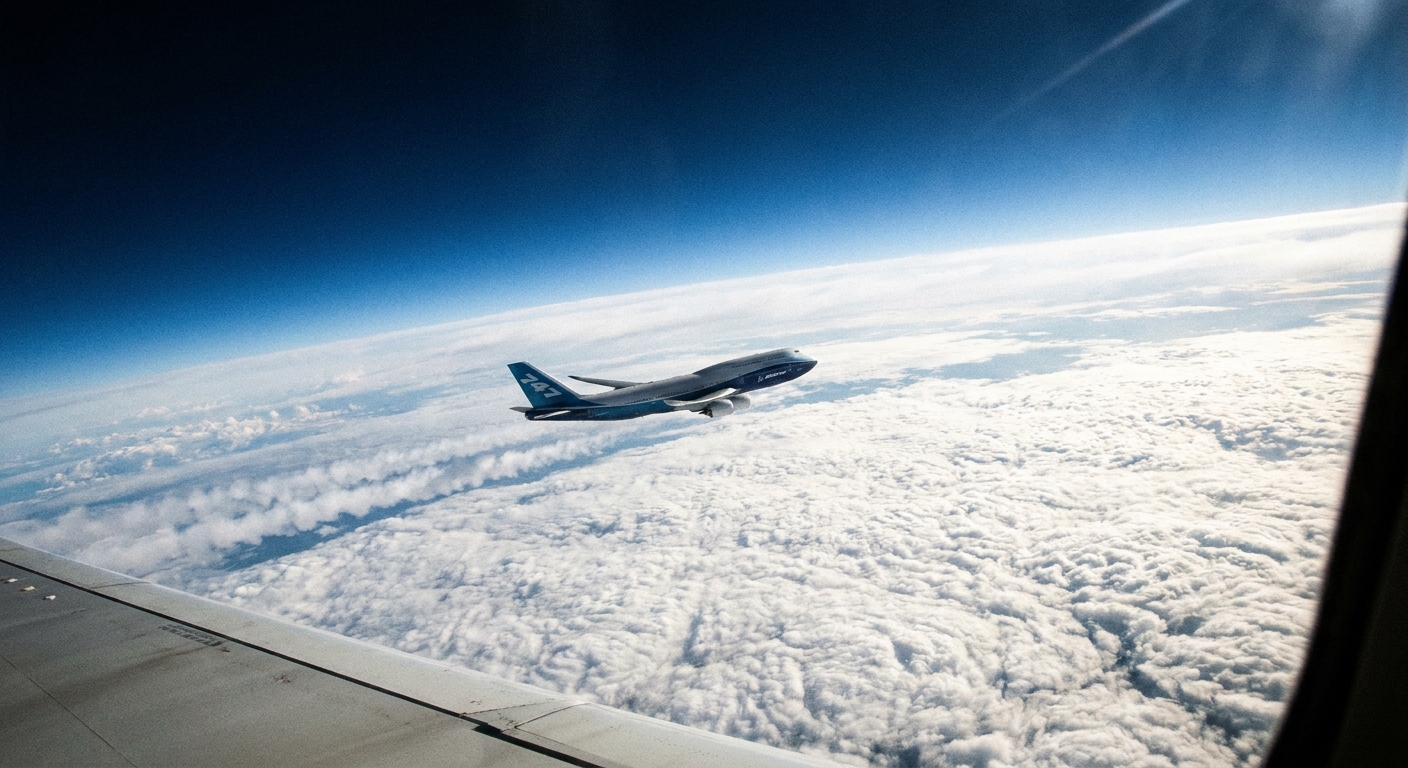
In reality, it is a broad zone of stronger winds, not a rigid tube. Commercial aircraft can take advantage of tailwinds in the jet stream and try to avoid headwinds, but the atmosphere is not a single-lane highway.
Jet stream basics you can spot on a weather map
Most consumer weather apps do not explicitly show the jet stream, but you can infer it from a few map layers:
- Upper-level wind maps (often 250 mb or 300 mb): the jet stream shows up as long corridors of the fastest winds.
- 500 mb height maps: ridges and troughs are especially clear here, and they often line up with the jet’s wave pattern.
- Surface fronts and pressure: storm tracks often arc along the same path the jet is taking aloft.
A handy rule of thumb from my teaching days: if you see a deep trough on the map, expect a better chance of unsettled weather near and ahead of it, and cooler air behind it. If you see a stout ridge, expect more stable conditions and, often, warmer temperatures for the season.
Quick FAQ
How high is the jet stream?
Typically near the top of the troposphere, often around 5 to 9 miles (8 to 14 kilometers) up. The exact altitude shifts with season and latitude.
How fast is the jet stream?
Winds in the jet stream commonly run around 80 to 140 mph (130 to 225 km/h), and can be higher in strong winter patterns or in concentrated “jet streaks.”
Is there a jet stream in summer?
Yes, but it is often weaker and shifted compared to winter because the temperature contrast between the equator and poles is smaller.
Does the jet stream exist in the Southern Hemisphere?
Yes. The Southern Hemisphere has its own jets, and because there is more ocean and less land disruption, its flow can be more continuous in some seasons.
The takeaway
The jet stream is a fast-moving river of air in the upper troposphere, typically split into polar and subtropical branches. Its ridges and troughs are not just pretty squiggles on a map. They are the pathways that guide storms, shuffle warm and cold air, and set the rhythm of week-to-week weather.
Once you start noticing those dips and bulges, a lot of forecasts stop feeling random and start feeling, if not predictable, at least wonderfully explainable.