If you have ever looked at a winter weather map and wondered why London is usually far milder than, say, places in Canada at similar latitudes, you have met the Gulf Stream, even if no one named it out loud. A big part of that story is also atmospheric: prevailing westerly winds and the moderating influence of the nearby ocean keep western Europe from swinging to the same winter extremes you see deep inside continents. The Gulf Stream matters because it is one of the main ways the Atlantic Ocean delivers heat to the air those winds carry east.
The Gulf Stream in plain language
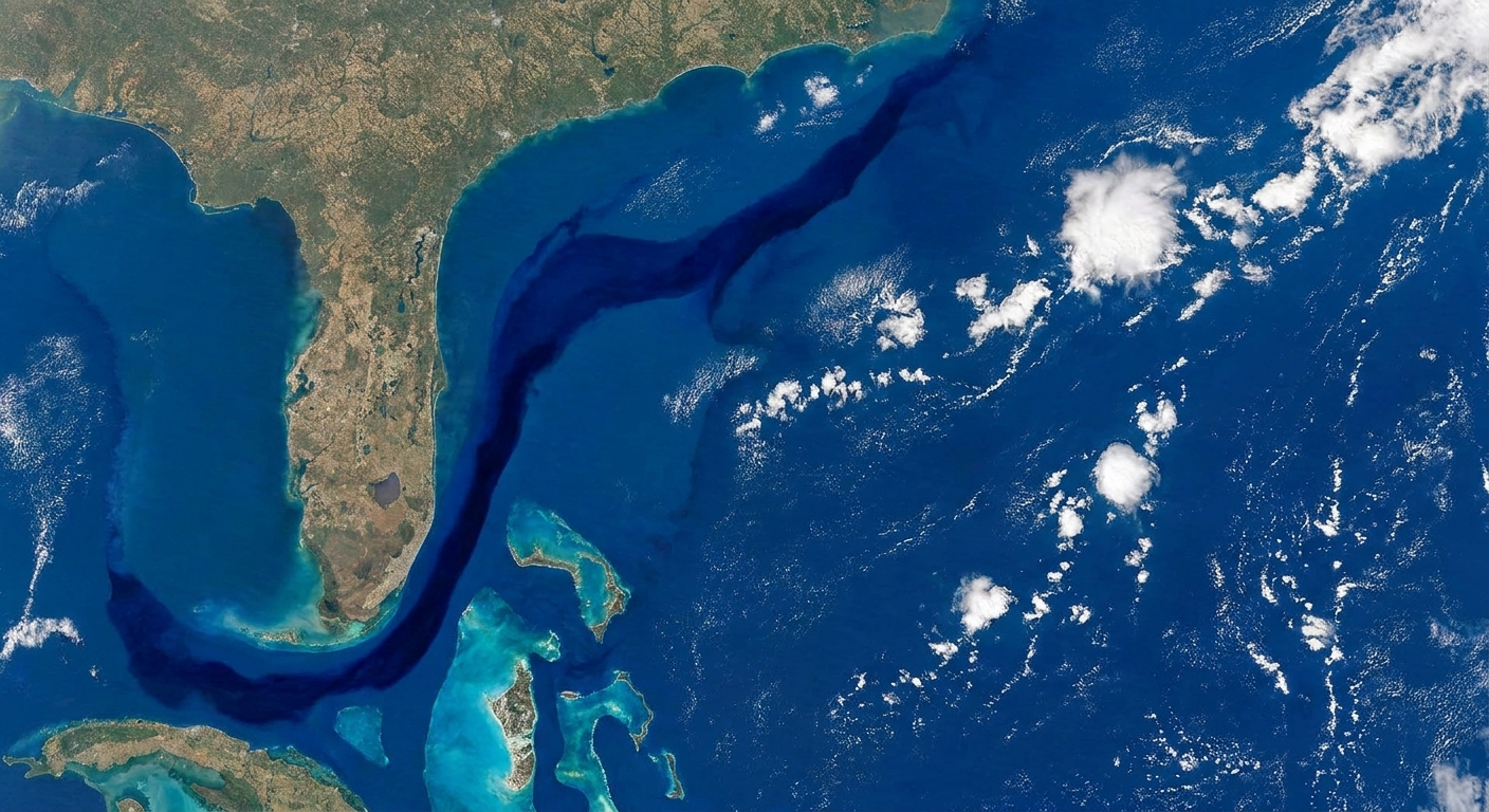
The Gulf Stream is a strong, warm surface current in the Atlantic Ocean. In most scientific definitions, it begins in or just downstream of the Florida Straits, where water is funneled between Florida and the Bahamas like water through a nozzle. That squeeze helps it speed up. From there, it flows north along the U.S. East Coast, mostly offshore, before turning eastward into the open Atlantic.
Two details help keep the mental picture accurate:
- It is warm because it draws from subtropical waters. Sunlight pours energy into low-latitude oceans. The Gulf Stream transports some of that stored heat northward.
- It is fast because the Atlantic’s wind-driven circulation and Earth’s rotation organize the flow. The Gulf Stream is part of a larger pattern of currents that circle the North Atlantic. Earth’s rotation helps steer moving water into coherent currents rather than letting it simply slosh around.
For a rough numerical anchor, surface speeds can reach around 1 to 2 meters per second in the Florida Current portion (think a brisk walking pace to faster), and the volume of water carried northward is enormous, commonly summarized as tens of Sverdrups (tens of millions of cubic meters per second).
Where it starts and where it goes
From the Gulf of Mexico to the Florida Straits
A common source of confusion is the name. The Gulf Stream does not simply leak out of the Gulf and wander away. It is fed by a loop of currents in the Gulf of Mexico (often called the Loop Current), and then that flow exits through the Florida Straits. In that narrow passage, the current can be especially swift.
Up the U.S. East Coast
As the Gulf Stream runs north, it stays mostly offshore, roughly following the edge of the continental shelf. It does influence coastal conditions, especially through the way it sheds swirling eddies that can tug warm water closer to shore or spin cooler water upward from below.
Turning into the North Atlantic
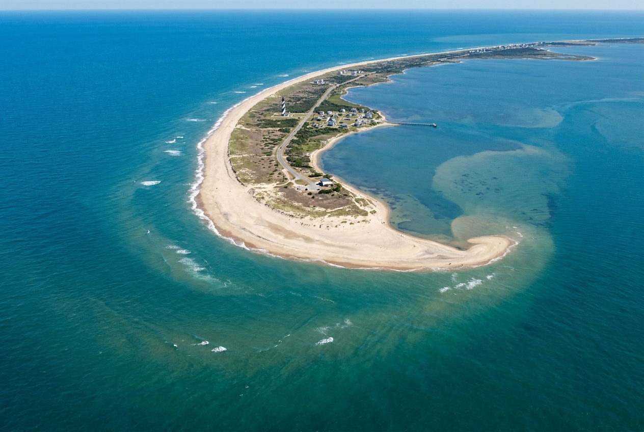
Near Cape Hatteras, North Carolina, the current begins to peel away from the coastline and head into the open ocean. Farther northeast, parts of the flow connect into the North Atlantic Current. At that point, the water is still helping move heat poleward, but the “highway” is broader and more braided, and it interacts more directly with the subpolar gyre and the ocean fronts that separate subtropical and subpolar waters.
What drives the Gulf Stream?
When I taught physics, I used to tell students that nature loves gradients. Differences in pressure and sea level are like charged batteries, and fluids are always trying to run that stored energy down. The Gulf Stream exists because of a few big “batteries” working together:
- Wind patterns: The trade winds and westerlies push surface waters into large circular motions called gyres. The Gulf Stream is the intense western boundary current of the North Atlantic subtropical gyre.
- Earth’s rotation: Rotation deflects moving water, helping currents hug coastlines on the western side of ocean basins and intensify into narrow, fast streams.
- Pressure and density structure: Density differences (set by temperature and salinity) shape the ocean’s layering and the placement of fronts, and they matter a great deal for the Atlantic’s deeper overturning circulation. For the Gulf Stream itself, winds and the resulting pressure gradients are the primary drivers, while density effects help set the background structure the current flows within and exchanges with.
One important clarification: the Gulf Stream is often mentioned alongside the Atlantic Meridional Overturning Circulation (AMOC). They are connected, but they are not identical. The Gulf Stream is a fast surface current in the western Atlantic. The AMOC is a basin-spanning system involving surface flow northward and deeper return flow southward. You can think of the Gulf Stream as one highly visible component in a bigger machine.
How scientists track the Gulf Stream
We cannot put speedometers on every gallon of seawater, so oceanographers use a toolbox of clever measurements that, stitched together, show where the current is, how fast it is moving, and how it is changing.
Satellites: the big-picture view
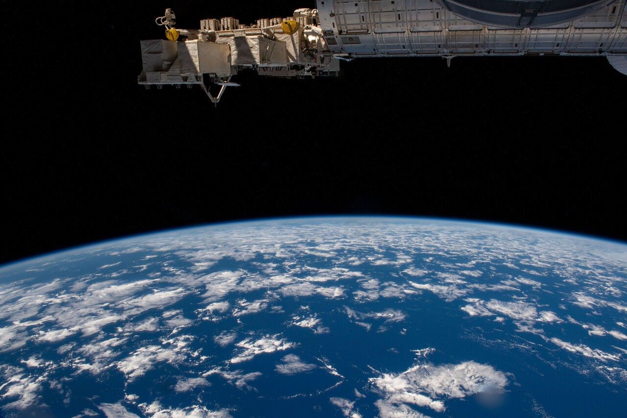
From space, scientists can estimate:
- Sea surface temperature: Warm water stands out. The Gulf Stream often appears as a sharp temperature boundary where warm subtropical water meets cooler shelf and subpolar waters. Across that boundary, temperature can change by several degrees Celsius over a relatively short distance.
- Sea surface height: A strong current tends to have a tilt in sea level across it. Satellite altimetry measures sea surface height with remarkable precision, and that helps infer surface currents.
Satellites are great at revealing the Gulf Stream’s path and its meanders, but they mainly see the surface. To understand the full structure, you need instruments in the water.
Moored instruments: continuous monitoring
In key choke points, such as the Florida Straits, researchers deploy arrays of instruments that measure current speeds and properties of the water over time. These are especially valuable because they provide continuous records through storms, seasons, and years.
Drifters and floats: following the flow
Surface drifters move with the upper ocean and report their positions via satellite, tracing out pathways like tiny message bottles with GPS. Profiling floats repeatedly dive and rise, measuring temperature and salinity as they go, giving a 3D view of the ocean’s structure.
Ships and gliders: targeted surveys
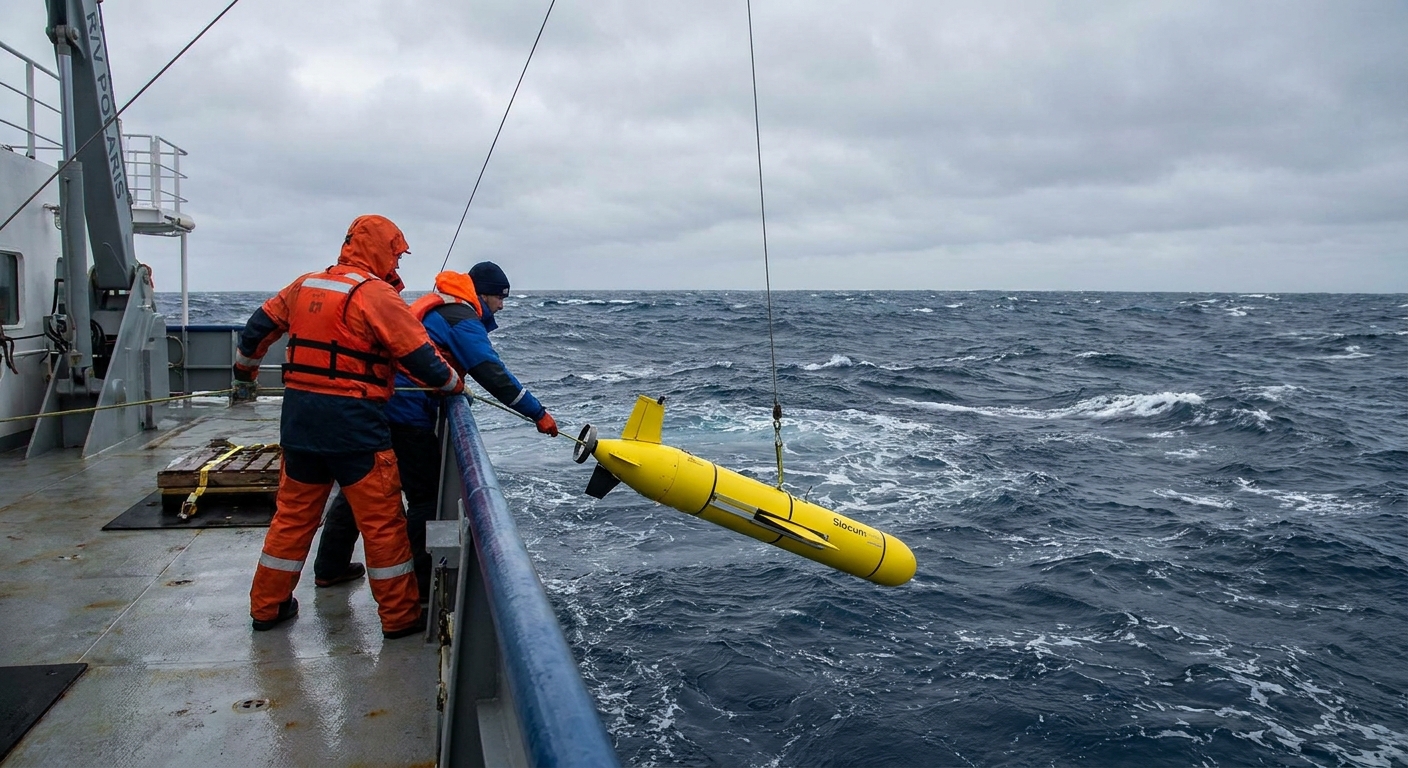
Research vessels can run cross-current transects, measuring temperature, salinity, and velocity from near the surface down through deeper layers. Autonomous underwater gliders can do similar work more slowly but for longer durations, quietly patrolling the edges of the current and mapping its fronts and eddies.
Why northwestern Europe is milder
Here is the core idea: the Gulf Stream and its downstream extensions transport heat from lower latitudes toward higher latitudes. That heat does not stay in the water forever. The ocean releases some of it to the atmosphere, especially in winter when cold air passes over relatively warm water. Winds then help carry that warmth toward land.
But the ocean is only half the partnership. A large share of northwestern Europe’s winter mildness comes from its maritime setting and the prevailing westerlies that frequently bring in ocean-tempered air. The Gulf Stream matters because it helps keep parts of the North Atlantic warmer than they would otherwise be, which influences what those winds are carrying.
- Prevailing winds: In mid-latitudes, winds often blow from west to east. That means air masses that have picked up heat and moisture over the North Atlantic are frequently delivered into western Europe.
- Ocean and air work as a team: The ocean stores heat efficiently. The atmosphere moves heat quickly. Together, they smooth out winter extremes compared with places where cold continental air dominates.
It is worth being careful with the common shorthand that “the Gulf Stream keeps Europe warm.” Europe’s climate is shaped by many factors including atmospheric circulation, geography, and the broader North Atlantic current system. But the heat transported by this ocean circulation is part of the reason winters in places like Ireland and the United Kingdom are generally milder than you might expect at their latitude.
What it affects along the U.S. coast
If you live along the U.S. East Coast, the Gulf Stream is not just a trivia answer. It can influence:
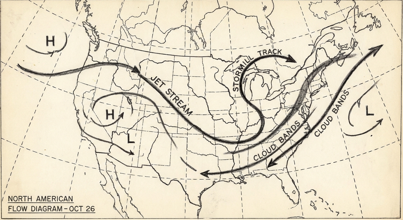
- Weather and storms: Warm ocean water can provide energy and moisture to passing storm systems. Sharp temperature contrasts near the Gulf Stream can also help shape storm tracks and intensification conditions.
- Fisheries and marine ecosystems: The boundary between warm and cold water masses can be biologically rich. Eddies spun off the current can transport nutrients and organisms in complicated ways.
- Sea level along the coast: Changes in the strength or position of major currents can subtly affect coastal sea level patterns. For example, shifts in current strength offshore can change how water piles up along parts of the U.S. Northeast coast, alongside the much larger effects of winds, tides, and long-term sea level rise.
Is it slowing down?
This question comes up a lot, and the most honest answer is: scientists actively study changes in the Gulf Stream and the broader Atlantic circulation, and the picture depends on what you mean by “slowing down.”
The Gulf Stream itself is a wind-driven boundary current embedded in a larger system, and it varies naturally from season to season and year to year. Trends in its strength depend on where and how you measure it (for example, transport through the Florida Straits versus shifts in the current’s path offshore). That makes simple, one-number claims hard to support.
The AMOC, meanwhile, involves deep-water formation and large-scale density-driven circulation that may respond to warming and freshwater inputs in the North Atlantic. The state of evidence is often summarized this way: there are observational and proxy records that suggest the AMOC could be weaker than it was in the past, and climate models project a weakening over the 21st century under continued warming. But translating that into a neat headline about “the Gulf Stream shutting down” is usually an oversimplification.
What is solid ground to stand on as a reader is this: the Gulf Stream meanders, sheds eddies, and shifts in strength and position over time. Scientists watch it with satellites and in-water measurements precisely because it matters for regional climate, sea level patterns, and ecosystems on both sides of the Atlantic.
Quick FAQ
Is the Gulf Stream the same as the AMOC?
No. The Gulf Stream is a fast surface current in the western North Atlantic. The AMOC is a larger, basin-wide circulation pattern involving surface and deep currents. They interact, but they are not the same thing.
How fast is the Gulf Stream?
It varies by location and conditions. It can be especially fast in constrained regions like the Florida Straits, where surface speeds can reach roughly 1 to 2 meters per second. It generally slows and broadens as it heads into the open Atlantic.
Can you see it from shore?
Not directly as a line on the water. But its influence can show up in sea surface temperature differences, fog patterns, and the movement of floating seaweed like sargassum. The crispest “view” is typically from satellite temperature maps that reveal the warm ribbon and its swirling eddies.
Why does it wiggle on maps?
Because it is a dynamic fluid system. The current develops meanders and pinches off eddies, much like a fast-flowing river can form looping bends and spinning side pools, just on a much larger scale.