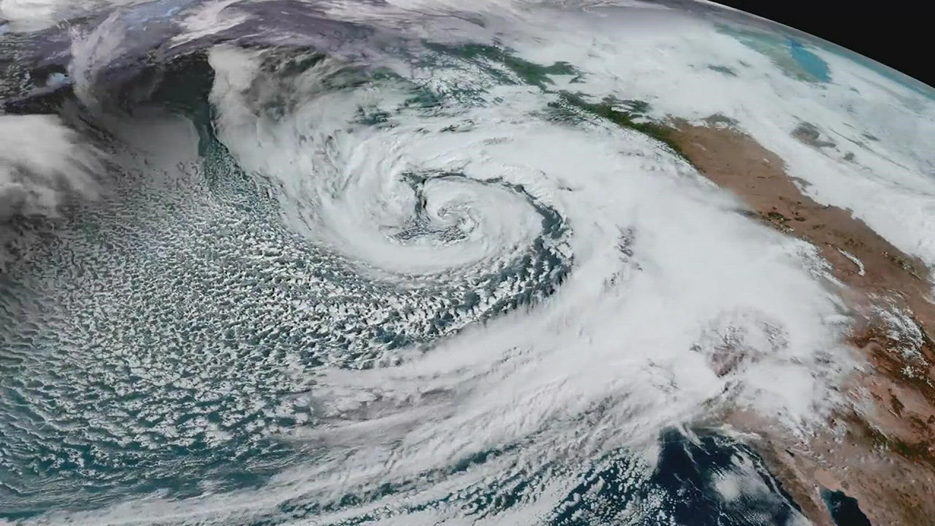
The first time I heard the phrase atmospheric river, I pictured something like a liquid stream hanging in the sky. That is not quite right, but it is not totally wrong. An atmospheric river is more like a firehose-shaped corridor of humid air that can stretch for thousands of miles, quietly transporting ocean-sourced water vapor toward land. When that invisible “river” runs into mountains or weather fronts, it can wring itself out fast.
These events matter because the heaviest impacts often concentrate over a narrow coastal strip and nearby mountains, where the atmosphere is forced to rise, cool, and drop its moisture as rain or snow.
The simple definition
An atmospheric river is a long, narrow region of unusually strong water vapor transport through a deep layer of the troposphere, most prominently in the lower-to-mid levels. Think of it as a preferred lane on a highway where moisture is moving much faster, and in much larger amounts, than the air around it.
Two key details often get lost in the dramatic name:
- It is mostly water vapor, not liquid water. You cannot “see” an atmospheric river directly with your eyes the way you see a river on a map. What you do see are clouds and precipitation that form when the plume is lifted and cooled.
- The defining feature is transport. It is not just humid air sitting in place. It is moisture being actively moved from one region to another.
How forecasters detect one: IVT
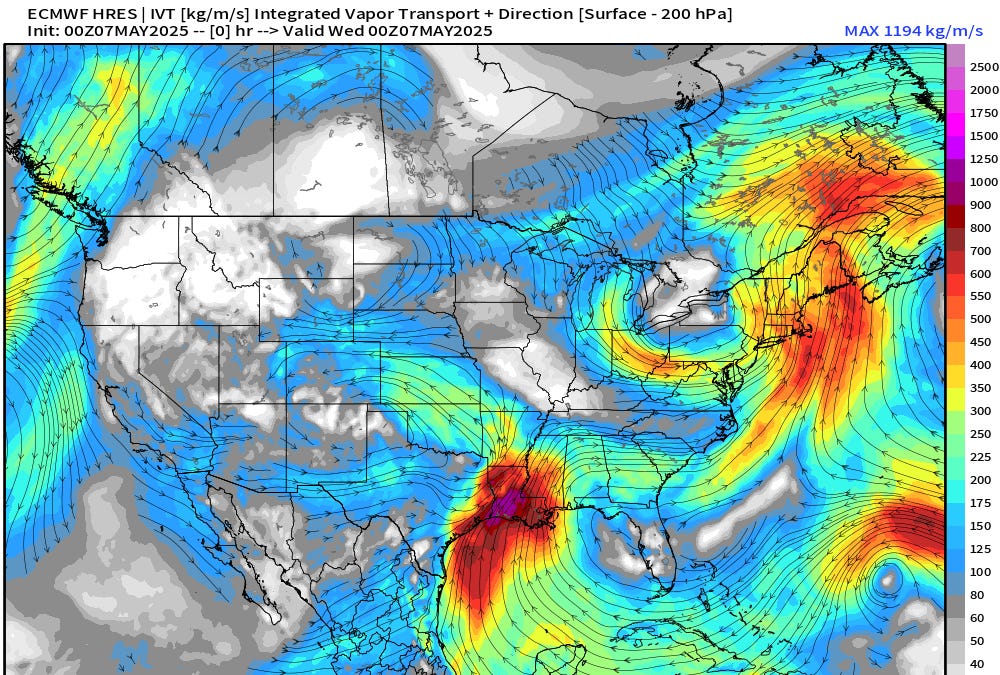
If atmospheric rivers are about moisture on the move, the natural question is: how do we measure that movement? One of the most widely used tools is integrated vapor transport, usually shortened to IVT.
What IVT means in plain language
IVT is a measure of how much water vapor is flowing past a line, and how fast, through a deep slice of the atmosphere. In practice, meteorologists combine two ingredients:
- How much water vapor is present (humidity through a vertical column of air)
- How strong the winds are that are pushing that vapor along
When both are high, IVT spikes. That is the signature of an atmospheric river: a thin ribbon of high IVT compared with the surrounding air.
Why IVT is better than “it feels humid”
A muggy summer day can have a lot of moisture, but if winds are light, the moisture is not being transported efficiently. IVT captures the combination that drives big landfall events: deep moisture plus strong steering winds.
Why landfall can mean intense rain
Over the open ocean, an atmospheric river can be impressive on a satellite map and still produce limited impacts for people. The trouble tends to start when the plume reaches land, especially a rugged coastline.
The squeeze: lifting the air makes it rain
As moist air is forced upward by terrain or by a weather system, it cools. Cooler air cannot hold as much water vapor, so vapor condenses into cloud droplets, and droplets grow into rain or snow. This process is why coastal mountains are such powerful “sponges” during atmospheric river events.
Why the bullseye is often so tight
Atmospheric rivers are often a few hundred miles (roughly 400 to 800 km) wide, sometimes less. Where the highest IVT intersects the coastline, the strongest upslope winds, and the most favorable storm dynamics, rainfall can ramp up sharply over a relatively small distance.
That is why you can see a pattern like this:
- Very heavy rain on windward coastal slopes and mountain foothills
- Moderate rain a county or two away
- Much lighter totals farther inland or in rain shadows
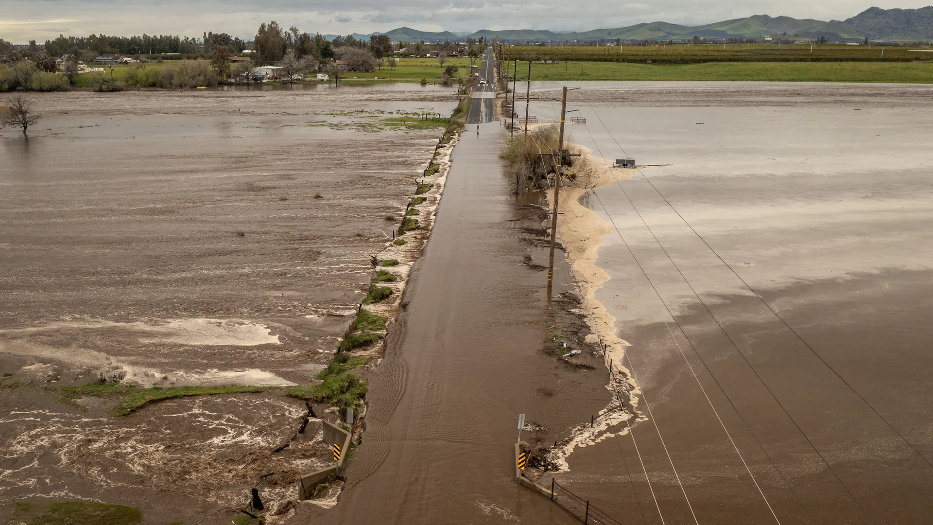
From a risk perspective, that narrow focus matters. Rivers, creeks, burn scars, and steep terrain respond quickly when intense rain concentrates in the same drainage basins for hours.

Atmospheric river vs. hurricane
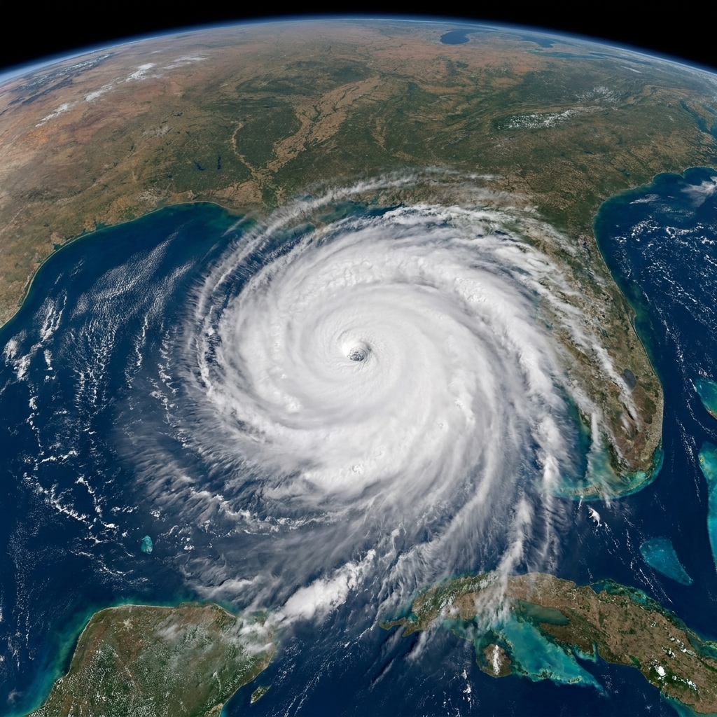
Both hurricanes and atmospheric rivers can deliver enormous amounts of water, but they are built differently.
- Structure: A hurricane is a compact, rotating, warm-core cyclone with a closed circulation. An atmospheric river is a long moisture corridor, usually tied to the larger flow around midlatitude weather systems rather than a standalone storm.
- Main hazard drivers: Hurricanes combine wind damage, storm surge, and rain. Atmospheric rivers are primarily a precipitation and runoff story, with wind sometimes playing a supporting role depending on the parent storm.
- Energy source: Hurricanes feed on warm ocean water and the release of latent heat in organized convection near the storm center. Atmospheric rivers are typically embedded in the jet stream environment and shaped by large-scale pressure patterns and fronts.
- Footprint: Hurricanes can affect wide areas, but their strongest core impacts are relatively localized. Atmospheric rivers can paint a long swath along a coast, yet still focus extreme rainfall into specific terrain-favored zones.
One quick mental picture: a hurricane is a spinning top of weather. An atmospheric river is a conveyor belt of moisture.
Atmospheric river vs. frontal rain
Most everyday rainy days in midlatitudes come from fronts. Warm air glides up over cooler air, clouds thicken, and you get steady precipitation. So where does an atmospheric river fit in?
Fronts are common; extreme transport is not
An atmospheric river is not a synonym for “a front.” Instead, it is a description of a particularly strong moisture pipeline that can feed a front or a midlatitude storm.
- Ordinary frontal rain: Moisture may be adequate, but transport is modest. Rainfall can be widespread and steady.
- Atmospheric river enhanced rain: The front or storm taps into a concentrated plume of high IVT. Precipitation rates can jump, and totals can stack up faster, especially where terrain forces extra lift.
It is the difference between watering your garden with a sprinkler versus opening the nozzle on a hose. Same basic ingredient, very different delivery rate.
How strength is rated
Because atmospheric rivers are defined by transport, rating systems focus on how strong the IVT is and how long it lasts over a region. In other words, the atmosphere can deliver a short punch or a long soak, and both matter.
One widely referenced approach is the Ralph et al. AR Scale, often shown as Categories 1 to 5, which groups events based on peak IVT and duration. It was developed with West Coast impacts in mind, but the core idea travels well: duration amplifies strength. A moderate plume that stalls can be more consequential than a stronger one that moves through quickly.
Forecasters also add crucial context that any single scale cannot capture on its own, including:
- Soil saturation from prior storms
- Snow level and the potential for rain falling on snowpack
- Wind direction relative to local terrain (which controls upslope lift)
- Watershed sensitivity, including recent wildfires or urban drainage limits
What to watch in forecasts
- IVT magnitude and where it points: A focused IVT “core” aimed at your coastline is a different animal than a broader, weaker plume.
- Duration: How many hours the strongest moisture transport is expected to sit over the same watersheds.
- Snow level (freezing level): A warmer atmospheric river can push snow levels uphill, shifting precipitation from snow to rain and increasing runoff.
- Expected rain rates: Short bursts can trigger flash flooding even when storm totals do not look historic on paper.
- Antecedent conditions: Saturated soils, high rivers, and recent burn scars can turn a “normal” event into a high-impact one.
Helpful and hazardous
I used to tell my physics students that nature rarely gives us pure “good” or “bad,” just tradeoffs. Atmospheric rivers are a perfect example.
- Benefits: They can deliver a large share of a region’s annual precipitation in just a few events, replenishing reservoirs and building mountain snowpack.
- Risks: When the same delivery system is too strong, too warm, too long-lasting, or aimed at vulnerable terrain, the water arrives faster than landscapes and infrastructure can safely handle.
In short, atmospheric rivers are part of how many coastlines get their water. The hazard comes from the rate, the placement, and the timing.
FAQ
Are atmospheric rivers caused by climate change?
Atmospheric rivers have always existed, because ocean evaporation and global wind patterns have always existed. What climate change can do, in a very direct thermodynamic sense, is increase the moisture the air can carry. As a rule of thumb, the atmosphere can hold about 7% more water vapor per 1°C of warming. How that translates into local atmospheric river impacts still depends on storm tracks, temperature profiles, and topography, so changes can look different from place to place.
Can an atmospheric river happen without a storm?
Often the moisture plume is connected to a midlatitude storm system and its fronts, but the defining feature is the concentrated transport. You can have a pronounced moisture corridor that becomes impactful mainly when it encounters lifting mechanisms like terrain or frontal dynamics.
Do atmospheric rivers only affect the U.S. West Coast?
No. They occur in many parts of the world, including regions influenced by strong ocean to land flow and midlatitude jet streams. The U.S. West Coast gets attention because steep coastal terrain makes the rainfall response dramatic and because a few events can dominate seasonal totals.
The takeaway
An atmospheric river is best understood as a moving corridor of water vapor, not a single storm type. Meteorologists spot it using integrated vapor transport (IVT), because IVT captures what matters most: moisture plus wind. And when that corridor makes landfall, especially along mountainous coasts, the atmosphere can convert that invisible vapor highway into very real rainfall or mountain snowfall over a surprisingly narrow slice of land.