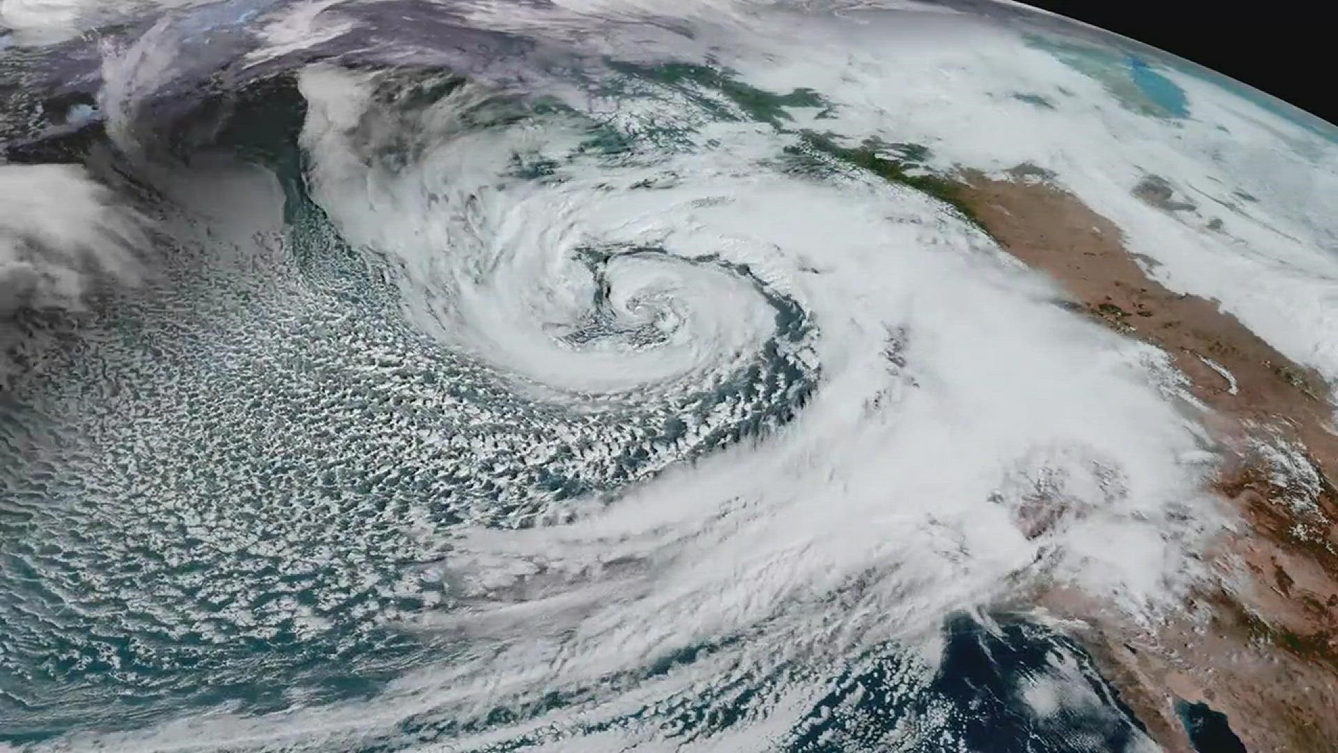
The first time I tried to explain a nor'easter to a classroom full of teenagers, I used a simple prop: a desk fan and a sponge. The fan was the wind, the sponge was the Atlantic, and my students immediately understood the key idea. These storms feed off ocean moisture and they love to run along the U.S. East Coast like a train on a track. When the air is cold enough, that moisture falls as snow. When it is not, it is a cold, soaking rain with a side of coastal flooding.
A nor'easter is not a single, official storm category like a hurricane. It is a pattern: a coastal low pressure system that typically moves up the East Coast and often produces strong, onshore winds from the northeast for parts of the coastline. That wind direction is where the name comes from, and it explains a lot about the impacts.
The quick definition
A nor'easter is a mid-latitude coastal storm (an extratropical cyclone) that usually develops near the East Coast of the United States and travels north or northeast, producing onshore northeast winds along parts of the coast. Those winds push Atlantic water toward shore and pull ocean moisture inland, setting the stage for heavy precipitation and rough seas.
You will sometimes hear nor'easters described as winter storms, but they can happen in other seasons too. Winter is just when they are most likely to produce snow and ice.
Why it is called a nor'easter
The name is wonderfully literal. In many of these storms, the strongest winds hitting the Mid-Atlantic and New England coast blow from the northeast. If you are standing on the coast, that means the wind is coming off the ocean and heading inland.
One important nuance I always tell students: wind direction around any low pressure system varies. In a classic nor'easter, northeast winds are most common on the north side of the storm, while other stretches of coast can see more easterly, southeasterly, or even northerly winds depending on where the center tracks.
When the flow is onshore, it tends to:
- Enhance precipitation by funneling moist ocean air into the storm.
- Increase coastal flooding by pushing seawater toward shore, especially during high tide.
- Build larger waves over a long stretch of open water, which can worsen erosion.
Not every moment of every nor'easter features a perfect northeast wind, and not every location experiences the same wind direction at the same time. But the hallmark is that, for a big part of the coastline, the storm setup produces persistent, strong onshore flow.
The track: a favored coastal route
Think of the East Coast as having a favored storm route. When conditions line up, low pressure develops near the Southeast or Mid-Atlantic coast and then rides northward along the coastline. Meteorologists often call this a “coastal low.”
This path is favored because the storm can tap into:
- Temperature contrasts between colder continental air and milder ocean air along a baroclinic zone.
- Plentiful moisture from the Atlantic, often enhanced near the Gulf Stream off the Carolinas.
- The jet stream, which can help storms intensify and steer them along the coast.
Where the center of low pressure travels relative to your town is huge. A small shift east or west can change who gets a blizzard and who gets a cold rain.
Snow vs. rain: a tug of war
If you have ever watched a forecast flip from “major snowstorm” to “cold rain” in the span of a day, you have experienced the most frustrating part of nor'easters. The storm supplies moisture. The atmosphere decides what form that moisture takes.
The basic recipe
A nor'easter often sits near a sharp boundary: cold, dense air to the north and west, and milder, moist air flowing in from the Atlantic. Precipitation usually forms as snow high in the clouds. Whether it reaches the ground as snow depends on the temperature profile from cloud to surface.
What keeps it snow
- Cold air locked in at the surface: Dense cold air can wedge down the interior and even into coastal areas, especially if high pressure is parked to the north.
- A storm track far enough offshore: This reduces warm air intrusion aloft and keeps coastal temperatures lower.
- Strong upward motion: Intense precipitation can cool the air column through melting and evaporation, helping snow survive longer.
What flips it to rain or mix
- Warm ocean air wrapping in: Onshore flow can bring above-freezing air into coastal regions.
- A warm layer aloft: If air a few thousand feet up rises above freezing, snowflakes can partially or fully melt and refreeze into sleet or freeze on contact as freezing rain if the surface is still cold.
- A track closer to the coast: This often pulls warmer air inland, nudging the rain–snow line west.
In plain terms: nor'easters are moisture-rich storms. The difference between a snow day and a soggy commute is often whether cold air can hold its ground against that ocean feed.
Common impacts
Nor'easters can last longer than many fast-moving storm systems. That persistence is part of why they can be so disruptive, especially along the coast where two high tides during one event can be enough to compound flooding and erosion.
Strong winds
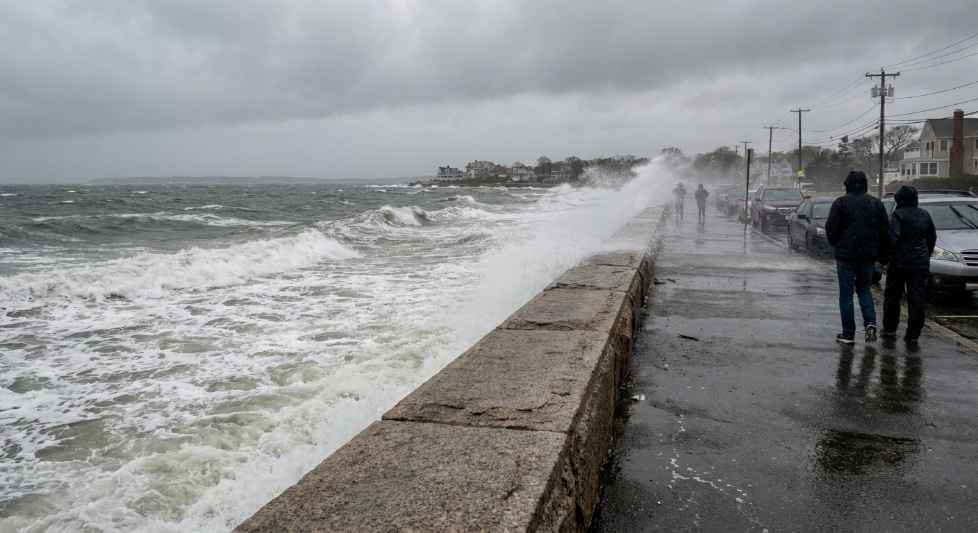
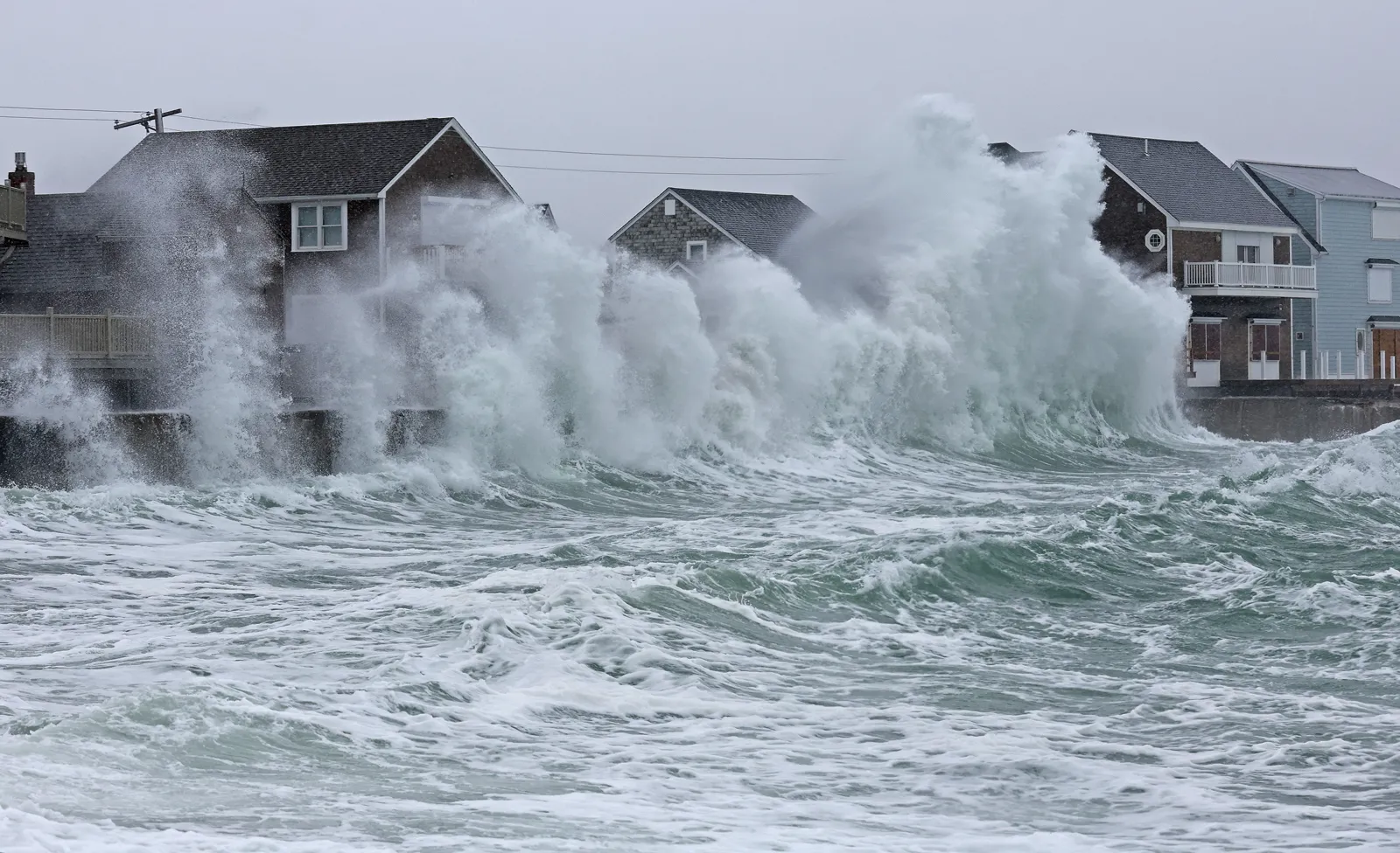
Winds can gust high enough to down branches, damage roofs, and cause power outages. Along the immediate coast, sustained onshore winds can make it feel like the ocean is trying to move in permanently for the weekend.
Coastal flooding and erosion
Because the wind pushes water toward shore and the storm can coincide with high tide, coastal flooding is a frequent headline. Large waves and storm surge (a wind-driven rise of water) can erode beaches and batter seawalls, dunes, and coastal roads.
Heavy precipitation
Depending on temperature, that precipitation can be:
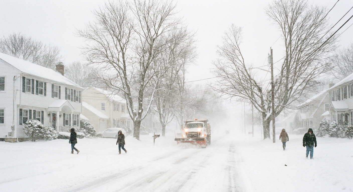
- Heavy wet snow, which is especially tough on trees and power lines.
- Powdery snow with blizzard conditions if winds are strong and temperatures are low.
- Cold rain that causes inland flooding, especially when the ground is already saturated.
- Mixed precipitation like sleet and freezing rain, often the most dangerous for travel.
Nor'easter vs. bomb cyclone
This is one of the most common points of confusion, so let’s separate the terms cleanly.
A nor'easter is a pattern
“Nor'easter” describes where the storm is and the wind setup it produces along the East Coast. It is about track and impacts: a coastal low moving up the coastline with strong onshore winds that are often from the northeast for a significant stretch of the coast.
A bomb cyclone is an intensity benchmark
“Bomb cyclone” refers to a storm that intensifies very rapidly, meeting a meteorological threshold called bombogenesis. In general, that means the central pressure drops by about 24 millibars in 24 hours at 60° latitude, with the threshold scaled by latitude (because storms behave differently closer to the equator).
Some nor'easters “bomb out” and qualify as bomb cyclones. Many do not. And bomb cyclones are not exclusive to the East Coast. You can have bombogenesis in other parts of the world and in storms that would never be called a nor'easter.
How a nor'easter forms
Every storm is its own beast, but many classic nor'easters follow a familiar storyline.
- A boundary sets up between cold continental air and milder ocean air.
- A low pressure area develops near the Southeast or Mid-Atlantic coast, often helped along by the jet stream.
- Moisture streams in from the Atlantic as winds wrap around the low.
- The storm strengthens as rising air cools and water vapor condenses into clouds and precipitation.
- The track up the coast keeps feeding the system moisture, sometimes for a day or two.
- Cold air placement decides who gets rain, mixing, or heavy snow.
What to watch in forecasts
If you live anywhere from the Mid-Atlantic through New England, the most useful forecast details are often not the flashy totals, but the setup pieces that drive them.
- Storm track: Farther offshore tends to favor more snow inland. Closer to the coast often means warmer air and more rain near the shoreline.
- Rain–snow line timing: Even a few hours of rain can compact snow totals drastically.
- Wind direction and duration: Persistent onshore winds raise flooding risk.
- Tide cycles: Coastal flood forecasts often hinge on whether peak winds align with high tide.
- Snow density: Wet, heavy snow can cause more damage than lighter snow at the same depth.
FAQ
Is a nor'easter a hurricane?
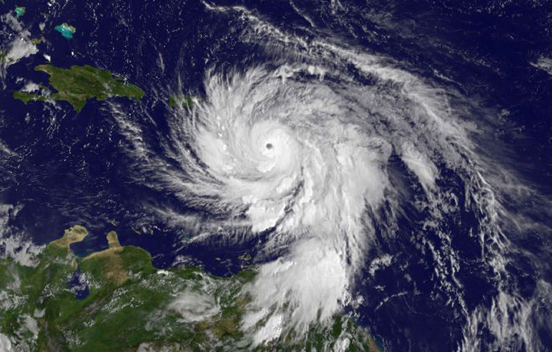
No. Hurricanes are warm-core tropical cyclones powered primarily by heat and moisture from warm ocean water. Nor'easters are mid-latitude storms driven by temperature contrasts and interactions with the jet stream. They can still produce damaging winds and coastal flooding, but their structure and fuel source are different.
Can a nor'easter happen in spring or fall?
Yes. The classic blockbuster events are often in late fall through early spring, but coastal lows with strong northeast winds can occur outside deep winter. In warmer months they are more likely to be rain and wind events rather than major snow producers.
Why do nor'easters sometimes stall?
They can slow down when steering winds aloft weaken or when the storm becomes wrapped up with larger-scale patterns in the atmosphere. A slower storm usually means longer-lasting wind, larger wave buildup, and prolonged precipitation.
What makes some nor'easters produce blizzard conditions?
Blizzard conditions are about wind and visibility, not just snow totals. If heavy snow combines with strong winds, snow gets lofted and blown around, dropping visibility for hours at a time.
The takeaway
A nor'easter is best understood as a coastal storm track and wind pattern, not a single label for “any big East Coast winter storm.” The defining features are a low pressure system running up the U.S. East Coast and the onshore winds that pull Atlantic moisture inland, often from the northeast along large parts of the coast. Whether that moisture becomes a snowstorm or a cold rainstorm depends on the battle between cold air and ocean warmth. And while some nor'easters rapidly intensify into bomb cyclones, many never meet that pressure-drop threshold.
Either way, the practical impacts are the same trio to respect: strong winds, coastal flooding, and heavy precipitation. If you live near the coast, keep one eye on the tide chart and the other on the wind forecast. The ocean always has a vote in a nor'easter.