I used to tell my physics students that nature keeps lab notebooks everywhere. You just have to know where to look. For droughts that stretch beyond a human career, the best notebooks are often trees, lake mud, and cave minerals. Those records are what let scientists recognize a special category of dry spell that is bigger than the usual headline drought.
A megadrought is not simply a drought that feels severe. It is a drought that lasts decades, long enough to reshape ecosystems, water planning, agriculture, and even the fate of societies. And yes, peer reviewed research has increasingly described the ongoing drought in southwestern North America as a megadrought, including work that dates its onset to around 2000 and compares it to the last 1,200 years of variability (for example, Williams et al., 2022, in Nature Climate Change).
Megadrought, defined
A typical drought is measured over months to a few years. A megadrought is different mainly because of timescale.
In the scientific literature, a megadrought generally means:
- Duration: a drought lasting multiple decades.
- Spatial scale: often affects a large region, not just one watershed.
- Persistence: dry conditions become the background climate state for a generation, not a short term anomaly.
There is no single global rule that says, for example, “exactly 20 years equals a megadrought.” Different studies use different thresholds or statistical definitions depending on region, metric, and data. But the core idea stays the same: this is drought measured on a generational clock.
One more subtle but important point: megadrought is about more than low rainfall. Scientists often focus on soil moisture, the water actually available to plants and ecosystems. A place can have near normal precipitation and still dry out if heat and evaporation increase. That matters a lot in today’s warming climate.
How scientists measure it
If you read megadrought papers, you will notice that researchers rarely rely on one simple “rainfall total.” Common approaches include:
- Tree ring reconstructions of PDSI: Many studies use gridded reconstructions of the Palmer Drought Severity Index, a widely used measure that blends moisture supply and atmospheric demand.
- Soil moisture modeling: Some analyses focus directly on modeled or reconstructed soil moisture, often summarized as percentiles or multi year running averages.
- Threshold definitions: A study might define a megadrought as decades where a region stays below a long term median, or where smoothed values remain below a chosen cutoff for 20 years or more.
Different metrics, similar story: you are looking for persistent, region wide moisture deficits, not one spectacularly dry year.
Why paleoclimate records matter
Weather stations and satellite records are fantastic, but they are also young. In many regions, instrumental observations are often around 100 years or so, sometimes longer, and sometimes much shorter depending on location and what was measured. That is not long enough to answer questions like:
- Have decades long droughts happened here before?
- How rare are they?
- How does the current event compare to the last 1,000 years?
To get that long view, climate scientists use paleoclimate proxies, natural records that respond to climate conditions. Think of proxies as indirect measurements. They do not “measure rainfall” the way a rain gauge does, but they contain patterns that reliably track moisture and temperature.
It is also worth saying out loud that these notebooks are not perfect. Proxy signals can vary by site and species, and different archives come with different kinds of uncertainty. That is one reason researchers love overlap. When multiple independent records point in the same direction, the case gets much stronger.
Tree rings
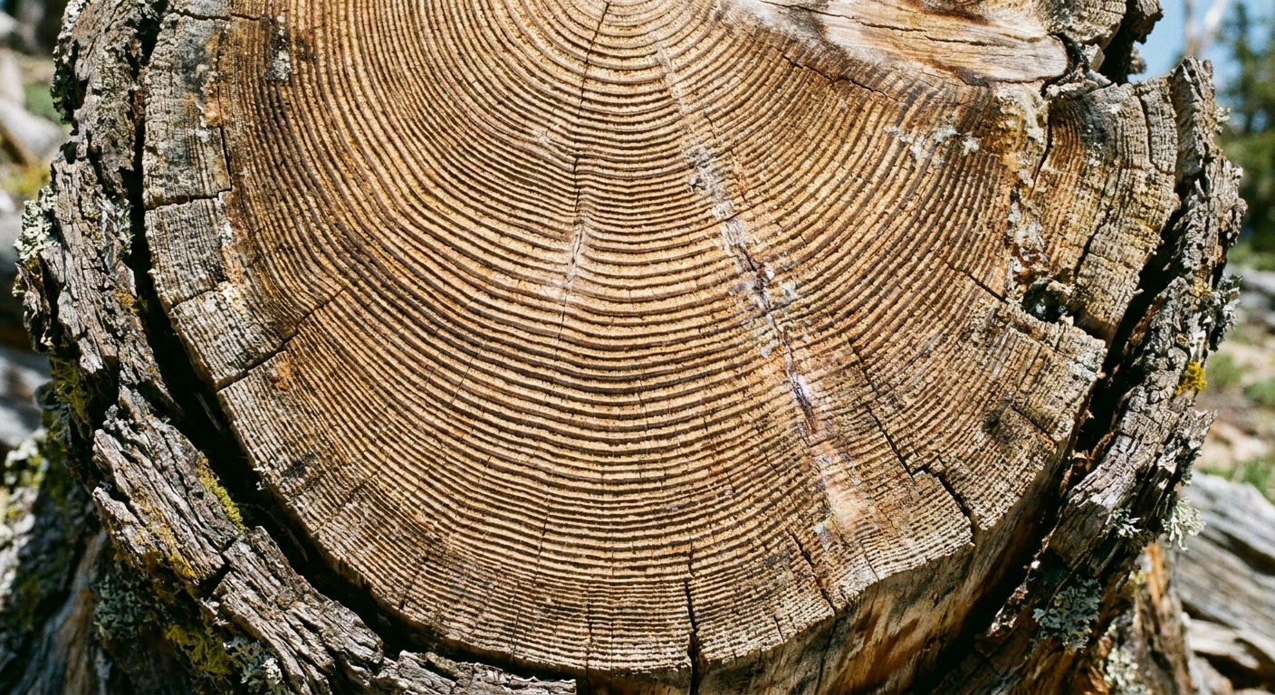
If you have ever looked at a cut log, you have seen the basic idea: trees add a growth ring each year. In many climates, the width and sometimes the density of those rings depend strongly on water availability.
How tree rings capture drought
During a wet growing season, many trees can lay down a wider ring. During a dry one, growth slows and the ring can be narrow. When scientists line up ring patterns from many trees across a region, they can reconstruct year by year swings in moisture going back centuries, and sometimes more than a millennium.
Why tree rings are powerful
- Annual resolution: one ring per year gives a detailed timeline.
- Exact dating: rings can be cross matched among trees, making the calendar years highly reliable.
- Regional coverage: networks of trees can capture broad drought patterns.
In the American West, tree ring science has been especially influential. Reconstructions show that the 20th century included several unusually wet decades in key basins, including parts of the Colorado River Basin, relative to many centuries of tree ring based estimates. That is a sobering design constraint for modern water management.
Other paleoclimate records
Tree rings are the celebrity proxy for drought, but they are not the only one. Researchers often combine multiple records because each proxy has its own strengths and blind spots.
Lake sediments
Lakes quietly collect layers of mud, organic matter, and minerals. Over time, those layers can record changes in:
- Lake level (a clue to long term water balance)
- Salinity (often increases when water inputs drop)
- Dust (can rise during dry, windy periods)
Some lakes preserve annual or near annual layers, while others give a more smoothed, long term picture. Either way, they can help confirm whether tree ring droughts correspond to broader hydrologic changes. Dating is usually good, but it can be less precise than tree rings depending on the site and methods.
Cave minerals
Stalagmites and stalactites grow from dripping water. Their chemistry, including oxygen isotopes and trace elements, can reflect shifts in precipitation sources and moisture conditions over long periods. Cave records are often lower resolution than tree rings, but resolution varies by cave and growth conditions, and some records can be surprisingly detailed. They can also extend far back and provide an independent check on regional climate swings.
Corals and marine sediments
In some regions, drought is strongly linked to ocean patterns like El Niño and La Niña. Corals can preserve seasonal to annual signals of sea surface conditions, while many marine sediments provide a more averaged, longer term view. Together, they help scientists understand the ocean and atmosphere machinery that can make megadroughts more or less likely.
What causes megadroughts
At the risk of sounding like a teacher at a whiteboard, drought comes down to a budget:
- Inputs: precipitation and snowpack
- Losses: evaporation, plant water use, and runoff patterns
A megadrought is what you get when the budget stays unfavorable for decades. That persistence can be driven by:
- Ocean atmosphere patterns that repeatedly steer storms away from a region
- Random variability that happens to line up in the dry direction for a long time
- Warming temperatures that increase evaporative demand and reduce snowpack efficiency, turning “dry” into “drier”
One key term you will see in research is aridification. It describes a shift toward a more permanently dry baseline, not just a temporary drought. While “drought” implies a deviation from normal, “aridification” hints that normal is moving.
Why the Southwest drought is labeled a megadrought
The ongoing drought affecting much of southwestern North America has been widely discussed as a megadrought by researchers because it has shown:
- Multi decade persistence, often dated from around 2000 into the 2020s, with ups and downs along the way.
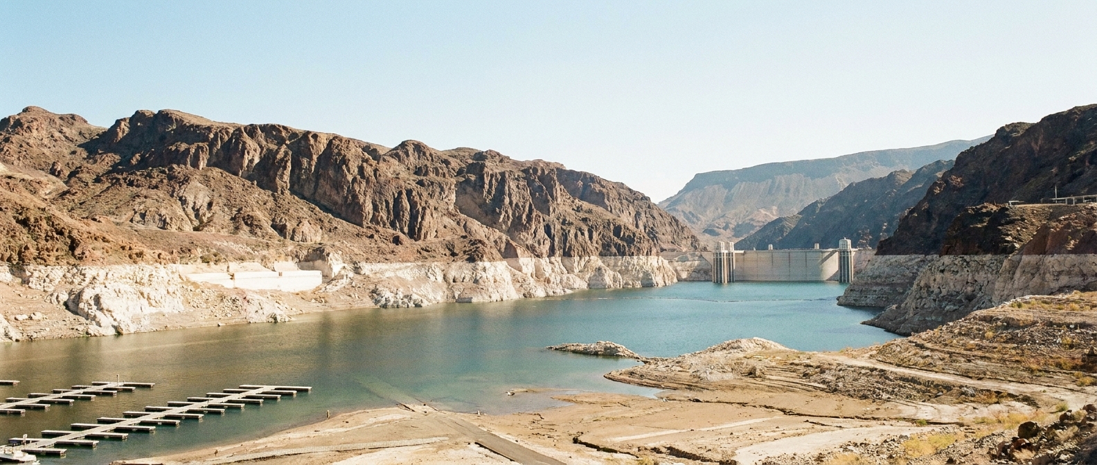
- Large geographic footprint, influencing the Colorado River Basin and surrounding regions that supply water to tens of millions of people across multiple US states, Tribal nations, and Mexico.
- Exceptional severity in soil moisture terms, with heat amplifying dryness even in years when precipitation partially rebounds.
- Paleoclimate context, where tree ring reconstructions suggest the event ranks among the most severe drought periods in many centuries, and in some analyses comparable to major medieval era drought episodes (including analyses summarized by Williams et al., 2022).
This is the part that often surprises people: a megadrought does not have to be uniformly bone dry every single year. What matters is the overall sustained deficit. You can get a wetter winter and still remain in a long term drought if reservoirs, soils, and groundwater never truly recover before the next dry stretch arrives. In fact, parts of the Southwest had notably wet conditions in 2023, but long running deficits and system level impacts did not vanish overnight.
Drought terms
Because drought language can get messy fast, here are a few quick contrasts that help anchor the vocabulary.
Meteorological drought
Less precipitation than normal for a region, often defined over months or seasons.
Agricultural drought
Not enough soil moisture for crops and rangeland plants, often felt quickly during hot conditions.
Hydrological drought
Low streamflow, reservoir levels, and groundwater, typically lagging behind precipitation changes.
Flash drought
A rapid onset drought that intensifies over weeks to months, often driven by heat and evaporation. A flash drought can be part of a longer drought, but it is defined by speed, not decades long persistence.
Megadrought
Decades long drought conditions, often recognized most clearly with the help of paleoclimate records.
Why it matters
When drought lasts decades, communities start making “temporary” choices that quietly become permanent. Megadroughts can:
- Strain water infrastructure built around 20th century assumptions
- Increase wildfire risk by drying vegetation over repeated seasons
- Reduce hydropower reliability where reservoirs and river flows are persistently low
- Stress ecosystems beyond their recovery time, contributing to tree die offs and habitat shifts
- Drive hard trade offs among cities, farms, Tribal water rights, and environmental flow needs
In other words, a megadrought is not only a climate story. It is a planning story. It forces long term decisions on a short term political calendar, which is always a fraught combination.
What scientists track now
Paleoclimate records tell us what is possible. Modern monitoring tells us what is happening now. Researchers often track megadrought conditions using:
- Soil moisture models that combine weather data with land surface physics
- Snowpack measurements and the timing of snowmelt
- Streamflow gauges and reservoir storage
- Evaporative demand, a measure of how “thirsty” the atmosphere is under warmer conditions
- Satellite observations of vegetation stress and groundwater related gravity signals
None of these alone declares “megadrought.” The label emerges when the time series shows persistence, and when comparisons to reconstructed past climate show the event is truly exceptional over long baselines.
FAQ
How long does a drought have to last
Typically multiple decades. Different studies use different criteria, but the defining feature is duration far longer than the usual multi year drought.
Can climate change cause a megadrought
Warming can increase the odds and severity of megadrought conditions by boosting evaporation and drying soils, even when precipitation does not drop dramatically. Climate change can also shift storm tracks and snowpack dynamics, which affects long term water supply.
Have megadroughts happened before
Yes. Tree ring reconstructions show several major multi decade droughts in the last 1,000 to 2,000 years, including events during the medieval period that lasted for decades in parts of the West.
Does one wet year end it
Usually, no. A single wet season can help, but megadroughts are defined by long term deficits. Recovering reservoir storage, groundwater, and soil moisture across a huge region often requires multiple wet years in a row.
The takeaway
A megadrought is drought on a generational clock: decades of sustained dryness that shows up not just in today’s gauges and satellites, but also when you compare modern conditions to the deep history recorded in tree rings and other paleoclimate archives.
That long view is precisely why scientists have applied the term to the ongoing drought in the American Southwest. It is not simply that it has been dry. It is that it has been persistently dry for long enough, and in a warming world, the atmosphere has been turning the dial toward even greater water loss.