Curiosity, with all its quills showing.
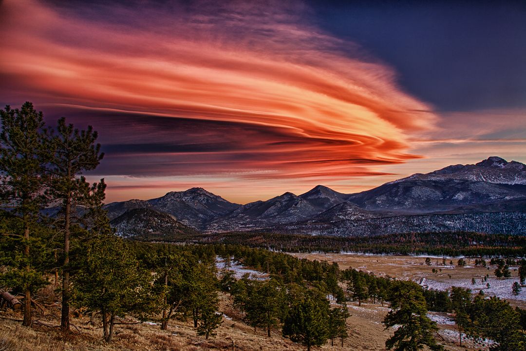
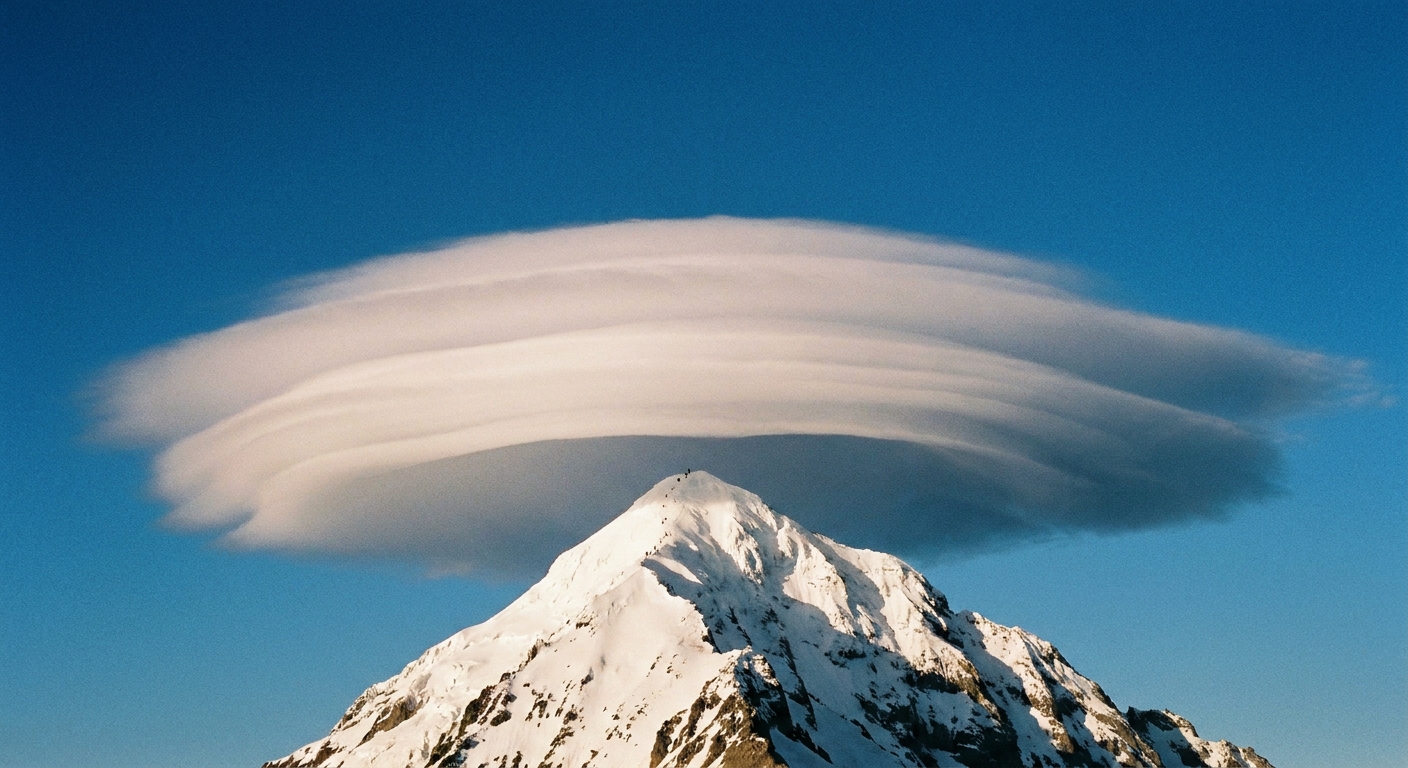
If you have ever seen a cloud that looks like a smooth flying saucer hovering over a mountain, you have likely met a lenticular cloud. They are famous for seeming to stay put, sometimes for hours, while the wind continues to rush right through them. That apparent stillness is the clue to how they form.
Lenticular clouds, in plain terms
A lenticular cloud is a lens-shaped (sometimes stacked like pancakes) cloud that forms when moist air flows over a mountain range and sets up a standing wave in the atmosphere. The cloud forms near the crest of that wave, where the air is forced to rise, cool, and condense. Those stacks often hint at multiple wave crests or layers in the airflow.
In formal cloud classification, lenticularis is the species name meaning “lens-like.” You will most often see it as Altocumulus lenticularis at mid-levels, but the same lens-shaped species can show up with other genera depending on height and conditions.
Why they can look stationary
The trick is that the cloud is not a fixed object. It is more like a fixed zone where cloud is continuously being made and unmade.
The standing-wave conveyor belt
- Air flows toward and over the mountain.
- Stable layering helps create an oscillation. After air is lifted, it tends to sink back toward its starting level, then overshoots, then rises again, setting up a wave pattern downwind.
- At the wave crest, air rises and cools. If it cools to its dew point, water vapor condenses into cloud droplets.
- Past the crest, air sinks and warms. Droplets evaporate, and the cloud disappears.
Because the wave itself can be nearly fixed relative to the mountain, the visible cloud seems anchored in one spot. Meanwhile, the air within it is moving quickly. New cloud forms on the upwind side as old cloud evaporates on the downwind side, all while the overall shape can hold steady.
Think “standing pattern, moving air.” The cloud marks the pattern.
How lenticular clouds form
Lenticular clouds most commonly appear when a few atmospheric conditions line up.
1) Terrain that forces air up
Mountains are the classic trigger, but ridgelines and isolated peaks can do it too. The common thread is a terrain feature that pushes airflow upward and helps start a wave.
2) Strong winds aloft
You do not need a gale at the surface. Lenticulars often signal stronger winds at ridge height and above. Those winds feed the wave.
3) Stable air
Stability matters. In a stable atmosphere, displaced air parcels tend to oscillate rather than keep rising freely. That oscillation is what supports wave structure downwind.
4) Enough moisture at the right altitude
The air has to be moist enough that cooling at the wave crest reaches saturation. If the air is too dry, you can still have the wave, but you may only see it indirectly, or not at all.
How to recognize one
Lenticular clouds are among the most recognizable clouds in the sky, but they can still be confused with other features. Here is what to look for.
Common visual clues
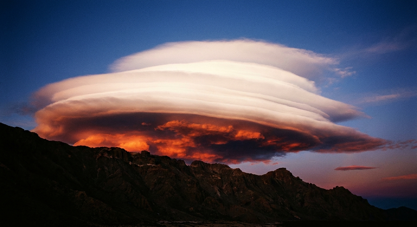
- Lens or almond shape: smooth edges, often symmetrical.
- Layered stacks: multiple “plates” one above another, especially in stronger wave setups.
- Fixed position: it appears to hover over or downwind of a ridge or peak.
- Clean, laminar look: they can look polished compared with fluffier cumulus clouds.
Where they show up
Many appear near and downwind of mountains, but not necessarily directly over the summit. Depending on wind direction and wave geometry, the cloud may sit offset from the peak and at a particular altitude band.
Colors and lighting
At sunrise or sunset, a lenticular can glow dramatically because it is smooth and thick enough to catch light cleanly. That does not mean it is “special weather” by itself. The shape is telling you about airflow and stability.
Are they rare, and do they mean a storm?
They are not rare in mountainous regions, but they are easy to miss because they may form at specific times and locations. A lenticular cloud does not automatically mean a storm is imminent. It mainly indicates strong, organized flow over terrain and stable air aloft with moisture at the cloud level.
That said, the larger weather pattern can matter. Lenticulars can appear ahead of fronts, within strong jet-level flow, or during otherwise fair weather. The cloud is a signpost, not a forecast all by itself.
Lenticulars vs. cap clouds
These get mixed up a lot. A cap cloud forms directly over a summit or ridge when air is forced upward and condenses right on the terrain feature, often draping the peak like a hat. A lenticular cloud usually sits near or downwind of the mountain, marking the crest of a standing wave. Both are orographic, but lenticulars are the cleaner signature of a wave pattern that extends beyond the ridge.
Lenticulars vs. rain shadows
Mountain weather has a talent for producing opposites in close proximity. Lenticular clouds are about condensation in a wave crest, often on or downwind of a range. A rain shadow, in contrast, is the broader pattern where the lee side becomes drier because much of the moisture was wrung out on the windward slope, and the air warms as it descends.
Here is the quick contrast:
- Lenticular cloud: a localized cloud at a particular altitude where air rises in a standing wave and cools to saturation.
- Rain shadow: a regional drying effect downwind of mountains after air has lost moisture on the windward side and then warms as it descends.
They can coexist. You might see a lenticular hovering above a range while, farther downwind, the landscape sits under clearer, drier air typical of a rain shadow.
Lenticulars vs. chinook winds
A lenticular cloud is a cloud form. A chinook is a wind and warming pattern on the lee side of mountains, driven by downslope flow that compresses and warms as it descends.
They are related only in the sense that both involve air moving over mountains. The difference is the main character:
- Lenticular cloud: forms where air is lifted and cooled within a standing wave, producing a smooth, stationary-looking cloud.
- Chinook wind: a warm, often gusty downslope wind that can rapidly raise temperatures and dry the air on the lee side.
In some setups, the same mountain-wave environment that supports lenticular clouds aloft can occur alongside strong downslope winds nearer the ground. But one is not “the cloud version” of the other. One is a visible condensation feature. The other is a meteorological wind event.
What they can signal for wind and safety
Lenticular clouds are visually calm but can be associated with energetic airflow. Winds aloft do not always translate to strong winds where you are standing, but in mountain country, the same setup can coincide with very strong ridge winds and sudden gusts in passes.
If you are hiking, climbing, or driving high routes, treat a bold lenticular as a reason to check the forecast and be conservative about exposed ridgelines.
Lenticulars, aviation, and turbulence
Lenticular clouds are visually calm but can be associated with energetic airflow.
- Mountain wave turbulence: The wave pattern can include strong vertical motions and turbulence, especially near the wave and in regions of wind shear.
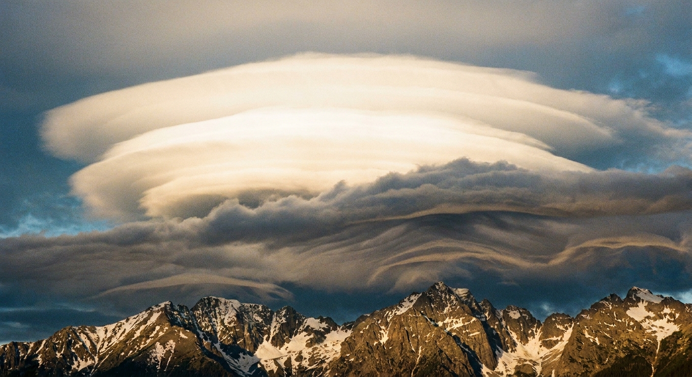
- Rotor zones: Under certain conditions, the airflow on the lee side can form rolling, turbulent eddies called rotors at lower levels, sometimes accompanied by ragged-looking rotor clouds below the smoother lenticular.
If you are flying, always treat lenticulars as a cue to check aviation weather briefings and turbulence forecasts rather than as a harmless sky ornament.
Quick FAQ
Are lenticular clouds the same as UFO clouds?
They are often nicknamed “UFO clouds” because of their shape, but they are ordinary clouds formed by wave-driven lifting and cooling of moist air.
Why are they so smooth?
The airflow involved is often relatively laminar at the cloud level, and the cloud forms along a narrow zone of condensation. That tends to produce clean edges and a sculpted look.
Can lenticular clouds form without mountains?
Mountains are the classic trigger because they generate standing waves efficiently. Similar wave clouds can form with other atmospheric wave setups, but when people say “lenticular,” they are usually talking about mountain-wave lenticulars.
Do lenticular clouds produce precipitation?
Usually not. Many are persistent without producing measurable rain or snow at the ground. Still, some can generate light virga or a few snow grains, depending on cloud depth, temperature, and ice formation.
What are they made of?
It depends on temperature and altitude. Lenticulars can be liquid, mixed-phase, or glaciated. In colder conditions they can include supercooled droplets and ice crystals.
The short takeaway
A lenticular cloud is a smooth, lens-shaped cloud that forms where moist air rises in a standing mountain wave, cools, and condenses. It can appear to hover in place for hours because the wave pattern stays put while air flows through it, continuously building cloud on one side and evaporating it on the other. If you spot one, you are watching the atmosphere draw its own streamlines in the sky.