The quickest way I’ve found to explain wind chill is this: the wind is not lowering the air temperature, it is turning up the speed at which your body loses heat. When that heat leaves faster than your body can replace it, you feel colder, and exposed skin can cool into dangerous territory sooner.
Wind chill is a standardized way meteorologists translate that faster heat loss into a single, familiar number: a feels-like temperature under specific conditions. It is useful, but it is also easy to misunderstand. Let’s unpack what it actually means and how the calculation works.

What wind chill measures
Your body is a warm object sitting in colder air. Heat flows from warm to cold, and the main ways you lose heat outdoors are:
- Convection: moving air carries away the thin layer of warmed air right next to your skin.
- Evaporation: moisture on skin (including sweat) evaporates and steals heat.
- Radiation: you radiate infrared energy to the environment.
Wind chill focuses on the first one, convection. In calm air, a thin boundary layer of slightly warmer air tends to cling to your skin. Wind strips that layer away and replaces it with colder air over and over, which increases convective heat loss.
It is like opening the oven door repeatedly. The oven temperature is the same, but the heat escapes much faster because you keep flushing out the warm air near the surface.
So when you see a wind-chill value, read it like this:
“In this wind, exposed skin loses heat about as fast as it would on a calm day at this lower temperature.”
It is not a measurement of the air temperature. Your car thermometer will not suddenly agree with the wind chill number. It is a heat-loss equivalence.
The wind-chill formula
In the United States and Canada, official wind-chill values use a formula adopted in 2001. It is based on experiments and heat-transfer modeling meant to represent cooling of exposed facial skin in shaded conditions (no direct sun).
For temperature in degrees Fahrenheit and wind speed in miles per hour, the formula is:
WCT = 35.74 + 0.6215T − 35.75(V^0.16) + 0.4275T(V^0.16)Where:
- WCT is wind chill temperature (degrees Fahrenheit)
- T is air temperature (degrees Fahrenheit)
- V is wind speed (miles per hour), using the standard 10 m (33 ft) wind observation adjusted to roughly face height (about 5 ft or 1.5 m)
If you are thinking, “Why the weird exponent 0.16?” you are not alone. In plain terms, heat transfer to moving air does not increase linearly with wind speed. That exponent is an empirical fit that tracks how convective heat loss tends to scale over typical outdoor wind speeds.
Many countries also publish wind chill in Celsius and kilometers per hour. If you use a weather app, it typically handles the unit conversion behind the scenes.
Worked examples
Let’s plug in a few realistic winter conditions. I’ll show the structure so you can follow along even if you never plan to type the equation into a calculator again.
Example 1: 20°F with a 15 mph wind
Given T = 20, V = 15.
First compute V^0.16: 15^0.16 ≈ 1.54.
Now the formula:
35.74 + 0.6215T = 35.74 + 12.43 = 48.17− 35.75(V^0.16) = − 35.75(1.54) ≈ − 55.06+ 0.4275T(V^0.16) = 0.4275(20)(1.54) ≈ + 13.17
Add them up: 48.17 − 55.06 + 13.17 ≈ 6.3°F.
Wind chill is about 6°F. That does not mean the air is 6°F. It means your exposed skin is losing heat at a rate similar to a calm day around 6°F.
Example 2: 0°F with a 25 mph wind
T = 0, V = 25, and 25^0.16 ≈ 1.67.
Compute:
35.74 + 0.6215T = 35.74− 35.75(1.67) ≈ − 59.7+ 0.4275T(1.67) = 0
Total: 35.74 − 59.7 ≈ −24°F.
Wind chill is about −24°F. This is the kind of jump that surprises people. The wind did not create colder air. It simply made the heat-loss pipeline from skin to atmosphere much more efficient.
Example 3: −10°F with a 10 mph wind
T = −10, V = 10, and 10^0.16 ≈ 1.45.
35.74 + 0.6215(−10) = 35.74 − 6.215 = 29.525− 35.75(1.45) ≈ − 51.8+ 0.4275(−10)(1.45) ≈ − 6.2
Total: 29.5 − 51.8 − 6.2 ≈ −28.5°F.
Wind chill is about −29°F. Notice how even a “modest” 10 mph wind matters a lot when the air temperature is already very low.
What it does and doesn’t tell you
What it tells you
The wind-chill temperature is designed to reflect cooling of exposed skin, particularly the face, under typical winter conditions. It is most useful for making decisions like:
- How quickly exposed skin may become dangerously cold
- Whether you need face covering and windproof layers
- How to plan outdoor work, sports, or school commutes
What it doesn’t tell you
Your core temperature depends on layers, activity level, wetness, and how much of you is exposed. A heavy parka blocks wind, which dramatically reduces convective heat loss. In other words, wind chill is not what you feel through a good coat. It is much closer to what your cheeks feel when you forgot a scarf.
Also, wind chill is about skin cooling. Hypothermia risk still depends heavily on exposure time, clothing, and whether you are wet, even if your skin is covered.
Not the same as a blizzard
This one is a frequent mix-up. Wind chill and blizzards both involve wind and cold, but they are different concepts with different criteria.
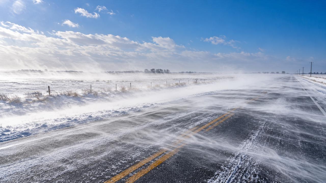
A blizzard is defined by wind plus visibility plus duration. Definitions can vary by country, but in the United States the National Weather Service defines blizzard conditions as:
- Considerable falling or blowing snow
- Visibility of 1/4 mile or less
- Sustained winds or frequent gusts of 35 mph or more
- For at least 3 hours
Wind chill may be extreme during a blizzard, but a blizzard warning is not issued because of wind chill alone.
When the formula applies
The standard wind-chill formula is not meant to be used all the time. Weather services typically limit when they publish it.
Common thresholds
- Air temperature at or below 50°F (10°C)
- Wind speed above 3 mph (5 km/h)
Those thresholds match how the National Weather Service commonly applies the wind-chill calculation. Above 50°F, wind can still make you feel cooler, but “wind chill” becomes less meaningful because you are no longer in the same cold-injury risk regime, and other factors (sun, humidity, clothing) dominate comfort.
Below about 3 mph, the formula is not used because the wind is too light for the underlying assumptions. In calm or near-calm air, the wind chill is essentially the air temperature.
Real-world caveats
- Sunlight: Direct sun can warm skin and clothing, so it can feel less harsh than the standardized wind-chill number (which assumes shade).
- Wet skin or wet clothing: Water changes the game. Evaporative cooling can make you lose heat faster than wind chill alone implies.
- Gusty winds: Wind chill is usually calculated from sustained wind, not the single strongest gust. A sudden gust can still sting more than the number suggests.
- Local wind differences: Wind speed varies a lot around buildings, trees, and terrain. The published value is typically from an open-area instrument exposure.
Why it drops fast, then slower
If you have ever noticed that going from 5 mph to 15 mph feels like a huge change, but 35 mph to 45 mph feels like “just awful either way,” you are sensing what the math bakes in.
Convective heat transfer increases with wind speed, but with diminishing returns. Once the boundary layer is already being stripped away efficiently, making the air even faster does not multiply the cooling in a straight line. That is one reason wind-chill tables show big initial drops, then a slower slide at very high winds.
How I use wind chill
I like to treat wind chill as a decision tool, not a trivia stat. A few rules of thumb that map well onto the physics:
- Cover exposed skin first: hat, gloves, scarf or face covering. Wind chill is most relevant to bare skin.
- Block the wind: a shell layer (even a thin one) can reduce convection dramatically.
- Plan for time: risk increases the longer you are exposed, especially with wind and low temperatures.
- Watch for frostbite risk guidance: local weather services often pair wind chill with estimated frostbite times. Use those as conservative planning numbers, especially for kids.
And yes, I have made the mistake of “it’s only 20°F” on a windy dog walk with my golden retriever, Quark. Ten minutes later I was wishing I’d treated my cheeks like exposed lab equipment in a high-speed cooling experiment.
Quick FAQ
Can wind chill ever be higher than the air temperature?
Not in the standard definition. Wind chill accounts for additional cooling due to wind, so it is the same as or lower than the air temperature in the range where it is calculated.
Is wind chill the same as “feels like” in my weather app?
In winter, the “feels like” value is often wind chill. In warm weather, apps may switch to a heat index style calculation that uses temperature and humidity instead.
Why does my face feel colder than the wind chill number suggests?
Common reasons are gusts, wet skin, standing in a wind tunnel between buildings, or simply being in shade with no solar warming. The published wind chill is a standardized estimate, not a personalized sensor.
Does wind chill affect objects like car engines or water pipes?
Wind can speed up how quickly an object cools down toward the air temperature, but it cannot cool it below the air temperature without evaporation or another mechanism. One common “other mechanism” is radiative cooling, for example a surface losing heat to a clear, cold night sky. For pipes, the bigger issue is that wind can remove heat from the pipe surface faster, helping it reach the surrounding air temperature sooner.