Curiosity, with all its quills showing.
Some places seem to collect weather the way a river collects tributaries. In the central United States, spring and early summer often feel like that: warm air sliding north, dry air pushing in from the west and southwest, fast winds sweeping overhead. When those ingredients stack up just so, the atmosphere can spin up some of the most intense thunderstorms on Earth, and sometimes, tornadoes. The nickname for the region where this happens most often is Tornado Alley.
Tornado Alley, in plain terms
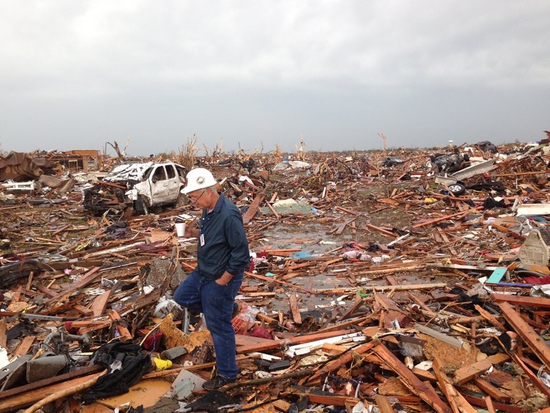
Tornado Alley is an informal name for a broad swath of the central US where tornadoes are especially frequent. It is not a single fixed corridor with official borders. Instead, it is a statistical hotspot that shifts a bit depending on what you count, which years you study, and whether you focus on all tornadoes or only the strongest ones.
In most descriptions, Tornado Alley arcs across the Great Plains, commonly including parts of:
- Texas (especially North Texas)
- Oklahoma
- Kansas
- Nebraska
- South Dakota and nearby Plains areas (in some definitions)
- Iowa and Missouri (often included in broader maps)
Depending on the map and metric, you will also see Tornado Alley stretch into eastern Colorado and sometimes farther east toward places like western Illinois. The point is less about a tidy outline and more about where the atmosphere most reliably builds the ingredients for strong, rotating storms.
The key idea is not that tornadoes only happen there. Tornadoes have been recorded in all 50 US states. The idea is that the Great Plains more reliably produces the atmospheric setup that makes strong, long-lived, rotating thunderstorms.
Why tornado ingredients converge in the Great Plains
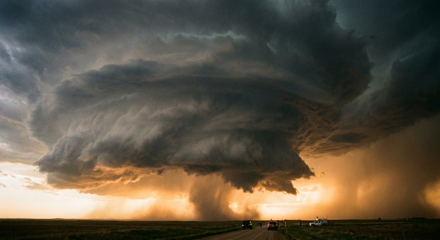
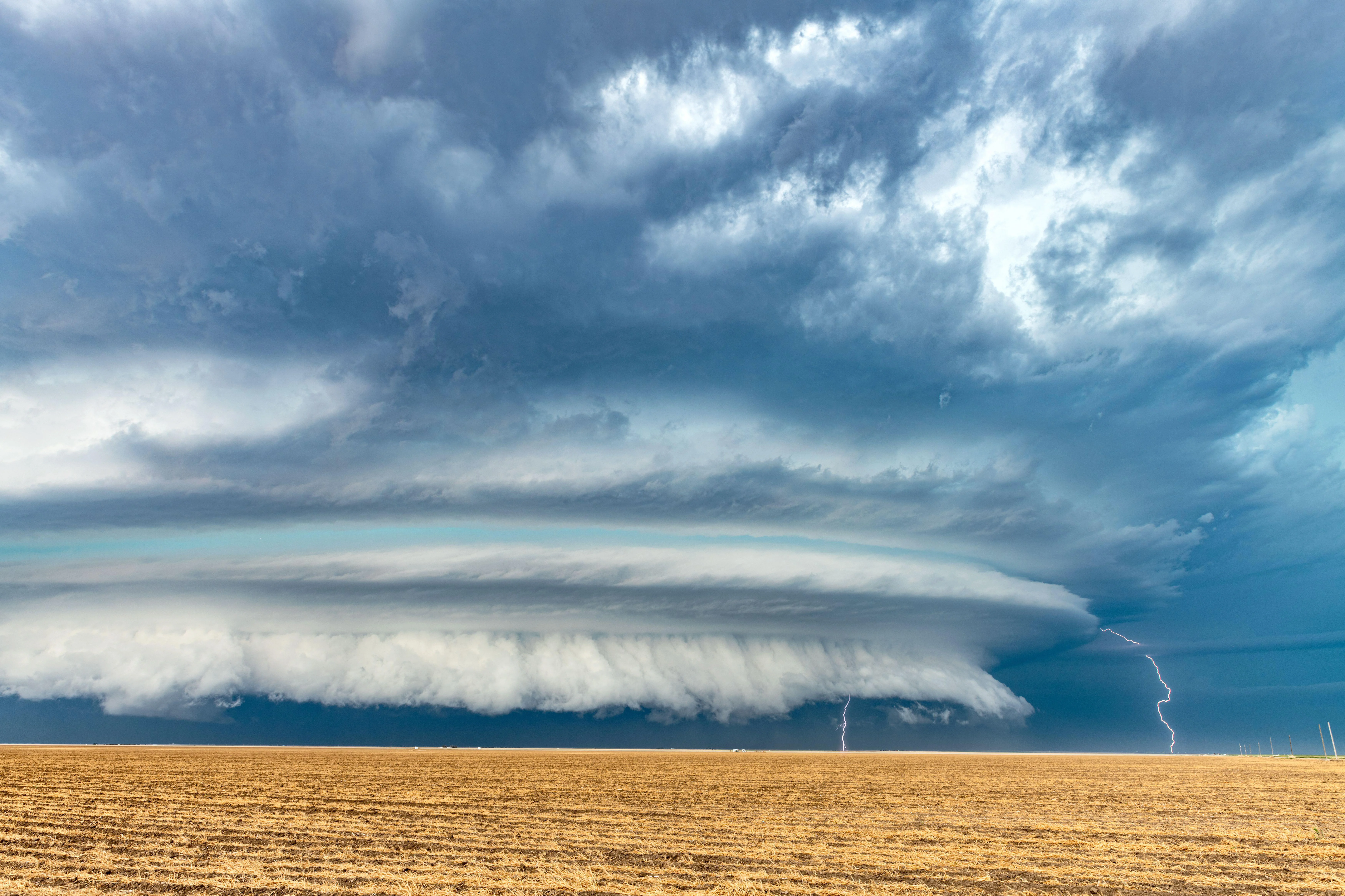
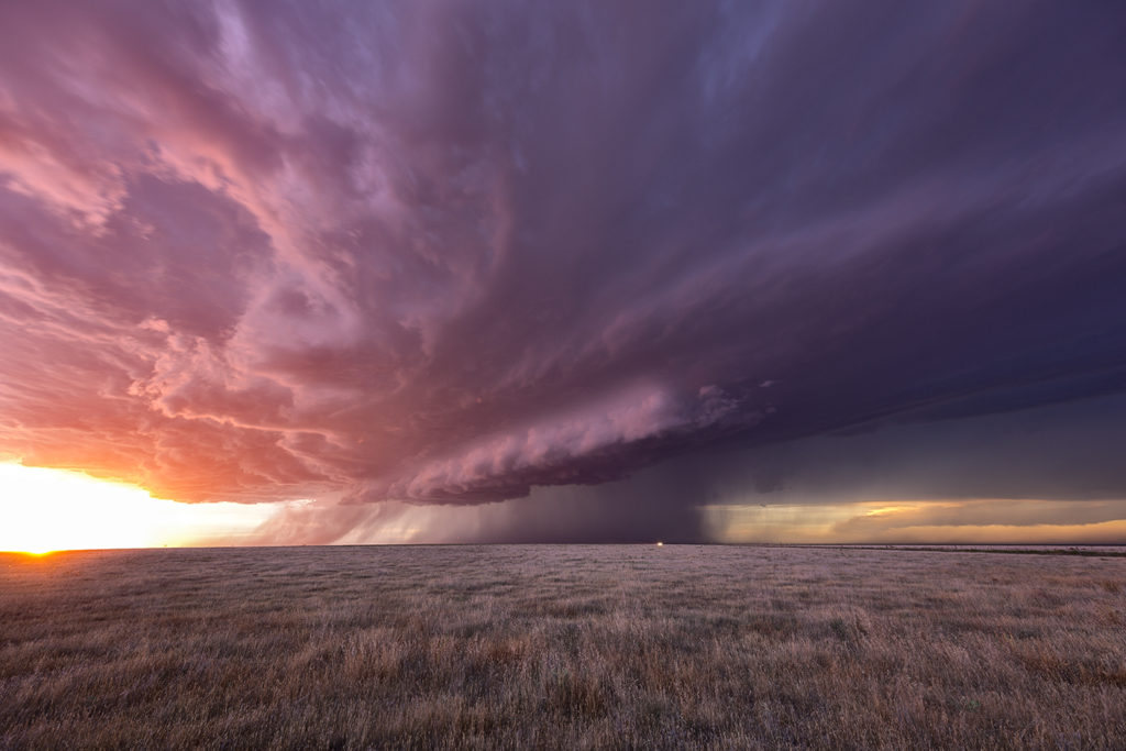
Tornadoes are born from severe thunderstorms, especially supercells, which are thunderstorms with a persistent rotating updraft. Supercells tend to form when heat, moisture, instability, lift, and wind shear overlap in just the right way. The central US frequently supplies all of those at once.
1) Gulf moisture: fuel from the south
A major reason the Plains are so storm-prone is geography. The Gulf of Mexico is a huge nearby reservoir of warm, humid air. In spring and summer, winds often pull that moisture northward into Texas, Oklahoma, Kansas, and beyond.
Moist air near the ground matters because it helps build instability. When warm, moist air is lifted, it can cool into towering clouds and powerful updrafts.
2) Dry air aloft: the Plains’ sharp contrast
While moist Gulf air flows in near the surface, the Southwest can send in a different character of air: warm and dry, often associated with the elevated mixed layer that forms over higher terrain to the west, including parts of the Rockies and the Mexican Plateau.
That dry air can form a boundary called a dryline, especially in Texas and Oklahoma. Across a dryline, humidity can change abruptly over a short distance. Drylines are excellent spark points for explosive thunderstorm development because they focus lift and concentrate the clash of air masses.
3) Wind shear: the invisible twist
To get a tornado, you usually need more than a strong updraft. You need wind shear, meaning wind speed and direction change with height.
The central US often has:
- Low-level winds bringing warm, moist air northward
- Faster winds higher up, often tied to the jet stream
This layered wind profile can help storms rotate. In the right setup, that rotation can be tightened and intensified within the storm, sometimes leading to a tornado.
4) A wide-open runway for air masses
Mountains and oceans shape weather patterns. In the middle of North America, the terrain is comparatively open from south to north across a huge distance. That makes it easier for warm Gulf air to surge north and for cooler or drier air to drop in from the west or north, meeting over the Plains.
5) Lift: the nudge that starts the storm
Even with moisture and instability, storms often need a trigger. In Tornado Alley, common triggers include cold fronts, drylines, outflow boundaries from earlier storms, and subtle ripples in the atmosphere moving along with upper-level winds.
So where are tornadoes most common, really?
It depends on how you measure “common.” Meteorologists can map tornado frequency by raw counts, tornadoes per land area, or the frequency of strong tornadoes. Each approach can produce slightly different hot zones.
There is also a practical complication: reporting. Tornado records are best in recent decades and are influenced by population density, radar coverage, and how damage is surveyed. A weak tornado crossing empty rangeland is easier to miss than one hitting a suburb.
Still, the Great Plains consistently stands out for environments that support major severe weather, including long-lived supercells that can produce strong tornadoes, very large hail, and damaging winds.
Dixie Alley: a second hotspot with its own risks
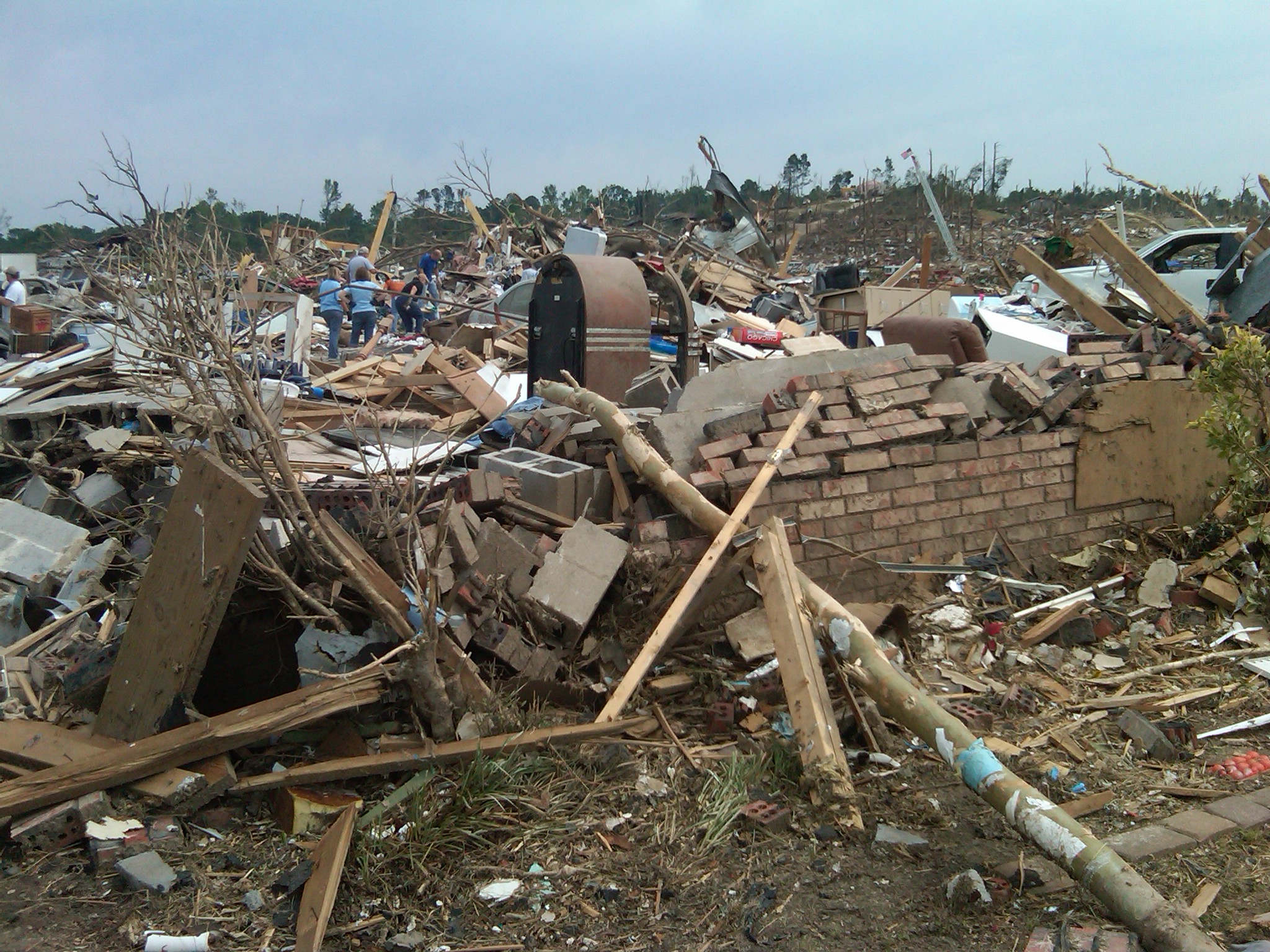
If Tornado Alley is the famous headline, Dixie Alley is the chapter many people are still surprised to learn about. Dixie Alley generally refers to parts of the Southeastern US where tornadoes are also frequent and, in some ways, particularly dangerous.
Depending on the source, Dixie Alley often includes some combination of:
- Mississippi
- Alabama
- Tennessee
- Georgia
- Arkansas and Louisiana (sometimes included)
Why the Southeast can be tornado-active
The Southeast can tap the same basic tornado ingredients: warm moist air from the Gulf, strong storm systems moving through, and wind shear that supports rotating storms. Cooler-season setups can be especially potent, bringing strong winds aloft over rich low-level moisture.
Why Dixie Alley can be especially hazardous
- More trees and complex terrain can reduce visibility. Tornadoes can be harder to spot until they are close.
- A higher share of tornadoes occur at night in parts of the Southeast, and tornadoes at night are harder to confirm visually and harder for people to respond to quickly.
- Higher population density in some areas can raise the odds that a tornado strikes homes and infrastructure.
- Vulnerability factors like housing type and warning access vary widely, affecting risk even when the meteorology is similar.
Why the boundaries are debated
Tornado Alley is a nickname, not a surveyed border. Its outline changes because the underlying question changes.
Different maps answer different questions
- All tornadoes vs. strong tornadoes: If you map every tornado, some maxima shift eastward where there are more storms overall and more reports.
- Counts vs. rates: Total tornadoes favor large states. Tornadoes per square mile can highlight smaller regions with frequent events.
- Time period: A 10-year window can look different from a 50-year climatology.
- Changing observation practices: Better radar, more storm spotters, and improved surveys tend to increase the number of documented weaker tornadoes over time.
Is Tornado Alley moving?
You may see claims that tornado activity is shifting eastward. Research does suggest changes in where and when the most favorable tornado environments occur, and some studies note more clustering and more active seasons in parts of the Mid-South and Southeast in recent decades. There is still active debate about how much of the apparent shift reflects climate signals, natural variability, and reporting differences. The safest, most honest takeaway is this: tornado risk is not confined to a single strip of the Plains, and the Southeast has long been a major part of the US tornado story.
When Tornado Alley is most active
Tornado season is not a single date on a calendar, but there is a familiar rhythm:
- Great Plains: often peaks in late spring into early summer, when moisture, warmth, and wind shear overlap frequently.
- Southeast: can see major outbreaks in spring but also a notable cool-season component, with tornadoes occurring in late fall and winter during strong storm systems.
Because the ingredients can assemble in different ways, tornadoes can happen any month. The peaks simply reflect when the overlap is most common.
Quick FAQ
Is Tornado Alley an official term?
No. It is a widely used nickname based on tornado climatology, and its borders vary by source.
Which state gets the most tornadoes?
It depends on the metric. Texas often has the highest total number because it is large and spans multiple climate zones. Other states can rank high when you adjust for land area or focus on strong tornadoes.
Are tornadoes only in Tornado Alley and Dixie Alley?
No. Tornadoes occur across the United States, including the Midwest, the Mid-Atlantic, Florida, and even parts of the West. The alleys are simply regions where tornado-friendly setups happen more often.
What should I do if I live in a tornado-prone area?
Know your safest shelter spot (preferably a basement or small interior room on the lowest floor), have multiple ways to receive warnings, and practice what you will do if a warning is issued. A plan you can execute quickly matters as much as the forecast.
Sources and further reading
- NOAA National Severe Storms Laboratory (NSSL): Tornado climatology and severe weather education
- NOAA Storm Prediction Center (SPC): Severe weather outlooks and historical data tools
- National Weather Service (NWS): Tornado safety guidance and warning definitions