I used to tell my physics students that the atmosphere is the biggest lab on Earth, and supercell thunderstorms are some of its most dramatic experiments. If you have ever watched a storm with a sculpted, almost “engineered” look to its clouds, one that seems to organize itself and stay intense for hours, you have probably been watching something in the supercell family.
Here is the plain-language definition first, then we will walk through what to look for in the sky and on radar, plus the big question people always ask: if supercells are the classic tornado storms, why do so many of them never produce a tornado?
The definition that matters
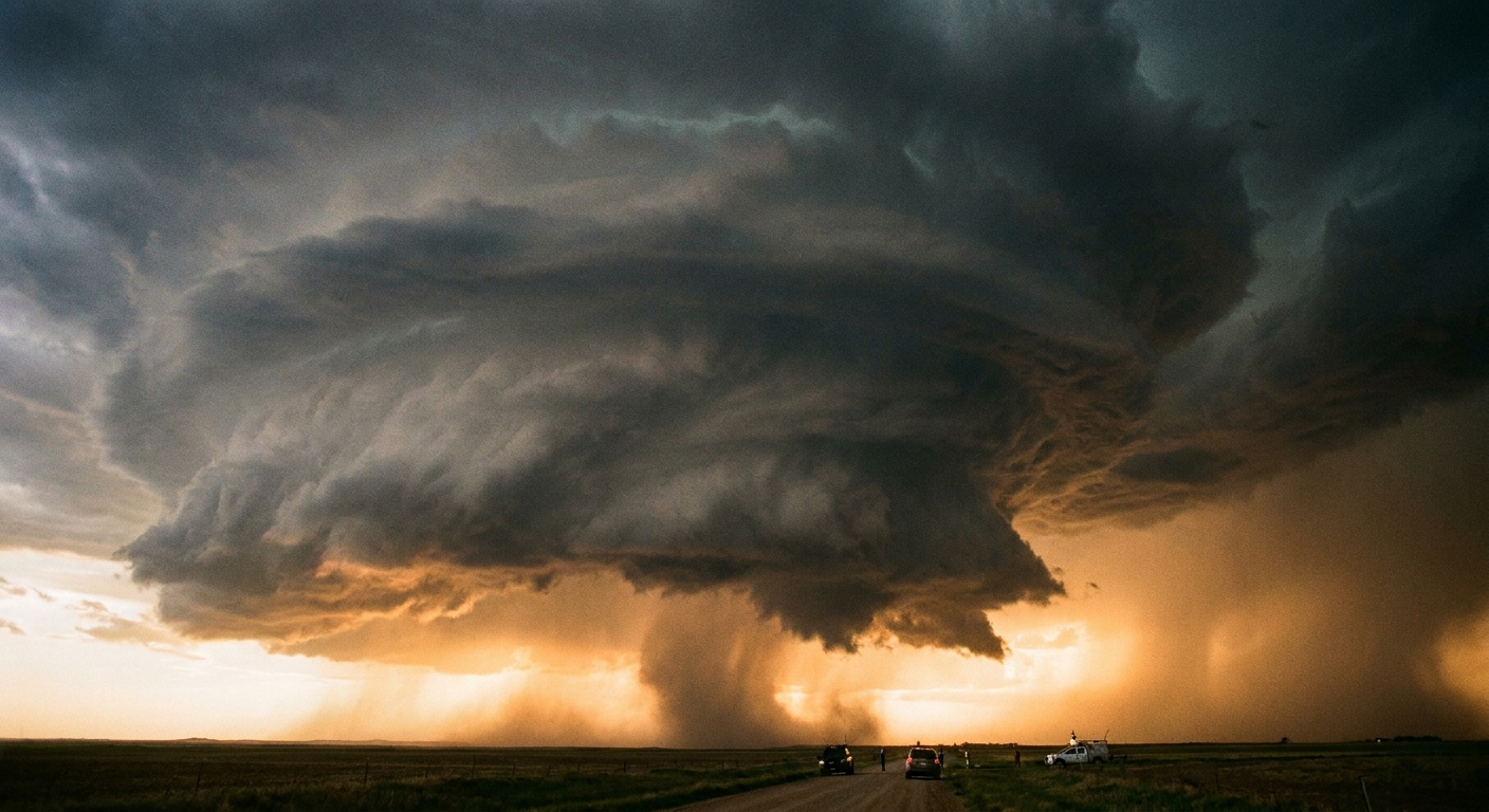
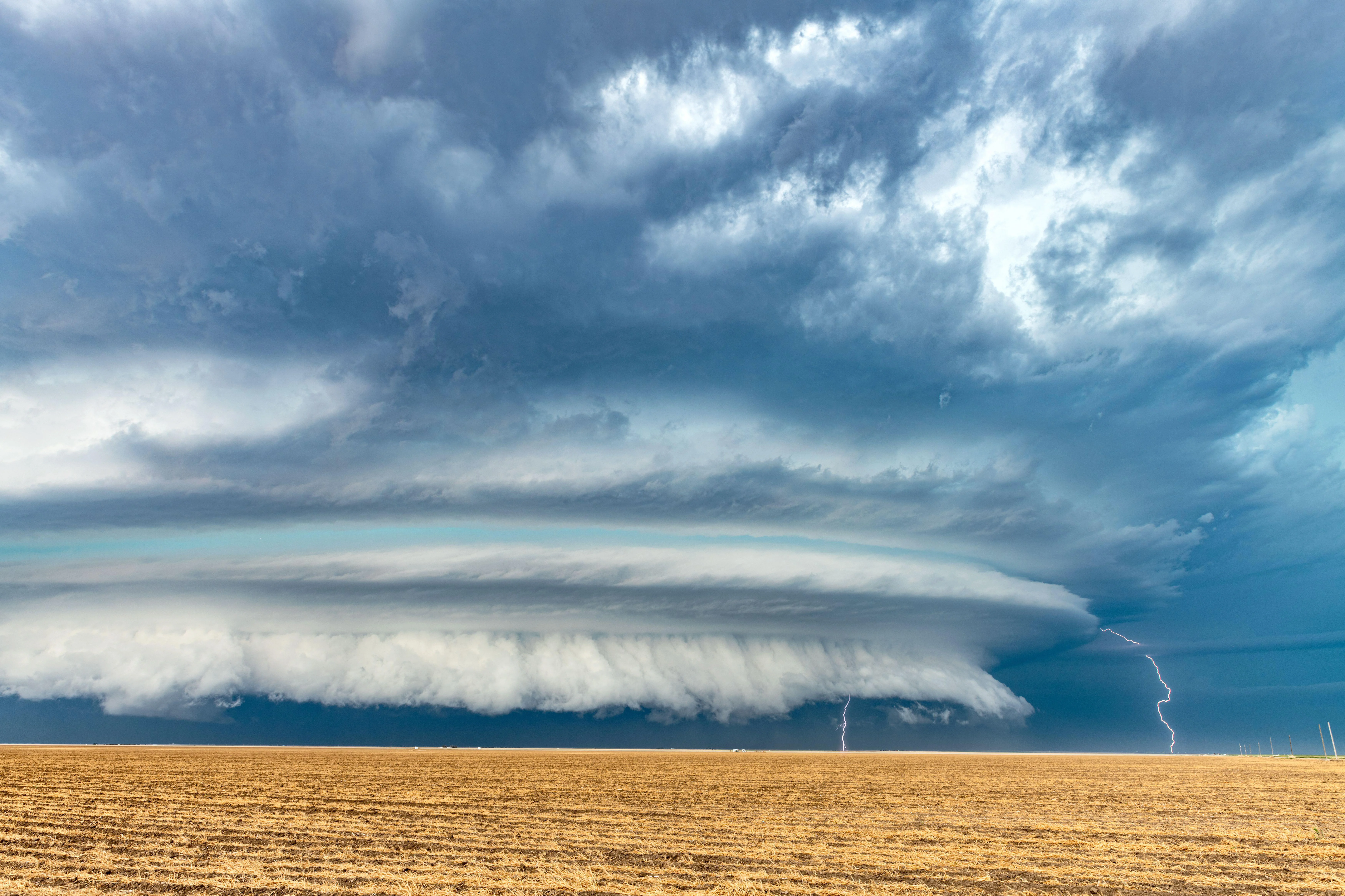
A supercell is a thunderstorm with a deep, persistent rotating updraft. Meteorologists call that rotating updraft a mesocyclone.
Two words in that definition do a lot of work:
- Deep: the rotation is not just a little swirl near the cloud base. It extends through a large vertical chunk of the storm.
- Persistent: the rotation holds together over time. Plenty of storms spin briefly or locally. Supercells keep that organized rotation while the storm keeps feeding.
This is why supercells are in a different category than the quick “pulse” thunderstorms that boom once and collapse, or the long lines of storms called squall lines. A supercell is not defined by how scary it looks or whether it drops a tornado. It is defined by its internal structure and that long-lived rotating updraft.
Why supercells are such a big deal
Think of a storm updraft as an elevator for warm, moist air. In an ordinary thunderstorm, the elevator goes up, rain and hail fall through it, and the whole system often chokes on its own downdrafts.
In a supercell, the rotating updraft tends to separate the rising air from the falling precipitation more effectively. That helps the storm stay “open for business” longer, sometimes for hours. A longer-lived storm has more time to produce hazards such as:
- Large hail (sometimes very large)
- Damaging straight-line winds, including powerful downbursts
- Heavy rain and localized flooding
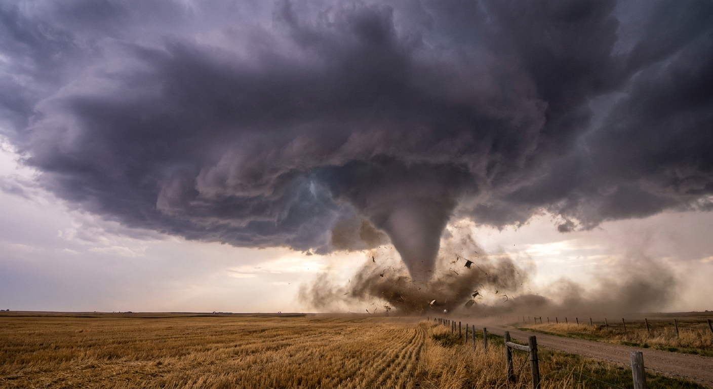
- Occasionally tornadoes
Not every supercell does all of these. But supercells have a reputation because they are efficient at turning atmospheric energy into organized, long-lasting severe weather.
Visual clues in the sky
Cloud watching is not a substitute for official warnings, but supercells often advertise their structure with a few classic features. You do not need to see every one of these for a storm to be a supercell.
1) A crisp, spreading anvil
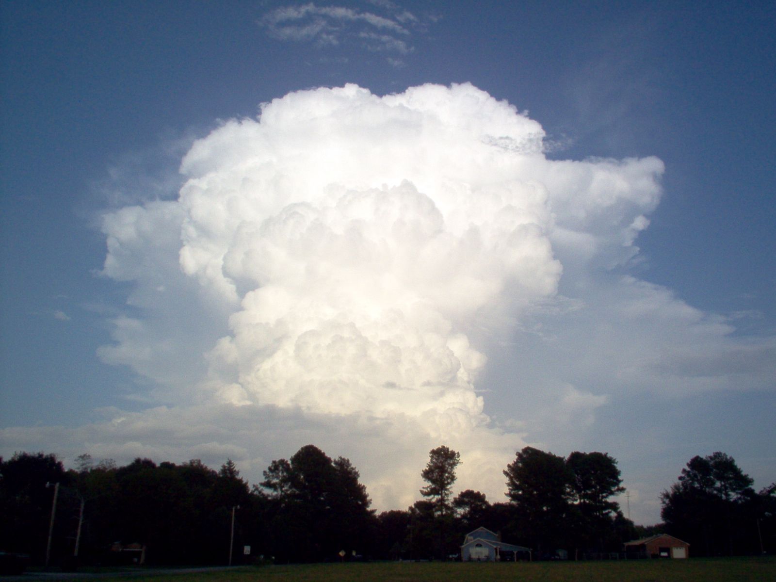
Many strong thunderstorms develop an anvil, the flat, icy cloud shield that spreads out near the top of the storm. Supercells often have a particularly sharp-edged, well-defined anvil, showing strong upper-level winds and a vigorous updraft punching into colder air aloft.
2) A wall cloud or lowered base
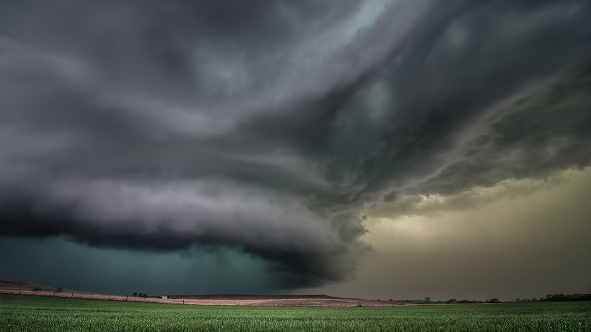
Under the rain-free side of the storm, you may see a lowered, blocky cloud base. Sometimes that lowered area becomes a wall cloud, a localized lowering that can rotate. Important note: a wall cloud can exist without a tornado. In fact, that is the most common outcome.
3) A rain-free base next to a heavy rain and hail core
Supercells are often visually “partitioned.” One side may look relatively clean and organized, while another side dumps a concentrated curtain of rain or hail. That separation is a hint that the storm has a structured inflow and a structured precipitation core, not just a messy blob of convection.
4) Striations and a stacked look
Some supercells show banded layers, sometimes called striations, wrapping around the updraft like grooves on a record. You are seeing cloud forming in air that is rising and rotating in an organized way.
5) Mammatus under the anvil (a common red herring)
Those pouch-like bubbles hanging under an anvil, called mammatus, can look ominous. They often accompany strong storms, but they are not a reliable sign that a storm is a supercell, and they do not mean a tornado is imminent. They are more about complex motions and ice processes in the anvil region than what is happening in the low-level updraft.
Radar clues meteorologists use
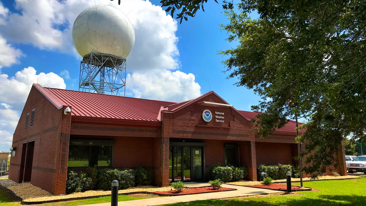
Radar is where the supercell definition really comes into focus, because radar can detect storm-scale rotation and precipitation structure. If you follow storms using public radar apps, here are the big patterns you will hear forecasters mention.
Hook echo
On reflectivity (the “how much stuff is in the air” view), a classic supercell may show a hook-shaped appendage on the backside of the storm’s precipitation. Not all supercells have a clean hook. But when a hook is present, it indicates precipitation being wrapped around part of the storm’s rotating circulation.
Velocity couplet
On velocity (the “wind toward and away from radar” view), a mesocyclone can appear as a tight inbound and outbound pair close together, often called a couplet. That is a radar signature of rotation, not automatically a tornado.
BWER and other updraft signatures
In strong storms, radar sometimes shows a bounded weak echo region (BWER), essentially a pocket of relatively low reflectivity within heavy echoes aloft. Translation: the updraft is strong enough to hold precipitation up and keep a hole in the reflectivity field. You will not always see this on every radar product, but it is one of the classic markers of an intense updraft.
One quick safety reminder I used to drill into students: radar is powerful, but warnings are the action item. If your local weather service or trusted meteorologist says “take cover,” that is not the moment to zoom in for a better look at the hook.
Why many supercells never produce a tornado
This is the part that surprises people. If supercells are the “tornado storms,” why do so many spin beautifully on radar and still never drop a tornado?
The simplest way to think about it is that a supercell can be organized and rotating aloft without the storm ever aligning all the ingredients needed to produce a tornado at the ground. Tornadoes require a very specific overlap of storm structure, near-surface winds, and how the storm’s downdrafts and inflow interact. If that overlap is off by a little, the storm may still be a perfectly legitimate supercell and still be capable of large hail and damaging winds, but it may not produce a tornado.
Common reasons a supercell stays nontornadic include:
- Not enough low-level spin where it matters: the storm may rotate strongly in the mid levels but never concentrate rotation near the surface.
- Outflow undercuts the updraft: if rain-cooled air spreads out and shoves under the inflow, it can disrupt the storm’s ability to keep a tight, surface-based circulation.
- Air near the ground is too cool or stable: supercells thrive on warm, buoyant inflow. If surface air is not eager to rise, the storm struggles to “connect” its rotation to the lowest levels.
- Storm mode and competition: nearby storms can steal inflow, merge, or force a supercell into a messier structure that is still severe but less favorable for tornado production.
- Timing: a storm might only briefly have a favorable setup. If the window is short, the storm can remain a supercell without ever producing a tornado.
Notice what I did not do there: I did not walk step by step through tornado formation. That is a whole topic of its own. The key takeaway is simpler: supercell does not equal tornado. It means persistent rotating updraft. Tornadoes are one possible outcome, not the definition.
Are all supercells the same?
Not quite. Meteorologists often talk about supercells in terms of what hazard dominates:
- Classic supercell: a balanced structure, with a distinct rain-free base and a well-defined precipitation core.
- High-precipitation (HP) supercell: the storm is wrapped in lots of rain, which can hide key features and increase flooding risk. Tornadoes, when they occur, can be rain-wrapped and hard to see.
- Low-precipitation (LP) supercell: less rainfall near the updraft, sometimes with a sculpted look. These can still produce large hail and strong winds, even if the storm looks deceptively “clean.”
These are not rigid boxes, more like personality types. A storm can shift from one to another as the environment changes.
Supercell vs. ordinary thunderstorm vs. squall line
If you only remember one comparison, make it this:
- Ordinary thunderstorm: usually short-lived, updraft and downdraft tangle together, can still produce lightning, downpours, small hail, and occasional severe bursts.
- Supercell: long-lived and organized, with a persistent rotating updraft, often produces large hail and can produce significant severe weather.
- Squall line: a line or band of storms, often with widespread wind damage and heavy rain. Rotation can occur in parts of the line, but the basic structure is different from a single rotating updraft dominating the storm.
This matters because the hazards and warning lead time can differ by storm mode. A supercell is often a “focused” severe weather producer, while squall lines can impact large areas quickly.
What to do if a supercell is nearby
Even without a tornado, supercells can be dangerous. If one is approaching:
- Take severe thunderstorm and tornado warnings seriously, and follow local guidance.
- Get away from windows. Large hail can shatter glass, and straight-line winds can launch debris.
- Do not chase a storm without training. Visibility can drop fast, roads can flood, and hail can disable a vehicle.
- Use multiple alert methods: phone alerts, weather radio, and trusted local meteorologists. Power and cell service can fail during severe weather.
FAQ
Can you have a supercell without a tornado?
Yes, and that is actually common. A supercell is defined by its deep, persistent rotating updraft, not by whether it produces a tornado.
Can a tornado happen without a supercell?
Yes. Some tornadoes form in other storm types, especially along lines of storms or in brief, localized circulations. Supercells are just one pathway.
Does a green sky mean a supercell?
Not reliably. A greenish tint can occur when sunlight filters through a storm with lots of water and ice, often with hail, but it is not a dependable supercell identifier.
Are supercells only in the Great Plains?
No. They are common in parts of the central United States because the ingredients line up frequently there, but supercells occur worldwide wherever the atmosphere provides enough instability and wind shear.
What is the “main” radar signature I should know?
If you are just learning, focus on this: reflectivity can show structure like a hook, but velocity is what reveals rotation. Even then, interpretation is tricky. When in doubt, rely on official warnings rather than DIY radar diagnosis.