Curiosity, with all its quills showing.
Every so often, the atmosphere serves up a scene that feels almost choreographed: two swirling storms on the same ocean basin, close enough that their clouds begin to tangle, their paths bend, and forecasts suddenly have a new complication. Meteorologists have a name for this storm-to-storm interaction. It is the Fujiwhara effect.
The simple definition
The Fujiwhara effect occurs when two nearby cyclones, most famously tropical cyclones like hurricanes and typhoons, get close enough that they begin to rotate around one another and noticeably alter each other’s motion. Sometimes that looks like both storms orbiting around a midpoint. Often it is more lopsided, with the weaker storm doing most of the circling around the stronger one.
The term comes from Japanese meteorologist Sakuhei Fujiwhara, who described how vortices can rotate around one another and sometimes merge.
Why cyclones start orbiting
A cyclone is a rotating vortex of air around a low-pressure center. When you place two vortices within the same neighborhood of atmosphere, their circulations interact. In a simplified view, each storm creates a broad field of rotating winds that can “steer” the other storm.
What has to be true for Fujiwhara to matter
- They must be close enough. There is no single magic distance, but the storms need to be near enough that their outer circulations overlap. Bigger storms can influence each other from farther away.
- They must be similar enough in vertical structure. Tropical cyclones are tall, layered systems. Interaction is strongest when both storms have a coherent circulation through a deep layer of the atmosphere.
- The environment must allow it. Strong wind shear or a dominant large-scale pattern can overwhelm the mutual orbiting tendency.
In reality, cyclone motion is always the sum of several influences: surrounding high and low pressure systems, jet stream patterns, ocean and land effects, and, when applicable, the pull of another cyclone. Fujiwhara is one more steering ingredient, but it can be a dramatic one.
How tracks can change
Once two cyclones begin to interact, their tracks can do several surprising things, often over just a day or two:
- Both storms curve. A storm that looked like it would keep moving west may begin bending poleward, or vice versa, as the combined circulation reorients the steering flow.
- One storm may loop. If the interaction becomes prominent compared to the background steering winds, the track can show a partial or full loop.
- They can separate after a dance. Sometimes the storms rotate briefly, then drift apart as environmental steering reasserts itself or one system weakens.
This is one reason forecast confidence can drop fast. Small differences in storm strength, size, and the surrounding winds can change how long the storms stay close, and that changes the geometry of the whole “dance.”
Why one storm can absorb the other
People often hear “Fujiwhara effect” and imagine two storms spinning forever like paired figure skaters. But a common outcome is less symmetrical: one storm weakens dramatically, or one is absorbed.
Three common reasons for an unequal outcome
- Size and strength mismatch. A stronger, larger cyclone has a broader circulation and tends to dominate. The smaller storm can get stretched, disrupted, and eventually pulled into the larger system’s circulation.
- Dry air and wind shear intrusion. The interaction can open pathways for dry air to wrap into one storm, or locally increase wind shear. Either can disrupt the storm’s inner core where intensification happens.
- Cold wakes and slower motion. Tropical cyclones churn the upper ocean, bringing cooler water to the surface and leaving a “cold wake.” A Fujiwhara-style interaction can slow a storm down, make it loop, or drag it back across previously churned water, which can reduce available heat energy, especially for the weaker storm.
When one storm is absorbed, it is not always a clean “gulp.” The smaller circulation may unravel into a lopsided rain shield, feed moisture into the larger storm, or contribute a pocket of rotation that slightly changes the bigger storm’s structure.
Fujiwhara or just close storms?
Two storms can be in the same ocean basin without a true Fujiwhara interaction. Meteorologists look for signs of mutual rotation and track deflection that cannot be explained by the large-scale pattern alone.
A helpful distinction:
- Nearby storms: They coexist, but each mostly follows the steering flow set by highs, lows, and the jet stream.
- Fujiwhara interaction: Their circulations overlap enough that one or both storms rotate around the other (or around a shifting midpoint) and noticeably alter each other’s motion.
Well-known examples
Fujiwhara interactions are often noted in the western North Pacific, where it is more common to have multiple tropical cyclones in the basin at once. The Atlantic sees them too, but less frequently.
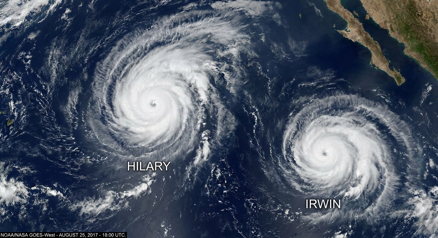
Hurricanes Hilary and Irwin (2017)
In July 2017, Hurricanes Hilary and Irwin in the eastern Pacific are widely cited as a case of binary interaction, with track changes and structural disruption as the storms influenced each other’s steering. Depending on the source, it is described as Fujiwhara or Fujiwhara-like, but the key idea holds: two nearby vortices tugged on each other’s motion.
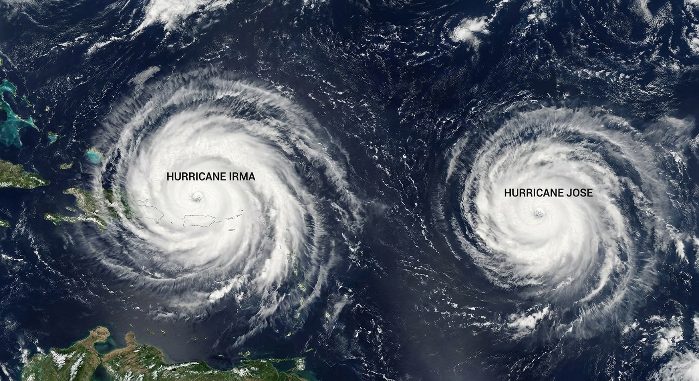
Hurricanes Irma and Jose (2017)
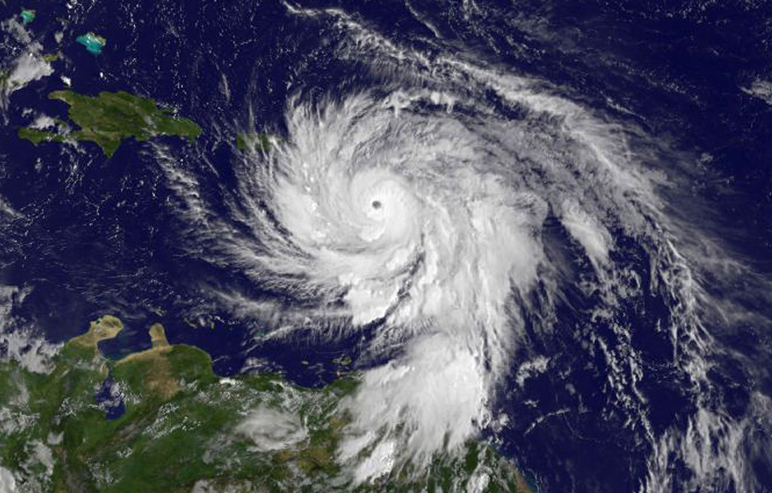
In September 2017, Irma and Jose occupied the Atlantic at the same time, and many people remember the striking satellite view of two large spirals. This pairing is also a good reminder of what can be mistaken for Fujiwhara. Their proximity contributed to a complicated steering setup, but it is cleaner to think of it as a multi-system pattern problem rather than a classic, two-vortex orbit.
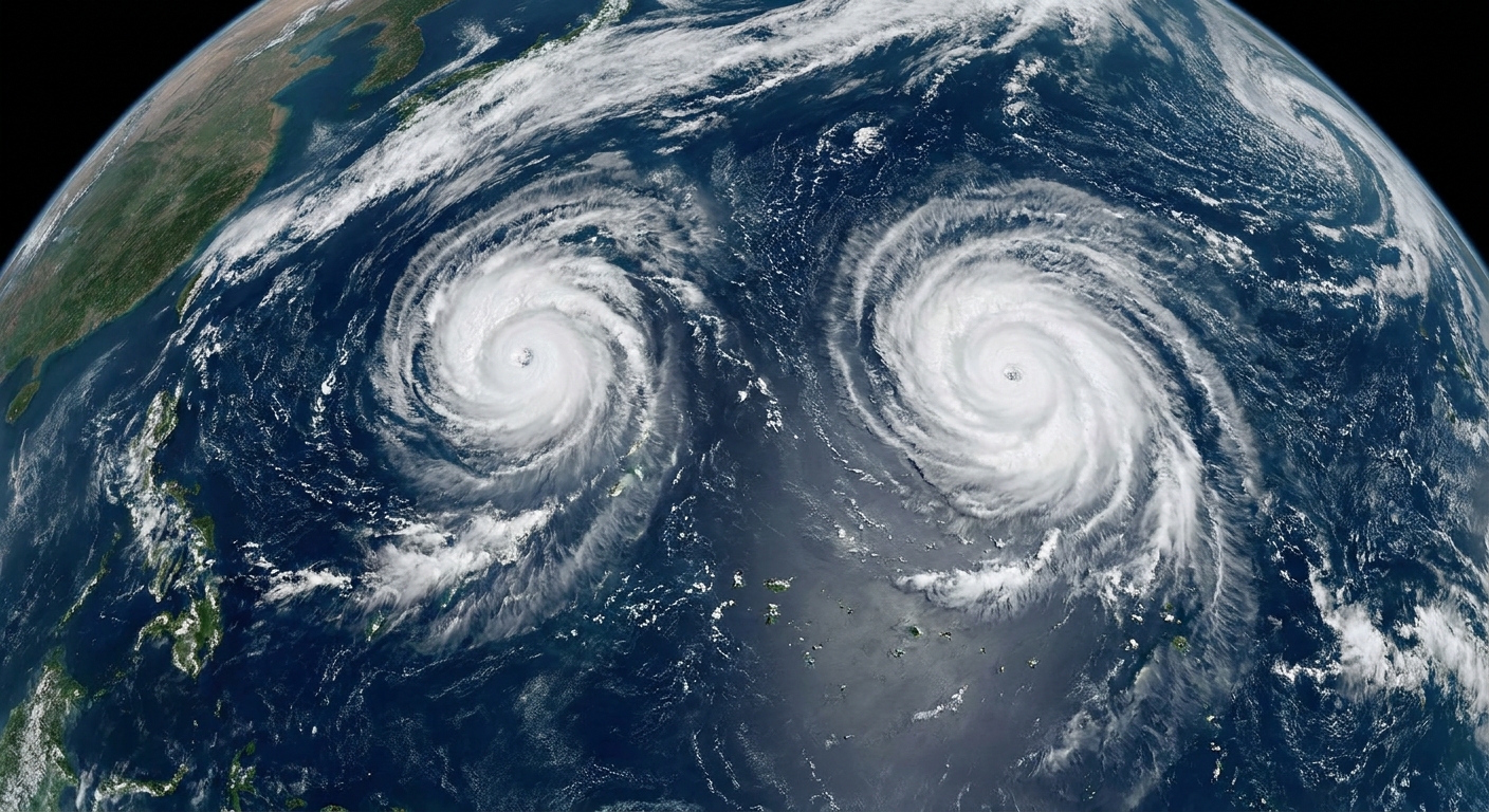
Typhoon pairs in the western North Pacific
The western North Pacific regularly produces clearer textbook cases where two named typhoons rotate around each other and sometimes merge. Those are the “watch the tracks curve in real time” moments that made the effect famous in the first place.
Does it make storms stronger?
Not reliably. The interaction can weaken one or both storms by disrupting their inner cores, pulling in dry air, or increasing wind shear. In some setups, one storm can indirectly benefit if the track shift places it in a more favorable environment, or if absorbed moisture and rotation help the larger circulation reorganize.
Think of Fujiwhara less as an “intensifier” and more as a track and structure changer. Intensity still depends on whether the storm’s engine, the warm ocean and a healthy core of thunderstorms, stays intact.
How forecasters talk about it
In official forecast discussions, you will often see careful language like “binary interaction,” “vortex interaction,” or “possible Fujiwhara.” That caution is deliberate. Real storms are messy, and the atmosphere rarely offers a clean two-body problem.
Forecasters evaluate things like:
- storm size and intensity trends
- distance between centers
- the depth of each circulation
- nearby ridges and troughs that can dominate steering
- model agreement on whether the storms rotate, separate, or merge
On satellite, one visual hint is when the cloud shields deform toward each other and the projected tracks start bending in ways that are hard to explain with the background pattern alone.
Quick questions
Is the Fujiwhara effect rare?
It is not rare globally, especially in basins that often host multiple tropical cyclones at once. It is less common in the Atlantic simply because the Atlantic less often has two strong, nearby tropical cyclones at the same time.
Do the storms always rotate counterclockwise?
In the Northern Hemisphere, tropical cyclones rotate counterclockwise. In the Southern Hemisphere, they rotate clockwise. Fujiwhara interactions follow that hemispheric rotation, though asymmetries in size and background winds can make the motion look uneven.
Can a hurricane and a midlatitude low do this too?
Yes, vortex interactions are not limited to tropical storms. That said, the classic Fujiwhara label is most often used for two cyclones of similar type, especially two tropical cyclones. When a tropical cyclone interacts with a larger extratropical system, forecasters may describe it with other terms tied to merger processes and extratropical transition.
Is “storm eating” always Fujiwhara?
Not always. A storm can absorb another circulation through other merger mechanisms, especially as a system becomes extratropical and expands. Fujiwhara is specifically about the mutual steering and rotation as the vortices approach and influence each other’s motion.
The takeaway
The Fujiwhara effect is what happens when two cyclones get close enough to rotate around each other, tugging one another off expected paths. Sometimes they separate after a brief atmospheric dance. Sometimes one storm is disrupted, weakened, or absorbed. Either way, it is a reminder that storms do not move through empty space. They move through a living, shifting fluid, and occasionally, they meet another whirlpool in the flow.