Curiosity, with all its quills showing.
If you have ever watched a forecast get “stuck” for days, the culprit is often not a single storm but a stubborn traffic jam in the upper air. A Rex block is one of those atmospheric setups that makes weather feel repetitive: the same cloud deck, the same general temperature trend, the same on and off drizzle, the same broad steering pattern, day after day.
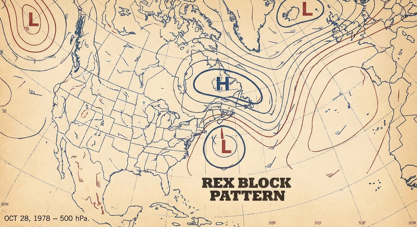
In meteorology, it is a blocking pattern where an upper-level ridge or anticyclone (high heights) sits poleward of a closed, cutoff low. In the Northern Hemisphere, that usually means the ridge is to the north of the low. In the Southern Hemisphere, the north south orientation flips. Either way, that stacked couplet tangles up the usual west to east flow aloft and can stall a pattern for several days or longer.
The core idea
In a Rex block, you have two key players in the mid to upper troposphere:
- A ridge or closed high to the poleward side. On a 500 mb (500 hPa) chart, this shows up as higher geopotential heights, often tied to sinking motion and a relative warming aloft.
- A cutoff low to the equatorward side. This is a closed circulation that has separated from the main westerly flow, often tied to colder air aloft and rising motion.
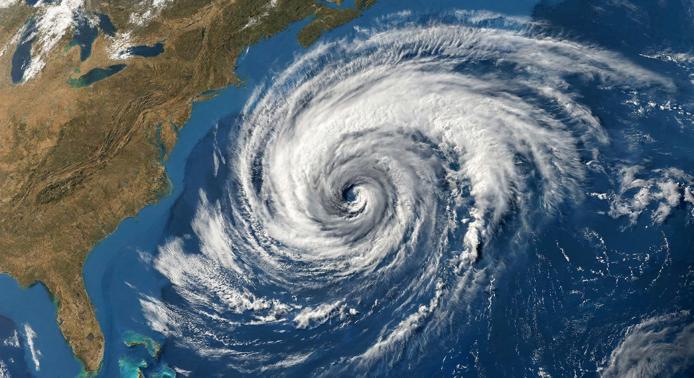
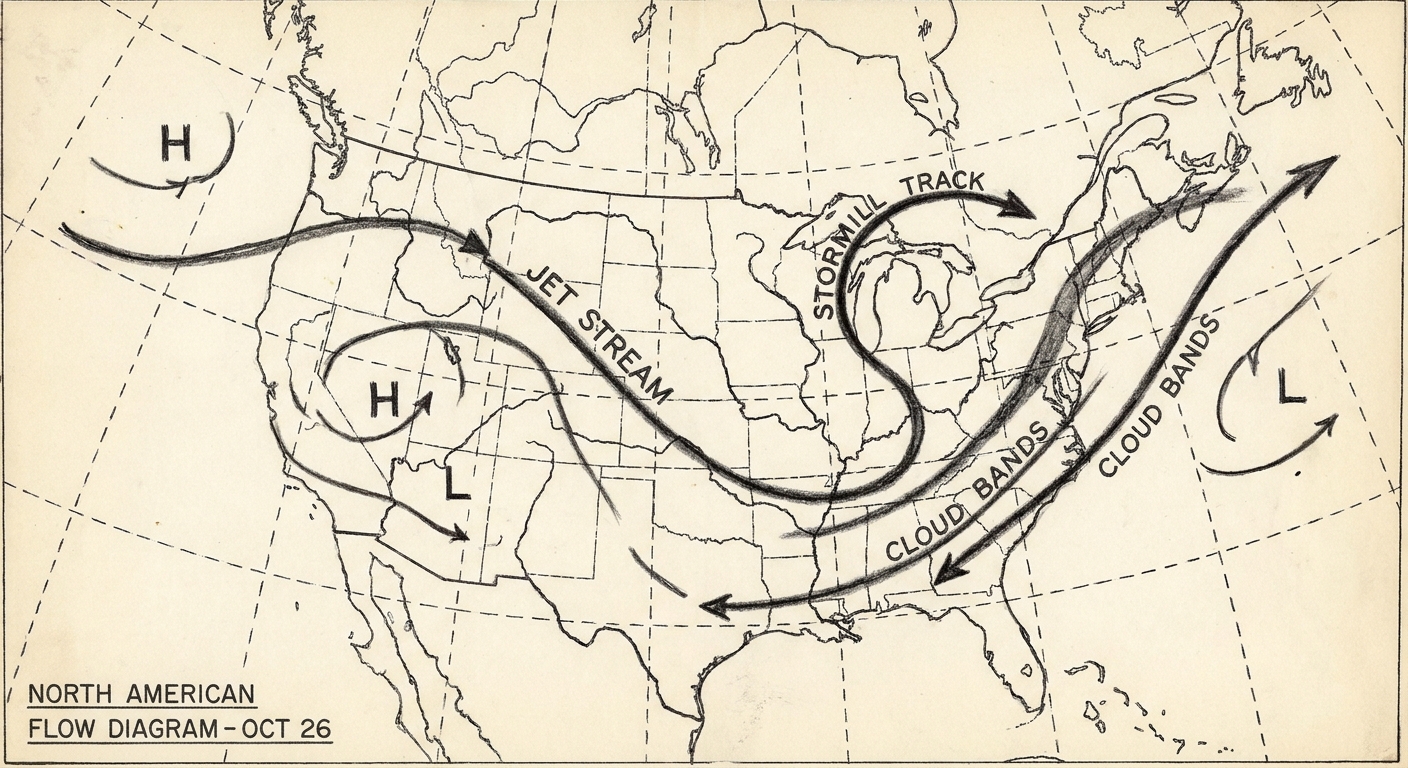
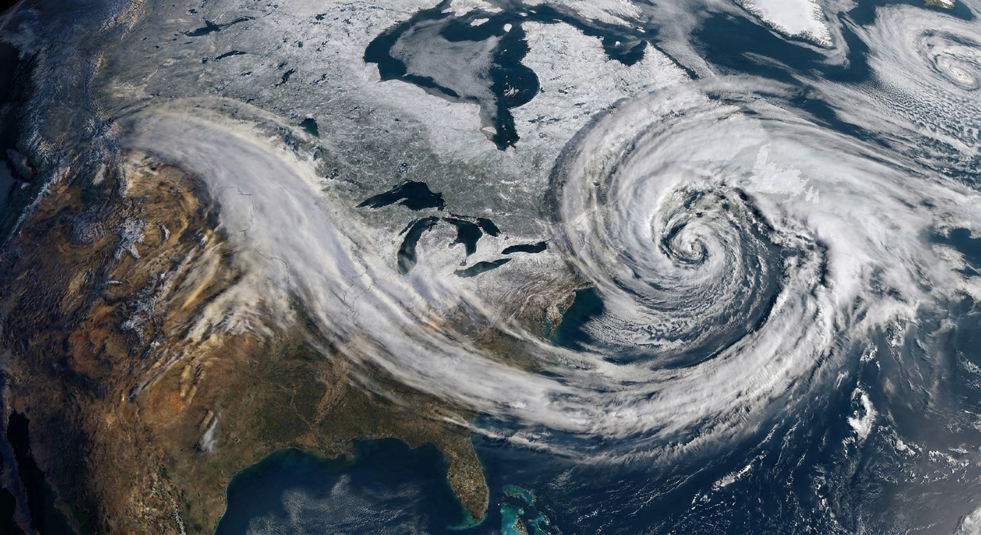
Put together, they form a north to south stack that disrupts the jet stream’s typical progression. Instead of weather systems marching along, the flow is forced to go around the block, and the cutoff low in particular can loiter.
One useful distinction: cutoff lows can exist without a classic Rex block. The “Rex” part is the specific pairing, with the ridge parked poleward of the cutoff low in a way that promotes blocking.
Why it stalls weather
Blocking patterns are all about slow-moving, self-reinforcing flow. A Rex block tends to persist because:
- The cutoff low is detached from the faster jet stream current that would normally carry it along.
- The ridge to the poleward side acts like a barrier, discouraging the low from lifting into the main flow and discouraging other systems from sweeping through.
- The jet stream splits or detours around the ridge and low, reducing the steering that would break the pattern apart.
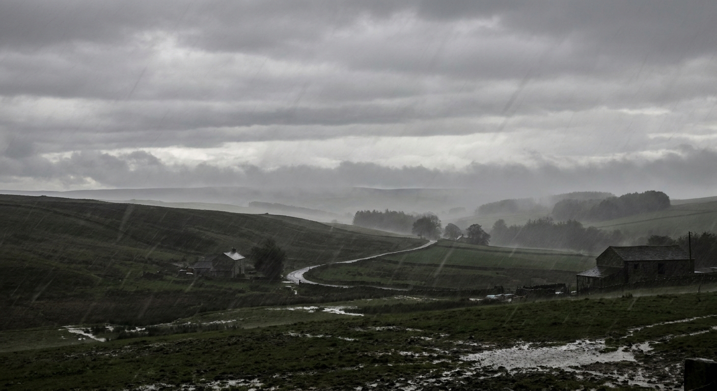
The practical result is that regions under the ridge can experience prolonged warmth, dryness, and lighter winds, while areas near or under the cutoff low can get repeated rounds of clouds and showers. Surface impacts vary with season and local details like cloud cover, onshore flow, and warm or cold advection. Cold air aloft can boost instability and make showers or thunderstorms easier, but it does not guarantee a chilly afternoon everywhere.
How to spot it
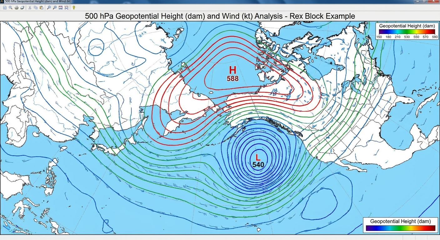
Forecasters most often spot Rex blocks using 500 mb (500 hPa) geopotential height maps, because that level cleanly shows the large-scale ridges and lows that steer weather systems.
What to look for at 500 mb
- Closed height contours at lower latitudes, indicating a cutoff circulation rather than an open trough.
- A strong ridge immediately poleward of the low, sometimes with closed high contours, indicating anomalously high heights.
- A north to south alignment, with the ridge centered poleward of the low, forming a stacked pair rather than a simple west to east wave.
- Little progress from one map time to the next. The pattern looks stubbornly similar across successive analyses or model runs.
Helpful supporting fields
A 500 mb height map is the classic view, but other layers help confirm the story:
- Upper-level winds: a noticeable detour around the ridge and low, with weaker steering flow near the cutoff.
- Thickness or temperature aloft: warmer air aloft under the ridge, cooler air aloft around the low.
- Surface pressure patterns: not always a neat mirror. Surface highs can strengthen beneath persistent ridging, and surface lows or troughing can linger beneath the upper low, but the defining signature is aloft.
Rex vs omega
Both Rex blocks and omega blocks are “blocking” patterns, but they are not the same creature.
- Rex block: defined by a ridge or high heights poleward of a cutoff low, a north to south pairing that can trap the low and slow everything down.
- Omega block: named for its resemblance to the Greek letter Ω, typically featuring a big ridge in the middle with troughs or lows on either side, creating a three-lobed look.
If you are staring at an upper-air map and thinking “this looks like a high sitting on top of a low,” you are leaning toward Rex. If you are thinking “this ridge is the centerpiece, with dips on both sides,” you are leaning toward omega.
What it means on the ground
Because the pattern stalls, the impacts often come from persistence rather than a single dramatic moment.
Common outcomes
- Extended warmth and dryness under the ridge, which can raise fire weather concerns in some regions.
- Repeated showers and thunderstorms near the cutoff low, sometimes leading to localized flooding if storms train over the same area.
- Cloudy, showery stretches that feel out of season, especially when cooler air aloft steepens lapse rates.
- Forecast sensitivity: cutoff lows can wobble, drift, or retrograde (move westward), and small shifts can change who gets clouds and who gets sun.
How it ends
Rex blocks usually break when the larger-scale flow reasserts itself. That might mean an upstream trough finally punches through, the jet strengthens and reconnects with the cutoff low, or the ridge weakens enough that the low can lift out and rejoin the westerlies. Until then, the atmosphere is content to replay the same track.
FAQ
Why is it called a Rex block?
It is named for meteorologist Daniel F. Rex, who documented and described this type of blocking pattern in the 1950s.
How long can it last?
Often several days, sometimes longer. Blocking patterns, by definition, are slower to break down than typical west to east weather waves.
Does it always involve a surface high and low?
Not always in a neatly stacked way at the surface. The defining feature is the upper-level ridge over the upper-level cutoff low. Surface features can be weaker, displaced, or evolve differently depending on season and geography.
Is it the same as the polar vortex?
No. A Rex block is a specific blocking arrangement in the mid-latitude flow involving a ridge poleward of a cutoff low. It is a different concept from the large-scale circumpolar wind pattern people refer to when discussing the polar vortex.
A mental picture
If you like metaphors that behave themselves: think of the jet stream as a river of air. A Rex block is like a stubborn eddy and a high bank working together. The flow splits, loops, and slows, and the weather downstream stops arriving on schedule.