If you have ever felt the ground do that unsettling wiggle and wondered, “Wait, the solid Earth can move like that?”, you are not alone. Earthquakes are not random tantrums of nature. They are the release valve for a planet that is always in slow motion, with enormous slabs of crust pushing, pulling, and sliding past each other. Most of the time, that motion is too gradual to notice. Then, in a snap measured in seconds, stored energy is set free and the ground reminds us it is part of a dynamic system.
Let’s walk through what is happening under your feet, from plate tectonics to faults to the waves that shake buildings, plus how scientists measure quakes and map risk.
Earth’s crust is broken into moving plates
The outer shell of Earth is not one unbroken skin. It is divided into large pieces called tectonic plates. These plates include both oceanic and continental crust, and they ride on top of hotter, softer rock in the upper mantle. Think of it less like a hard billiard ball and more like a very, very slow conveyor system. Heat from Earth’s interior drives motion in the mantle, and the plates respond by drifting a few centimeters per year, about the speed your fingernails grow.
Where plates interact, stress builds. Earthquakes are most common along these boundaries, although they can happen within plates too, sometimes far from the nearest plate edge.
The three main types of plate boundaries
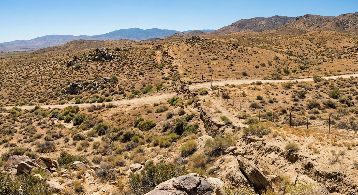
- Transform boundaries: Plates slide horizontally past each other. This sliding is a classic earthquake maker because friction can lock the boundary until stress overwhelms it. The San Andreas Fault system is a well known example.
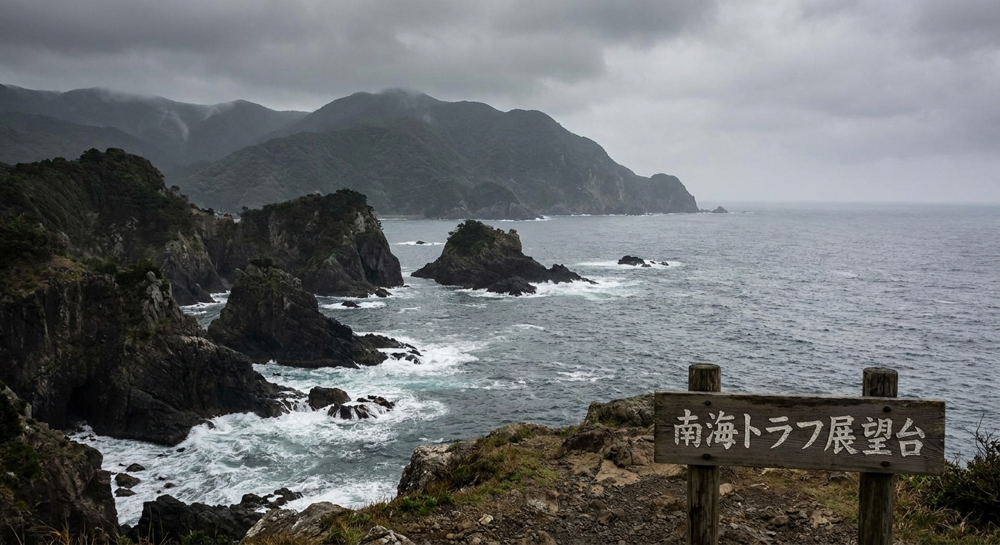
- Convergent boundaries: Plates collide. If an oceanic plate dives under another plate, it forms a subduction zone, the source of many of the world’s largest earthquakes and tsunamis.
- Divergent boundaries: Plates pull apart. Magma rises to fill the gap, forming mid-ocean ridges and rift zones. Earthquakes here are typically smaller but frequent.
Faults: where rocks stick, strain, and then slip
An earthquake happens when rock on opposite sides of a crack in Earth’s crust, called a fault, suddenly moves. The key word is suddenly. Plates want to move, but faults are not frictionless. They can get locked, which lets stress build like bending a thick plastic ruler.
Eventually, the stress exceeds the friction and strength holding the rocks in place. The fault ruptures, the rocks slip, and the stored energy is released as seismic waves. That release is the earthquake.
Common fault types you will hear about
- Strike-slip faults: Blocks slide sideways past each other (common at transform boundaries).
- Normal faults: The crust is being pulled apart, and one block drops relative to the other (common in rifts and stretching regions).
- Reverse or thrust faults: The crust is being compressed, and one block is pushed up over another (common in mountain building and subduction settings).
Real faults are messy. They branch, bend, and contain rough patches called asperities that can lock and then fail. That complexity is one reason earthquakes can be difficult to forecast in the everyday sense of “Tuesday at 3 pm.”
From rupture to shaking: the quake’s anatomy
When a fault slips, the rupture starts at a point inside Earth called the hypocenter (also called the focus). The point directly above it on the surface is the epicenter.
Two details matter a lot for how an earthquake feels:
- Depth: Shallow earthquakes, typically defined as less than about 70 km deep, tend to cause stronger surface shaking than deeper ones of the same magnitude.
- Rupture length and direction: A quake is not a single point pop. It can rupture tens to hundreds of kilometers of fault. If the rupture propagates toward you, shaking can be amplified, a bit like the beam of a flashlight sweeping your way.
Seismic waves: the messengers of the quake
The shaking you feel is the arrival of seismic waves . They carry energy away from the fault, and different wave types move differently through the ground.
Body waves: traveling through Earth
- P waves (primary waves): The fastest. They push and pull the ground in the direction the wave travels, like sound moving through air. P waves are usually the first to arrive.
- S waves (secondary waves): Slower than P waves. They shear the ground side-to-side or up-and-down. S waves typically cause stronger shaking than P waves and cannot travel through liquids, which is one reason they helped reveal Earth’s liquid outer core.
Surface waves: traveling along the skin of the planet
- Love waves: Side-to-side horizontal motion.
- Rayleigh waves: Rolling motion, like ocean waves moving through the ground.
Surface waves often contribute heavily to damage, especially because they can carry large motions at longer periods that some structures respond to strongly. Near the source, sharp S-wave pulses and rupture directivity can also be destructive.
Why some places shake more than others
Two neighborhoods the same distance from the epicenter can experience very different shaking. That is because the ground beneath them acts like a filter and sometimes like an amplifier.
Key factors that control shaking
- Soil type: Soft sediments can amplify shaking compared with solid bedrock. They can also lengthen the shaking, which is tough on structures.
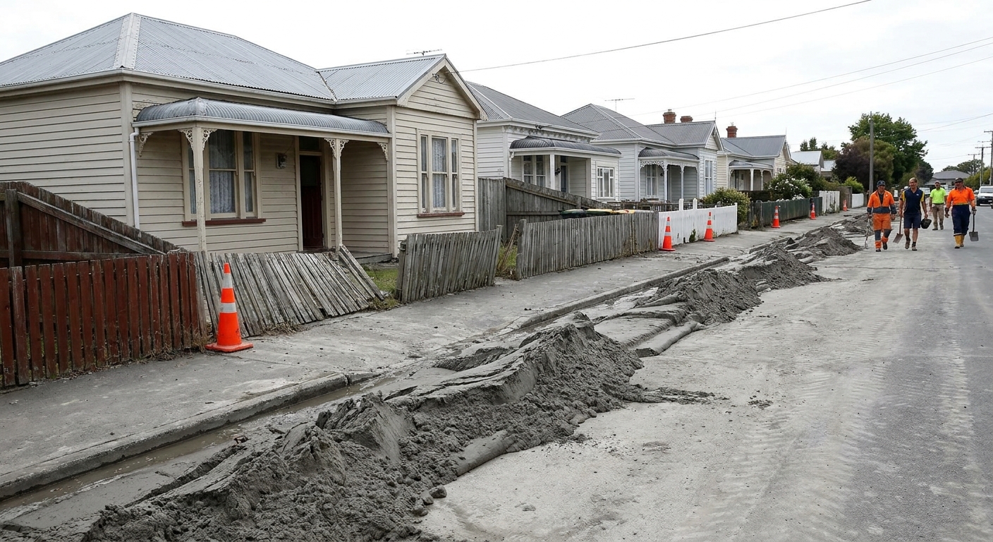
- Water-saturated ground and liquefaction: In some loose, wet sediments, shaking can increase pore water pressure until the ground behaves more like a fluid. This is liquefaction, and it can tilt buildings, crack roads, and break buried pipes.
- Topography: Ridges, slopes, and basins can focus or scatter seismic energy. In some earthquakes, ridge crests have recorded stronger shaking than nearby flat ground.
- Building resonance: Every structure has natural frequencies. If ground shaking matches a building’s “favorite rhythm,” motion can build up. That is why some earthquakes are especially hard on certain height ranges of buildings.
Magnitude vs intensity: two ways to describe a quake
People often say “How strong was it?” but there are two different ideas hiding in that question: how big the earthquake was at its source, and how strongly it shook a specific place.
Magnitude: the earthquake’s overall size
Magnitude is a single number for the event. Modern agencies typically report moment magnitude, written as Mw. It is tied to the physics of the rupture: how much of the fault slipped, over what area, and how stiff the rocks are.
Important magnitude facts to keep straight:
- The scale is logarithmic . As a rule of thumb, each whole-number step (for example, 5.0 to 6.0) corresponds to about 10 times larger recorded wave amplitudes.
- In terms of energy released, each whole-number step is roughly 32 times more energy.
- That means a magnitude 7 is not “a little bigger” than a magnitude 6. It is a different beast.
Intensity: how it felt and what it did
Intensity describes shaking at a particular location. A widely used system is the Modified Mercalli Intensity scale, which uses Roman numerals (I to XII) based on human experience and observed damage.
One earthquake can produce many intensities across a region, because intensity depends on distance, depth, local geology, and construction.
How quake maps show risk
If magnitude tells you how big a quake was, maps help answer a more practical question: Where did it hit hardest, and where is it likely to hit hard again?
Epicenter maps and fault maps
Dots on a map show earthquake locations over time. When you plot enough of them, patterns emerge: lines of quakes trace faults, and clusters reveal active zones. Fault maps add the known fractures, giving context to where future ruptures could occur.
Shake maps: the footprint of shaking
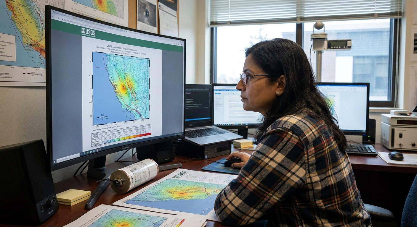
After significant earthquakes, agencies produce shaking intensity maps using instrument data, ground models, and reports from people. These maps show where shaking was strongest, which helps:
- direct emergency response to the hardest-hit areas
- identify where infrastructure may be compromised
- improve building codes by comparing predictions with reality
Hazard maps: planning for the long game
Seismic hazard maps estimate the likelihood of different levels of shaking over long time windows, often decades. They combine knowledge of faults, earthquake history, and ground conditions. They do not say “an earthquake will happen on this date.” They say something more useful for design and policy: “this region has a higher probability of strong shaking, so build and retrofit accordingly.”
Aftershocks and foreshocks
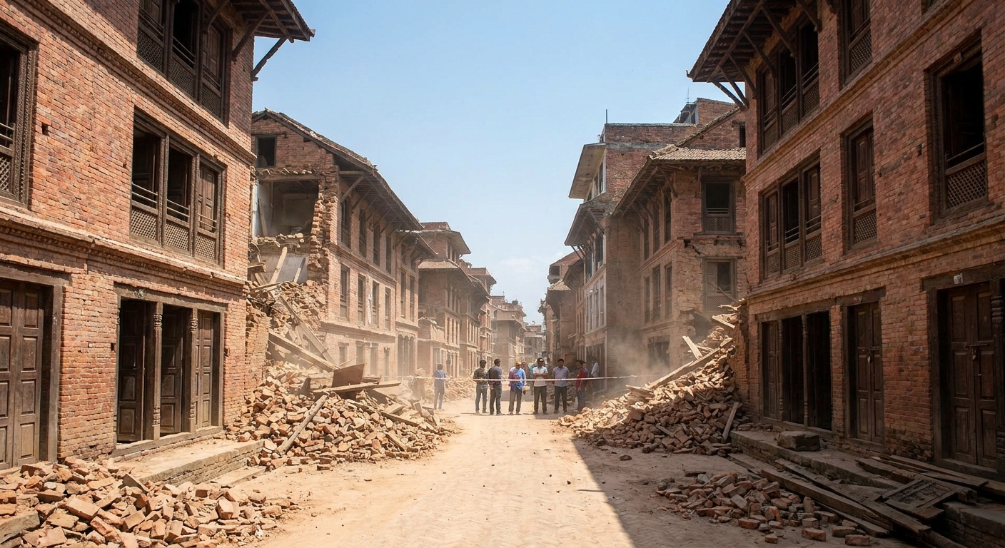
A major earthquake rearranges stress in the surrounding crust. Nearby faults and segments respond, often producing aftershocks that can continue for days to months, sometimes longer. Aftershocks are not “extra earthquakes tacked on.” They are the crust settling into a new balance, and some can be strong enough to cause additional damage, especially to already weakened buildings and slopes.
Foreshocks are smaller quakes that occur before a larger mainshock, but here is the catch: you usually only know they were foreshocks after the mainshock happens. Many small quakes do not lead to a big one, so identifying a true foreshock in real time is tricky.
Can we predict earthquakes?
Scientists can estimate where earthquakes are more likely and how strong shaking might be, but predicting the exact time and size of a specific quake remains out of reach. The fault system is complex, and tiny differences in friction, fluids, and rock properties can change when a locked patch finally gives way.
That said, there are two forms of progress that matter in daily life:
- Earthquake early warning : Systems can detect the fast P waves near the source and send alerts before the stronger shaking arrives farther away. The warning may be seconds to tens of seconds, but that can be enough to take cover, slow trains, and pause sensitive procedures.
- Risk reduction: Better building codes, retrofits, and public preparedness have saved lives in many regions. In earthquakes, engineering and planning are often the “prediction” that counts.
Earthquakes away from plate edges
Not every damaging earthquake sits neatly on a plate boundary. Intraplate earthquakes happen within plates, often on ancient faults that can be reactivated by today’s stress field. The New Madrid seismic zone in the central United States is a classic example, and intraplate quakes also occur in places like Australia and eastern Canada. They are less frequent than boundary quakes, but they can still be serious, especially where buildings were not designed with strong shaking in mind.
Quick FAQ
What causes the ground to shake during an earthquake?
The shaking is caused by seismic waves produced when a fault suddenly slips, releasing stored elastic energy in the crust.
Is a bigger magnitude always more dangerous?
Not always. A moderate quake close to a city, shallow and on soft ground, can be more damaging than a larger quake far away or deep. Magnitude measures size at the source, not local impact.
Why do some earthquakes cause tsunamis?
Tsunamis usually form when an undersea earthquake, often at a subduction zone, causes the seafloor to move vertically and displace a large volume of water. Not every ocean earthquake produces that kind of seafloor shift.
What should I do if I am near the coast and the ground shakes hard?
If you feel strong or long shaking near the coast, move to higher ground as soon as you can. Do not wait for an alert. Official warnings are crucial, but your first warning may be the shaking itself.
What is the safest thing to do during shaking?
Follow local guidance, but a common recommendation is “Drop, Cover, and Hold On” indoors, staying away from windows and unsecured objects. If you are outside, move to an open area away from buildings and power lines.
Are aftershocks dangerous?
They can be. Aftershocks may bring down already-damaged walls, chimneys, and facades. Be cautious around compromised structures, and follow local instructions about re-entering buildings.
The big idea to remember
Earthquakes are the sound of a moving planet, translated into motion we can feel. Plates creep, faults lock, stress accumulates, and then the crust slips and sends waves rippling outward. Once you see that chain of cause and effect, the mystery fades a little, and what remains is something more useful: an understanding of where risk comes from, and how smart choices in mapping, engineering, and preparedness can turn a natural process into a survivable one.